ALERT DAY PM: Rain to snow, gusty winds; impacts possible
(ABC 6 News) – A quick moving storm system will bring a variety of weather to the region prompting an ALERT DAY from Thursday afternoon lasting into Friday.
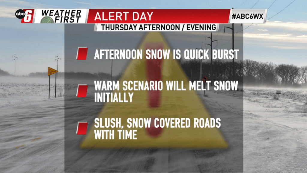
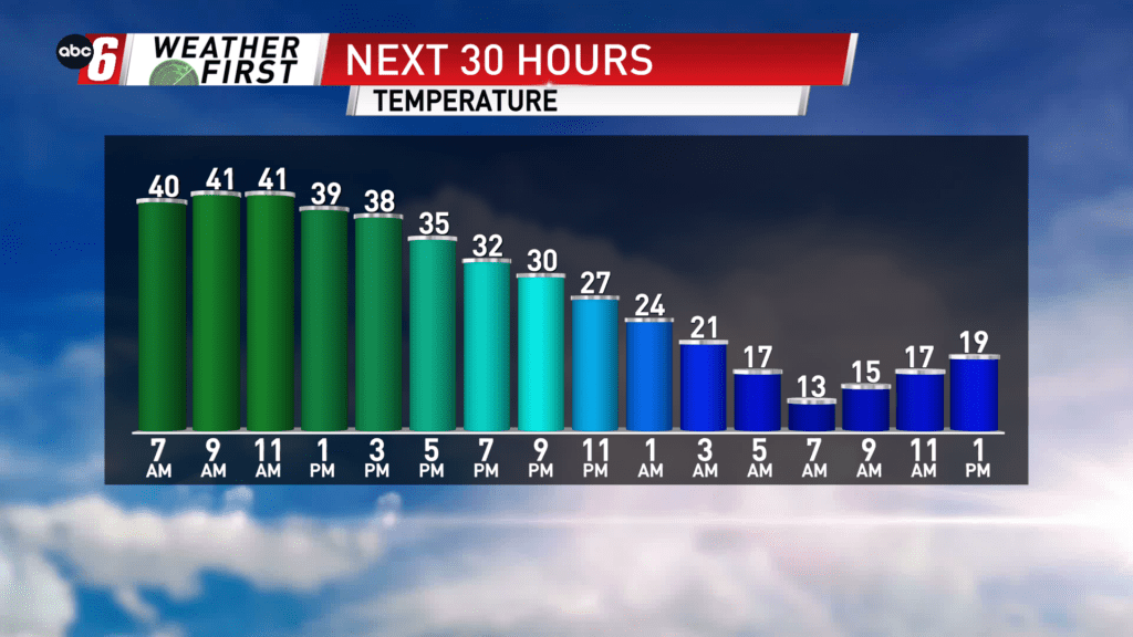
Rain will be the theme through the last few hours of the morning with temperatures well above freezing. However, as colder air wraps in behind the storm, temperatures will drop and snow will come into the picture around early-to-mid afternoon, and will be at it’s heaviest through the evening commute.
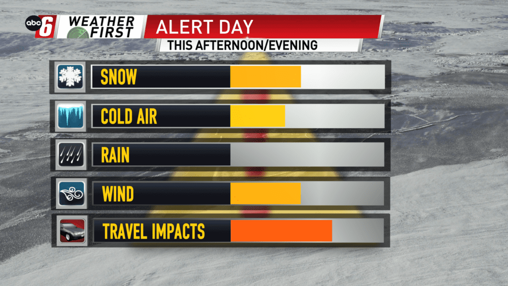
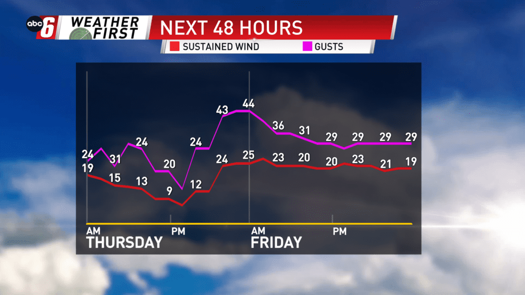
Winds will also pivot from the south to the north with gusts up to 45 mph possible which will likely lead to low visibility as the snow is falling and areas of blowing snow.
Snow may melt initially on the warmer ground, however accumulations will really begin after the snowfall picks up in intensity. Expect snow covered and icy spots on roads as we cool off into Friday morning. Snowfall totals look to top off in 1-3″ range around I-35 in southern Minnesota and get lower the farther east and south you go.
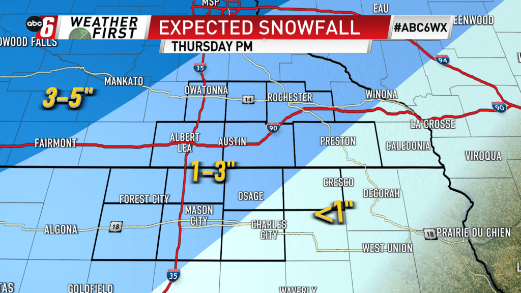
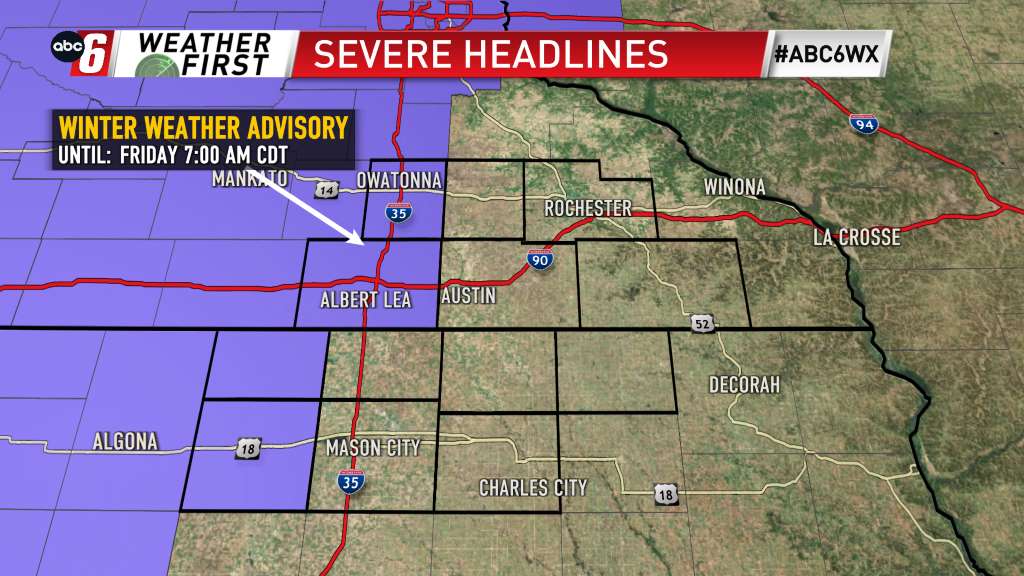
A **WINTER WEATHER ADVISORY** is in effect for areas along and west of I-35 in Minnesota and Iowa until early Friday.
Temperatures will consistently drop as the Thursday goes along. It will be to the point where temperatures are in the teens out the door Friday. Sub-zero wind chills cannot be ruled out as winds are expected to still remain gusty early Friday.
For all weather information, and to stay updated with the forecast, CLICK HERE.
For the latest road conditions per the MnDOT, CLICK HERE.
To view road cameras provided by the Minnesota & Iowa D.O.T., CLICK HERE.
To submit a weather photo, CLICK HERE.