Light snow, flurries slowly end Thursday

Credit: MnDOT
[anvplayer feed=”ASJWMB2EQZ2SXAAJAA” station=”998128″]
(ABC 6 News) – The storm system that has brought a mess to the area this week will finally be exiting the region on Thursday.
However, before it does, light snow showers or flurries will continue into Thursday afternoon before slowly tapering off. Not much more is expected for additional accumulation, however it will be enough to keep some area roads slick.
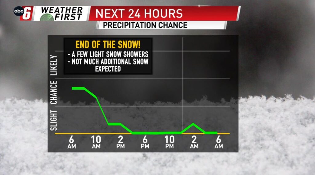
We’ll hold mainly cloudy skies and temps on the mild side one last day. Highs are near 30 for Thursday. Cooler temps take us into the weekend. With some clearing some sub-zero overnights are expected but with minimal wind we aren’t talking about anything too severe.
The weather pattern settles down after today, with not much to track heading into & through the weekend. Aside from a flurry or two possible late Saturday night, we are holding off on any other snow chance until later next week.
For all weather information, and to stay updated with the forecast, CLICK HERE.
To view closings and delays, CLICK HERE.
For the latest road conditions, CLICK HERE.
To view road cameras provided by the Minnesota & Iowa D.O.T., CLICK HERE.
To submit a weather photo, CLICK HERE.