Winter returns Tuesday
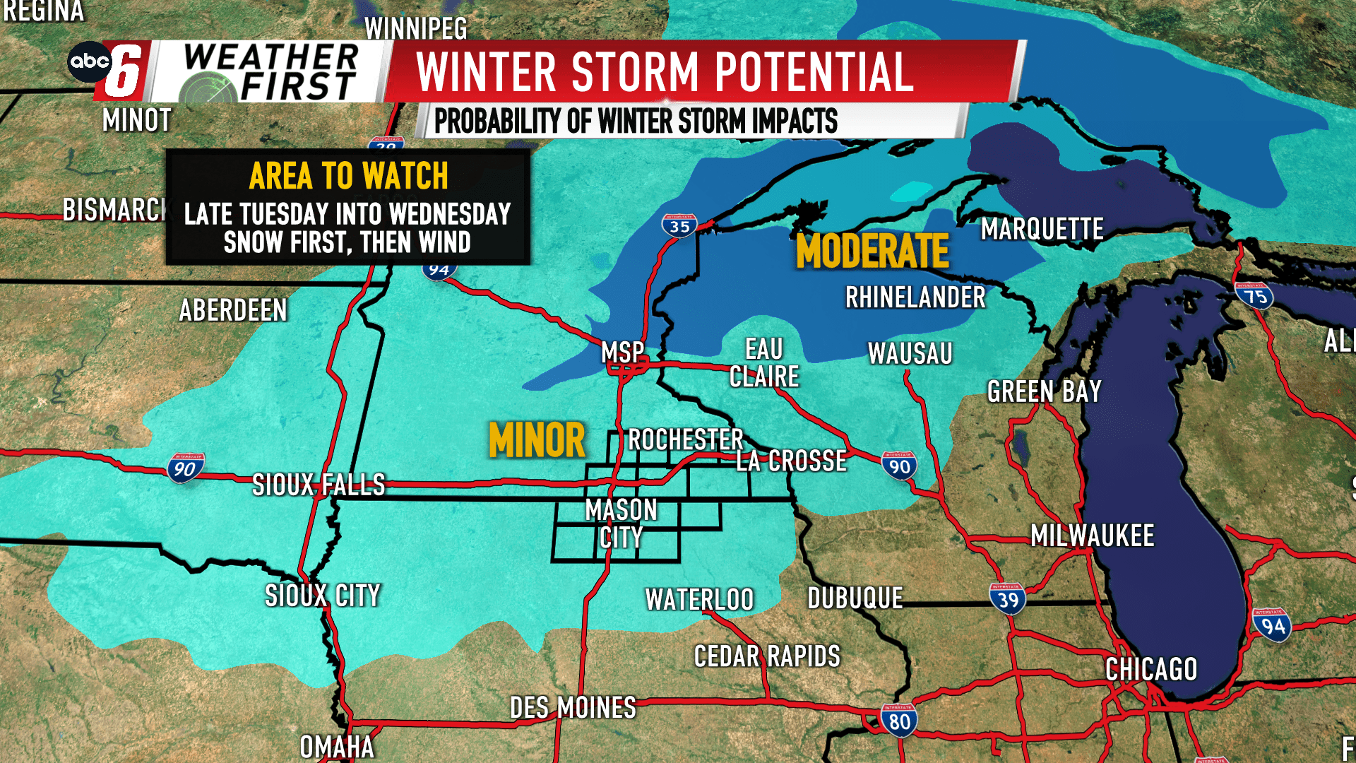
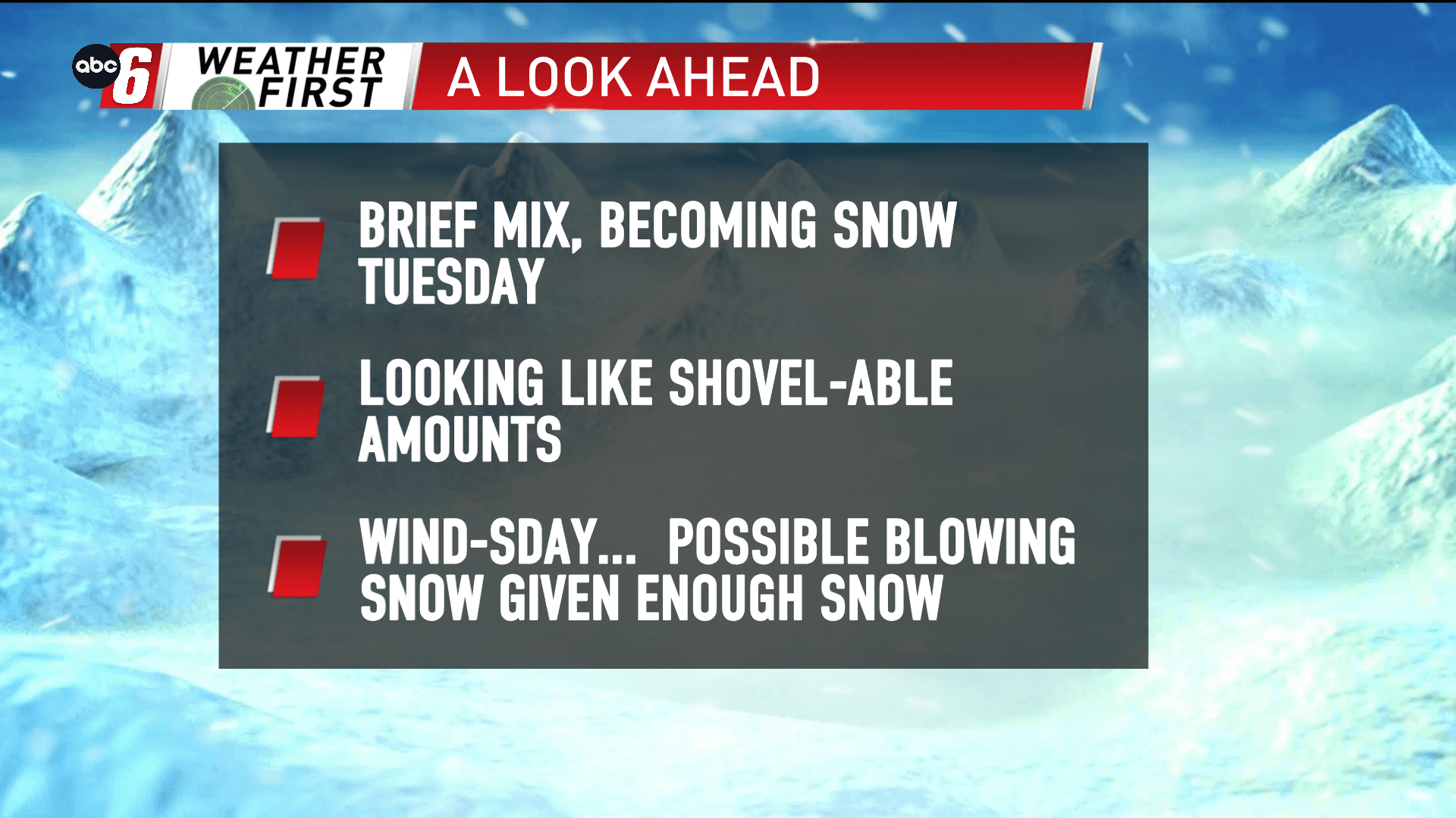
It’s been a fixture in our forecast for the last five days. Confidence continues to grow that the area sees impact from a quick moving Winter Storm System Tuesday into Tuesday night. The trend has been to remove most of the mix precipitation out of the forecast turning it more into snow. Though, a brief period of mix is possible mid-Tuesday. Snow takes over into Tuesday night and looks to largely wrap things up before sunrise on Wednesday.
The snow may be done falling but not stirring. Provided we see enough, blowing snow would be an issue with a breezy northwest wind as this system departs. This would be strongest through the day on Wednesday.
Travel troubles are looking more likely in the late Tuesday through Wednesday stretch.
An Alert Day(s) may be needed if this persistence continues to hold. It’s still too early for amounts, but enough to get the shovel out is possible. That said, this won’t be a gold medal system… more of a nuisance. Travel impacts are possible as mentioned. Timing will continue to be honed in with time.