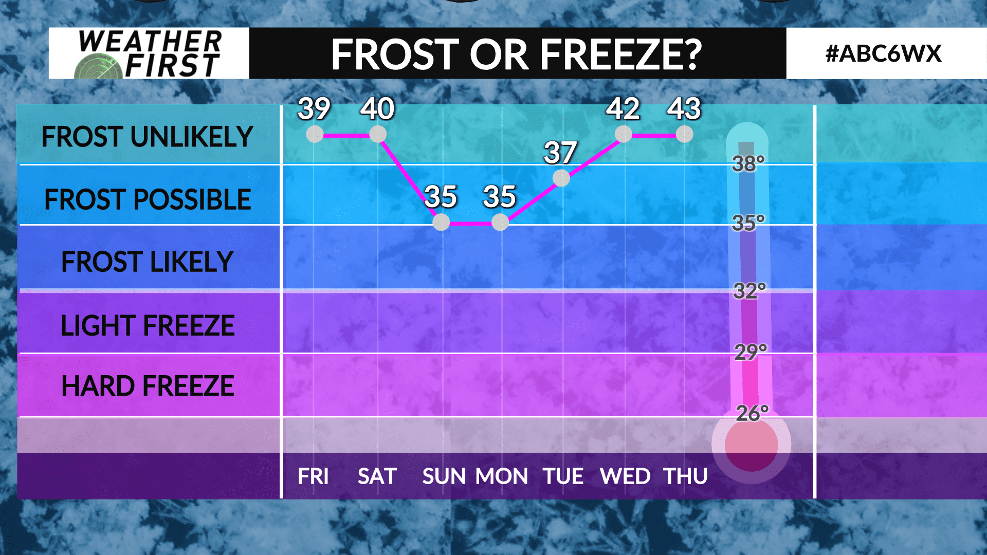
Patchy frost possible early next week
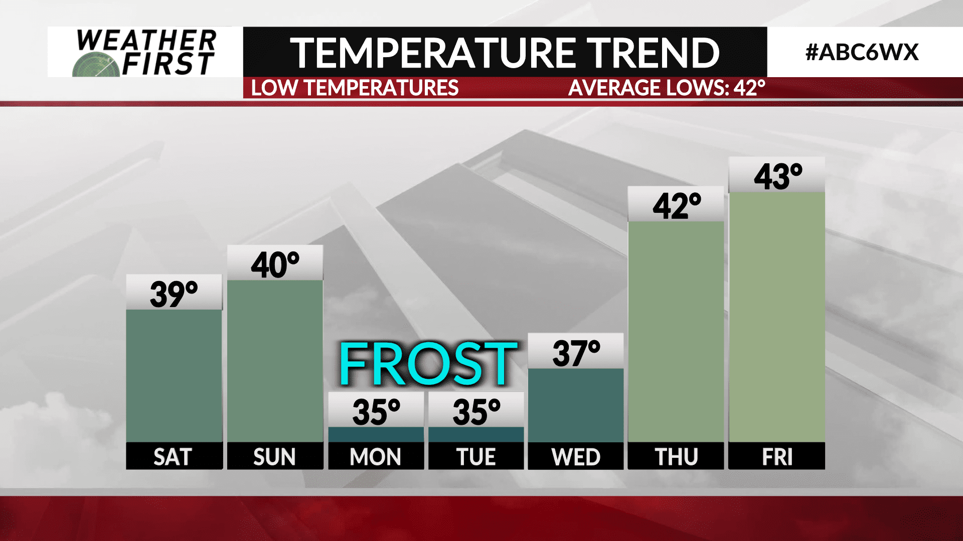
Just on time, the first frost is possible in some locations early Monday morning and Tuesday morning. The most likely areas will be wind-protected and low-lying areas that tend to be more frost prone. Overnight lows will be around 35° at most stations by Monday morning. So, why do we get frost when the air temperature isn’t freezing? Station thermometers are typically at a height of about 6 feet. On a quiet night, especially one with a clear sky and light wind, there can be a significant difference from only 6 feet off the ground to ground level. At night, the heat absorbed by the earth during the day is radiated away, a process called radiational cooling. When there is little to no wind and a clear sky, radiational cooling is most efficient. Due to the continual heat loss at ground level and a greater density of cold air, temperatures can vary quite a bit in short heights.