Tracking Tuesday’s T-Storms
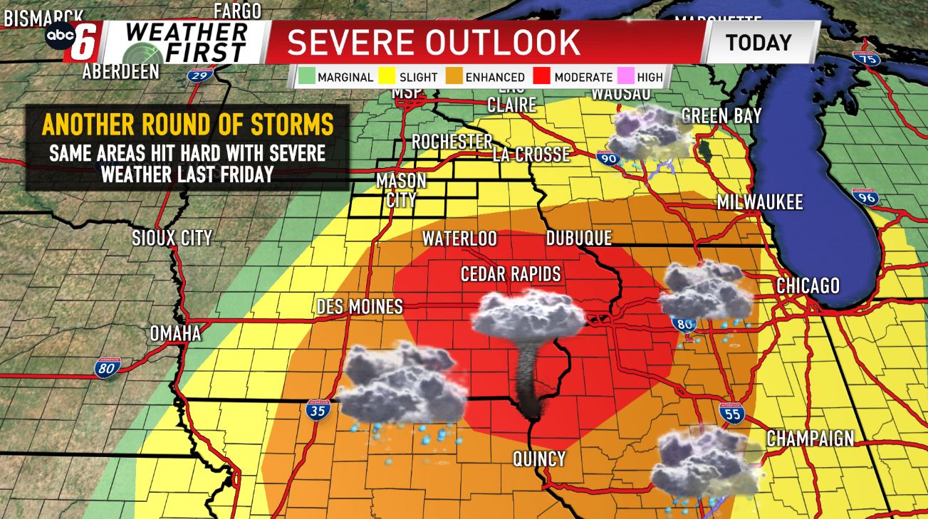
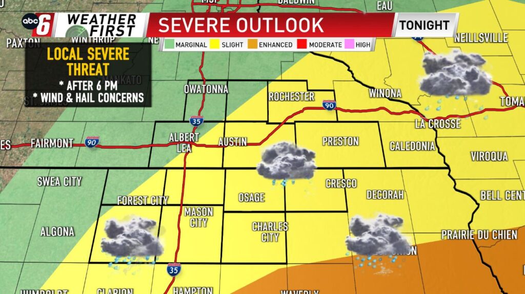
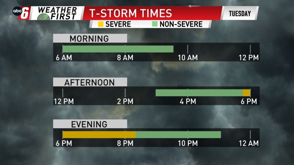
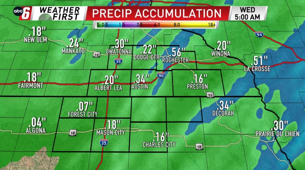
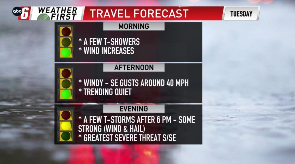
Areas that were hit very hard with severe storms last Friday, will be on guard once again for another severe weather threat. Overall, the better chance for damaging wind, large hail, & tornadoes will be across eastern & southeastern Iowa, once again, the same area that saw the storms last Friday. Locally, the Weather First Area isn’t in the clear completely from the severe threat, as a few strong to severe storms will be possible along and E/SE of a line from Algona – Forest City – Albert Lea – Rochester. This will be especially the case after 6 PM, with damaging wind & large hail the primary threats locally. Rainfall will be in the quarter of an inch range or higher, with a few of the stronger storms.