Storms erupt over Iowa Friday afternoon
The scenario is ripe for severe weather across the nation’s mid-section on Friday afternoon. We sit at the far northern edge of the threat, but it isn’t a threat we should take lightly. Those that warm up significantly on Friday need to be on high alert.
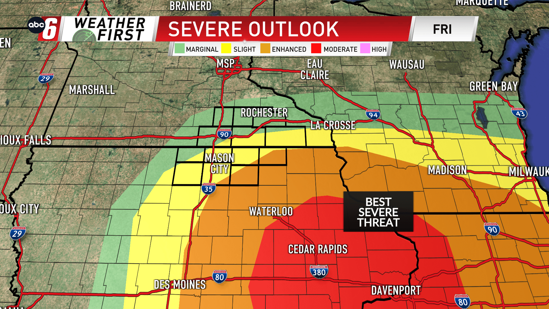
The warm front sets up very near the state line to about I90 during the afternoon. South of it, is where we’re watching the biggest threats locally. Thunderstorms erupt between 2-3PM and dot the area, especially south of the border quickly. They’ll then race northeast and be out of the Weather First coverage area by 6 PM.
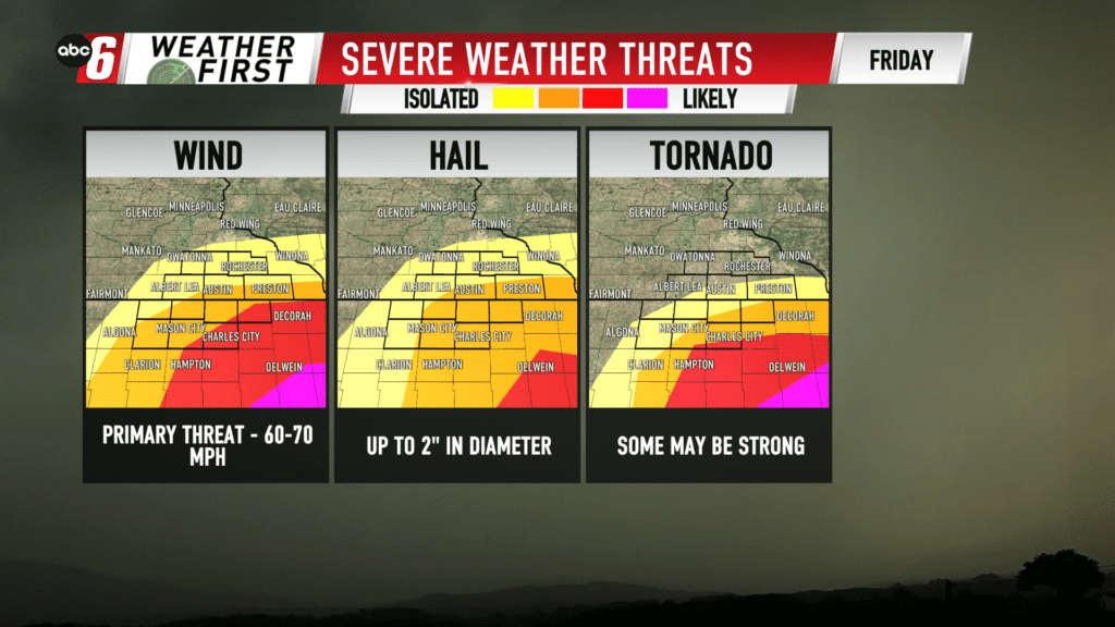
These storms will possess the capability of damaging wind, large hail and tornadoes. All of these categories, a strong variety of each is possible.
Storms will be individual at first but congeal into a line moving northeast.
Eastern Iowa has the most robust environment. Those that don’t see warming out of the 40s and 50s will have a more stable atmosphere when it comes to t-storms. Any strong storms entering this area will elevate, then weaken with time.
Keep updated by downloading our mobile app and following the station online, on-air and on social media.