Storms develop Thursday morning
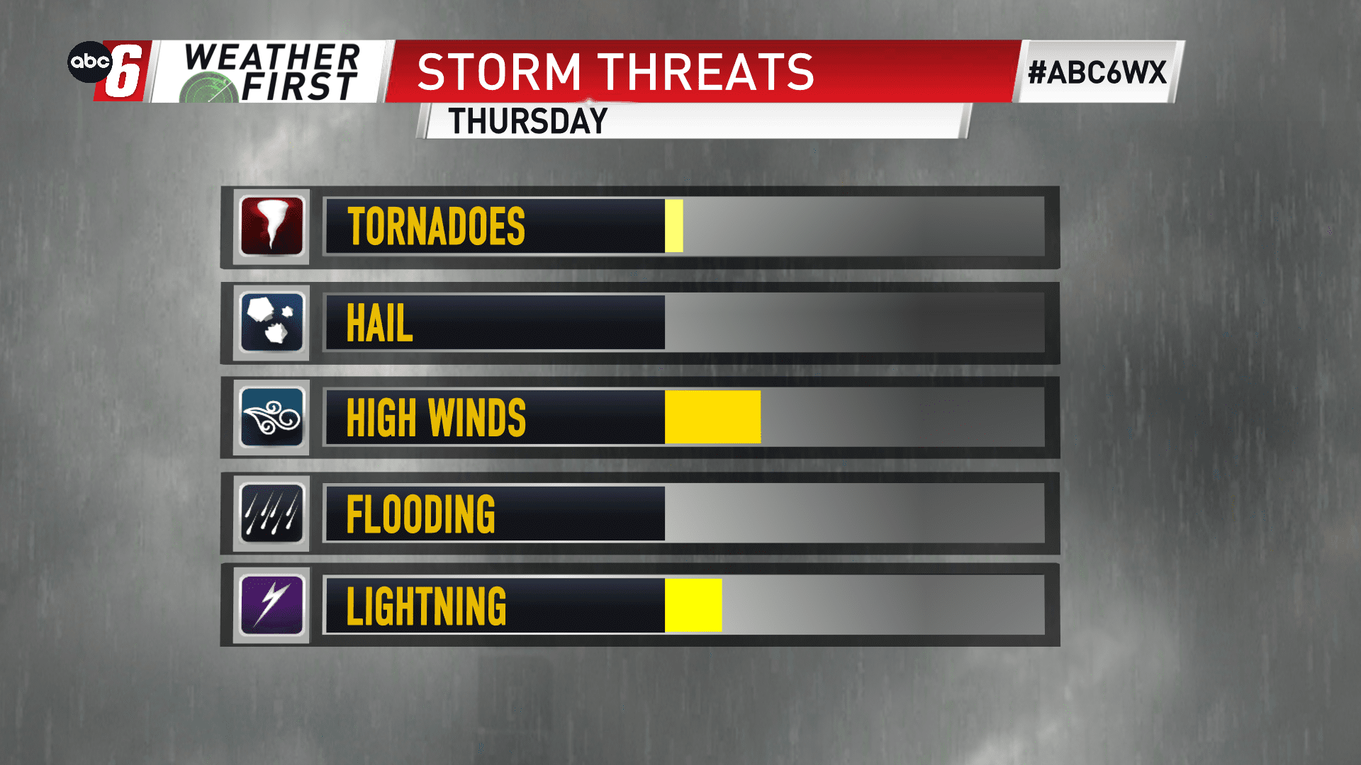
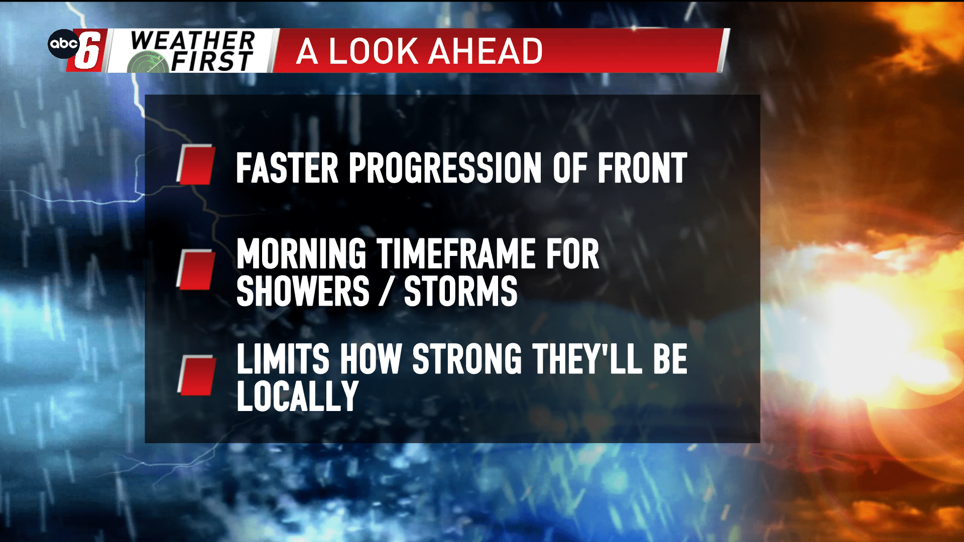
Storms develop along a cold front charging through our region Thursday morning to the middle of the day. The timing to watch will be from 8 AM to 1 PM. We’re watching for some stronger storms but they look more likely to develop as they exit our area to the east. It’s a high shear, low instability setup which leaves things a bit of a wild card.
What we’ll be watching is for a stronger storm, again on our east, to kick up the stronger winds. While an isolated tornado can’t be ruled out, I don’t think we’ll have the instability to get a robust updraft going.
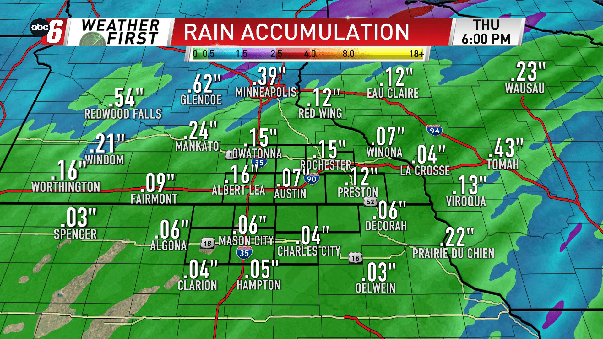
Around 1/4″ of rain or less is expected. These will be swift movers through our area.
Jim Peterson will keep you updated with the radar trends through the morning as the front draws through our area.