Riding the edge
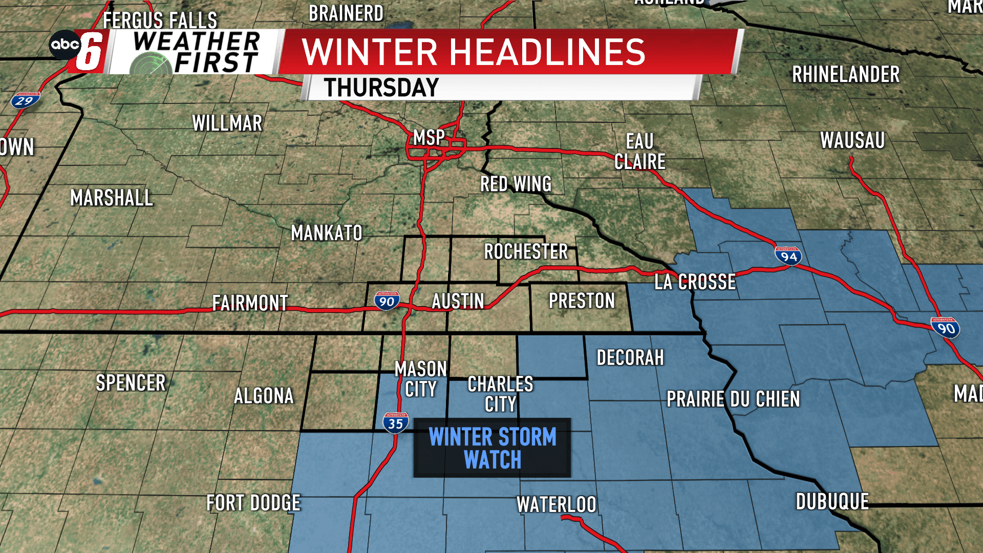
Thursday morning to Thursday night is the timeframe to watch for a winter storm charging up from the deep south. We’ll be just cold enough we’re talking about snow through the duration of this one. But it’s looking more and more that we’ll be riding the edge of this one.
Many miss significant totals and only a select few south and east have the highest potential. These amounts will be highly dependent on the track of this system, which is still wavering on it’s projected position.
The most susceptible to picking up some decent amounts of snow will be Floyd, Howard and Fillmore Counties. Our initial call will be for 2-5″ of snow in these areas, but more than likely we’ll be seeing a tight gradient between less than 1″ and 5″ of snow. Right now, that threshold to quickly lop off totals occurs just west of here.
A secondary band does slide in from the west late Thursday evening. This feature looks to bring only meager amounts of snow for everyone as it slides through.
The going snow forecast is shown below, but is highly subjective to the path wavering. Those outside of Howard, Fillmore and Floyd counties at this point should expect only around 1″ or less of snow.

