Major storm expected to cripple travel scene
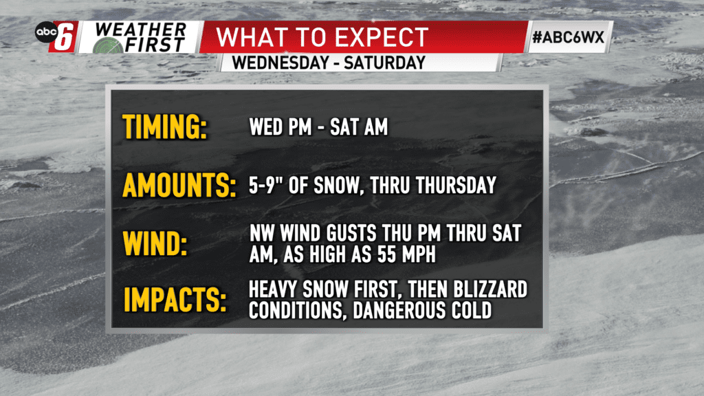
A major winter storm/blizzard is expected for the end of the week, along with dangerous cold. Wednesday evening through early Saturday morning is the timeframe with major impacts expected. Travel in this timeframe should be avoided. It may be impossible at times too. Alert Day status is in place.
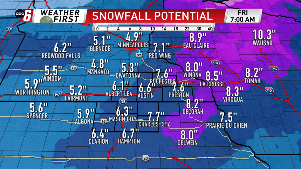
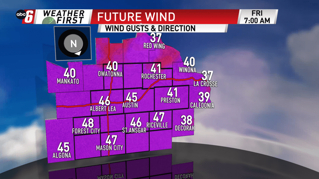
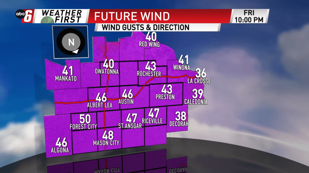
There is a disconnect from the snow and strongest wind. We’ll pick up the most snow, anywhere from 5-9″ area wide Wednesday afternoon to Thursday afternoon. The strongest wind begins to arrive at the tail end of that period and continues through early Saturday morning. Even if we pick up a fraction of the totals, the strong wind will still mean blizzard conditions on the ridgetops/open areas as winds gust 40 to 55 mph. This will be because our area already has a large amount of loose snow on the ground. The issue is certainly much worse with more snow being added.
Travel while the snow falls will be difficult enough. Heavy snow and low visibilities will grind the travel scene down. But with the onset of the strongest wind late Thursday, travel will be extremely difficult, dangerous, and in some cases, impossible all across the Midwest. It is best to change travel plans to outside the aforementioned window. If you travel and become stranded it is possible you will be in the elements for several hours.
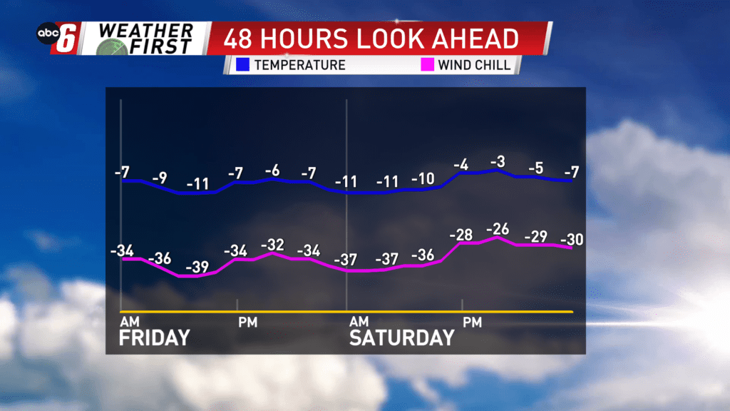
Dangerous cold settles in with that strongest wind. Sub-zero temps are expected Thursday night through Saturday afternoon. With the wind, the wind chill may drop to the -35 to -45° range at times. To risk being caught out in these conditions is unnecessary and very dangerous, and potentially life threatening if you don’t have the means to stay warm.
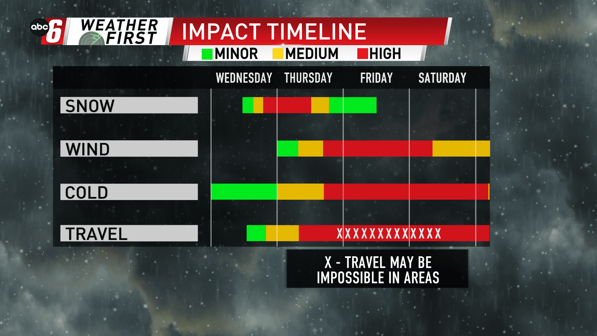
Check out the hazard impact timeline graphic to get a sense at when the worst of each variable will occur in the four day stretch from Wednesday – Saturday.