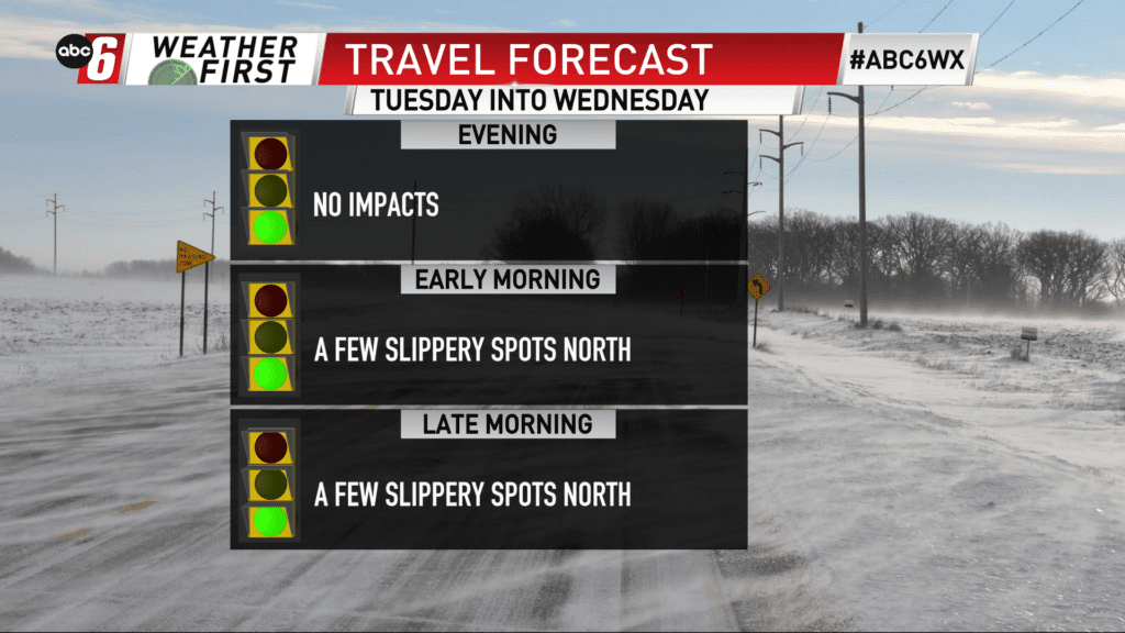
Light wintry mix returns for Tuesday night
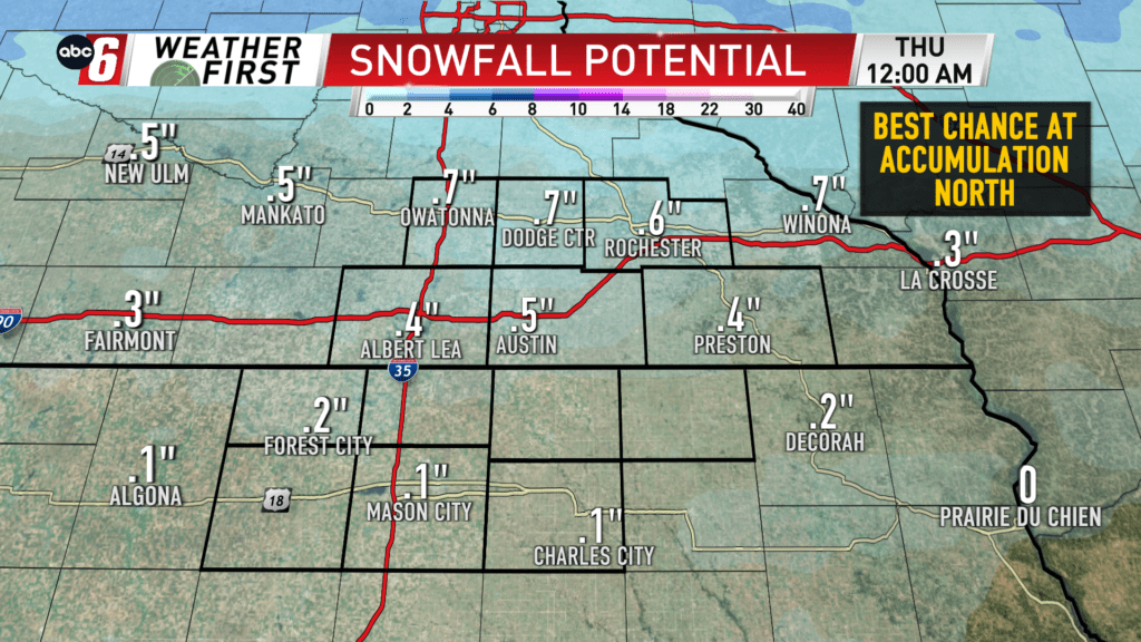
A band of rain/snow is on the way for Tuesday evening into Wednesday morning. Temperatures hover near the freezing point so it’s possible some of that rain would produce a glaze of ice. Of interest with snow, the impacts would mainly be felt north, on the Minnesota side of the border. Accumulations appear to be minor, generally around 1″ or less, tailing off southward.
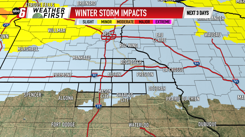
While a few slippery spots may arise, the overall impacts appear to be slight at this point.
The higher resolution data is showing a stronger signal for snow than before. So we’ll watch to see if any adjustments need to be made into the morning.