Let It Snow, Let It Snow, Let It Snow… Again…
With severe thunderstorms over, we shift back over to snow chances overnight into Saturday morning.
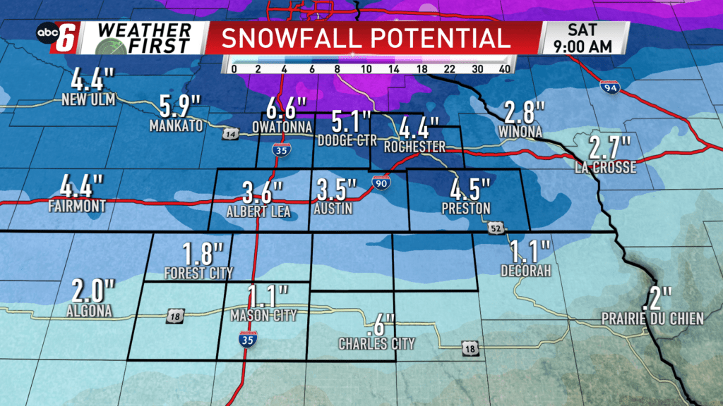
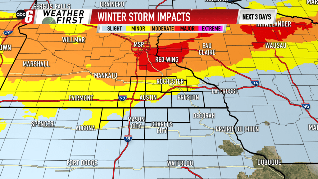
Snow is expected to have, at least, minor to moderate impacts for all communities. Those at least risk for severe weather (north of I-90) will be at most risk for the snow.
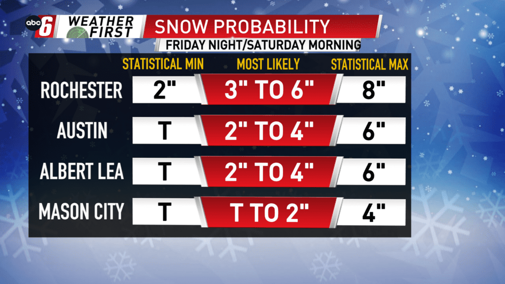
Highest totals look to be around 3-6″ up toward Highway-14, with higher totals up towards Red Wing and the Twin Cities. Northern Iowans are less likely to see the higher totals, topping out between 1-3″ for most of them.
Most of this snow will be gone by the beginning of the work week (if not all).
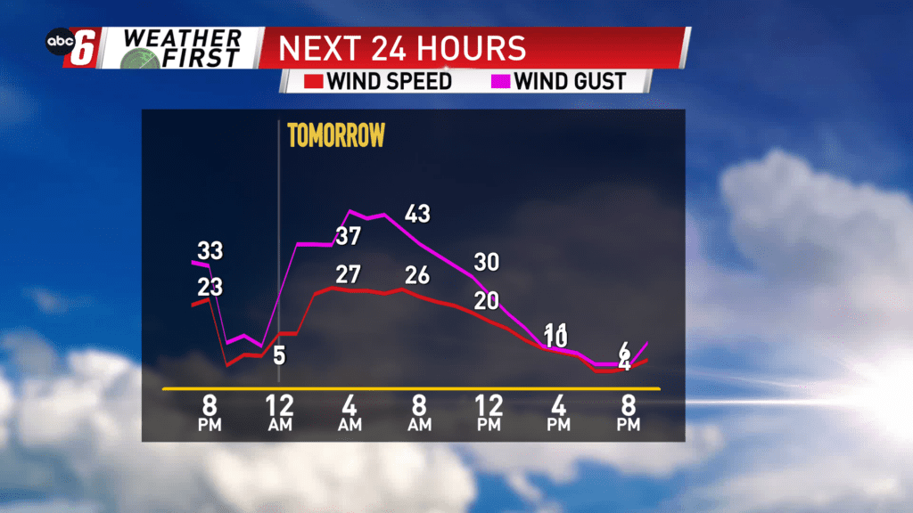
Gusty winds will create blowing snow early, but less of it is expected heading into the afternoon and evening with less winds.