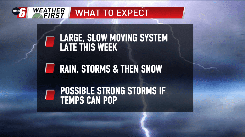
Eyeing the end of the week
The end of this week is the key timeframe to watch as a slow moving, very dynamic storm system moves in. We’ll see rain Thursday, storms Friday and snow Saturday.
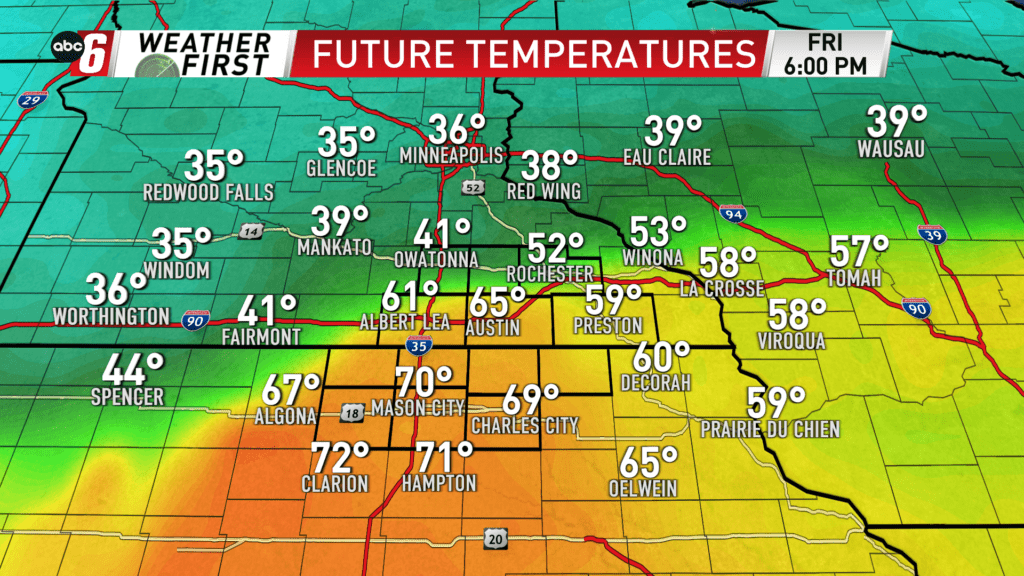
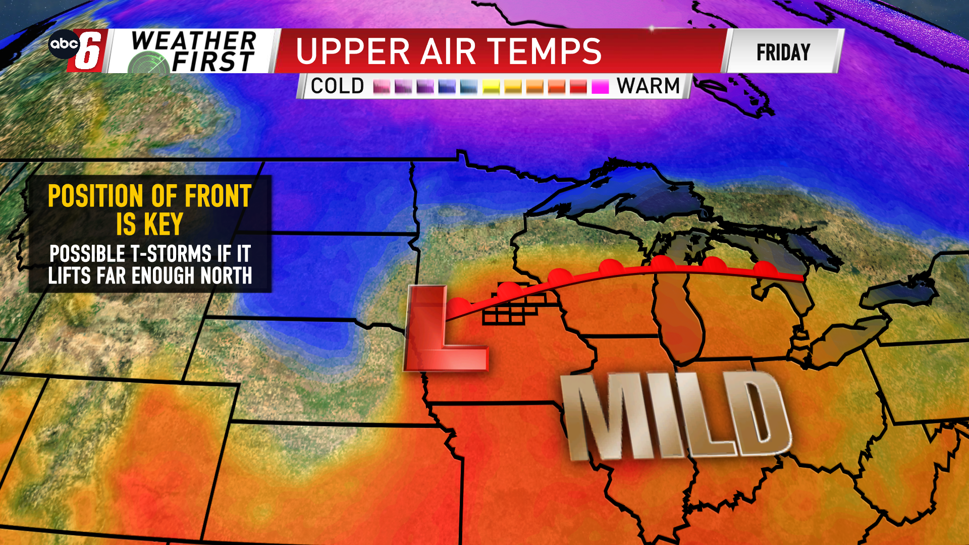
My biggest focus is being put on Friday at the moment. It appears we’ll be riding the northern edge of a severe weather zone. Our prospects for a stronger storm would surround a warm front and if it could lift far enough north into our region. Being on the edge leaves a fair amount of uncertainty on the matter but it is the lynchpin in the whole scenario.
It is possible that if the front gets into our area, temperatures will range from the 40s to 70°. It’s the areas south, that have the best chance of warming that would be the first to enter the troubled zone.
Being four days out, we have some time to monitor. We’ll continue to do just that and check back up with updates.