Dodging the severe storms, highly impactful again to the southeast
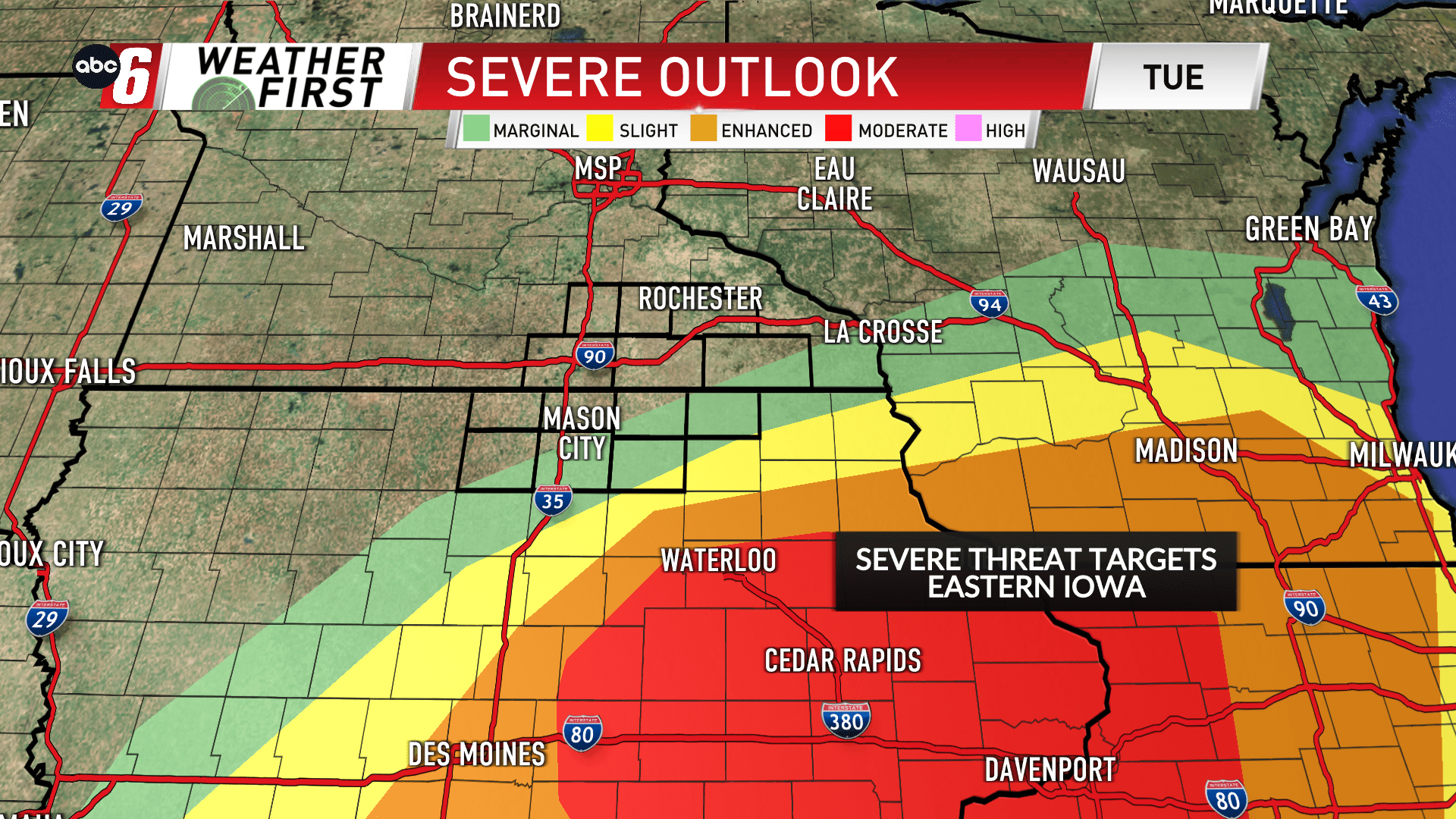
The severe weather threat does not appear too likely or widespread for the ABC 6 Weather First area. The setup takes the heart of the low over NE Iowa which will not be favorable for bringing the best thunderstorm prospects northwards.
The target zone is again eastern Iowa for another potential tornado outbreak. The Severe Outlook does nudge the lowest category up into NE Iowa.
We’ll track the conditions closely going into Tuesday evening. That’s our local timeframe to watch. 7PM and after this time. Our eastern edge has the most likely opportunity to see this activity. Many will not. That window will be brief, likely closed by 9PM.
The most likely timeframe for rain on Tuesday will be in the middle of the day. From mid-morning to mid-afternoon. This activity will not possess severe weather.
