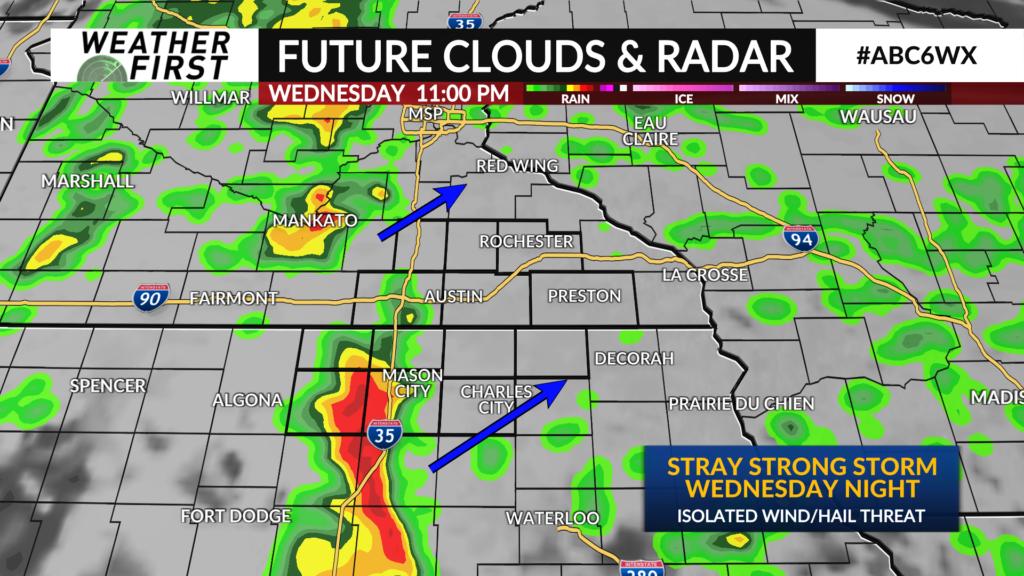
Monitoring storms Wednesday night
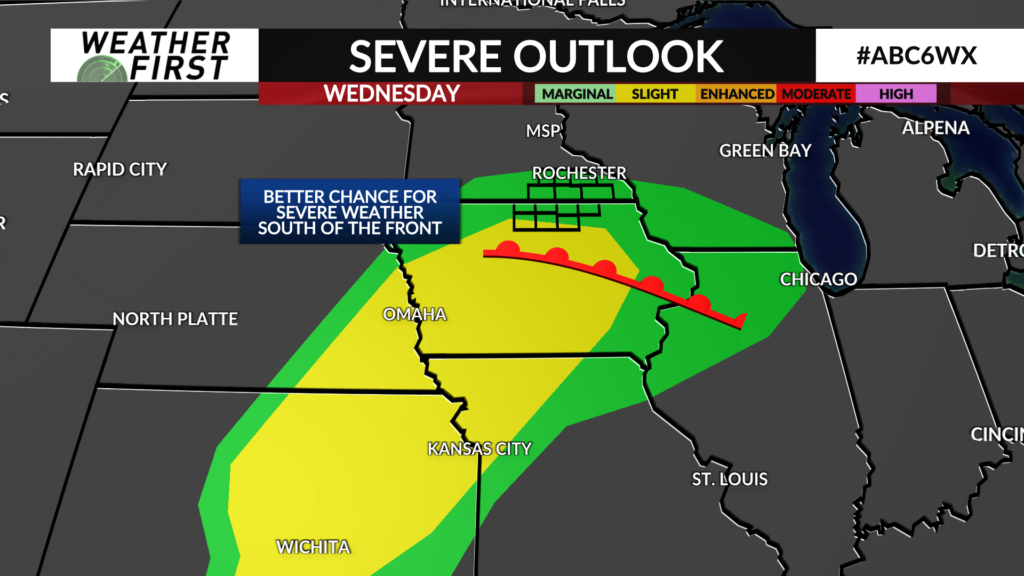
It’s an outside shot for a severe storm. We’re riding the northern edge of a warm sector of air which will hold a bit more impact with thunderstorms in the south. That warm front separating us from the risk zone will never fully get here.
We’ll still see some showers and storms. There is a bit of energy and also some bits of spin. But being in the cooler side of the system provides some benefits in stability and means these storms will be elevated and they pose a bit less of a severe risk.
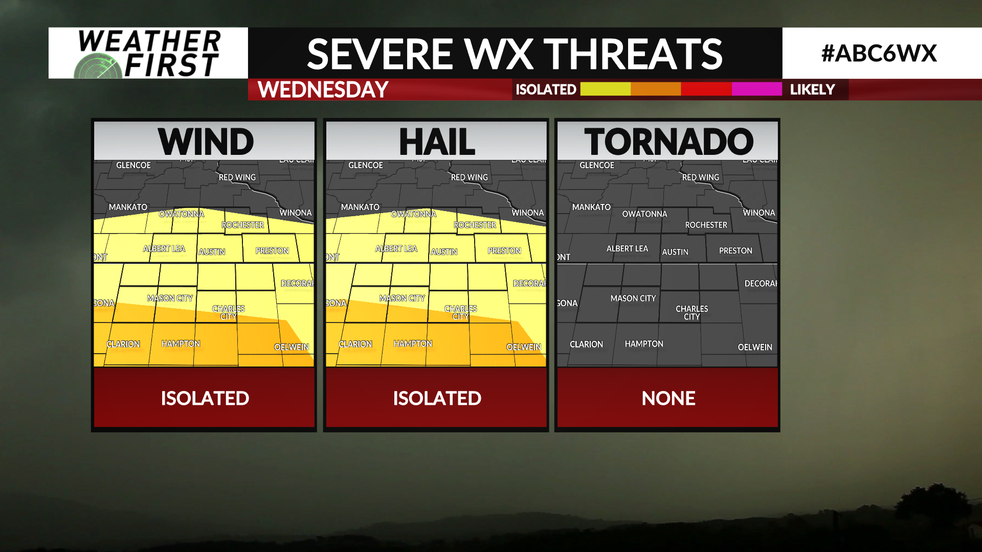
Any severe threat looks isolated and a bit more favored over Iowa. Threats would include hail and wind.
Timeframe to watch for this opens up after 7 PM, but looks more likely a bit later. This also doesn’t do any favors for the severe risk.
We’ll be monitoring the situation as we get closer.