ALERT DAY: Several schools closing early, snow leading to slick travel
[anvplayer video=”5150242″ station=”998128″]
UPDATE 11/29 (11:36 a.m.) – Multiple schools are closing early as snow continues to fall leading to slick travel across southeast Minnesota. To view the closings, CLICK HERE.
The Minnesota State Patrol says between 6:00 a.m. and 10:00 a.m. Tuesday, there were 139 crashes statewide including 7 with injury, 53 vehicle spin-outs, and 3 jackknifed semis. Most have been tied to the central and southern part of the state as the snow has been persistent for much of the day. However, the snow will transition further southeast as the day goes along.
#MSPNumbers Statewide 6:00 a.m. to 10:00 a.m., 11/29/22: 139 crashes (7 with injury, 0 serious/fatal) & 53 veh spin out/off the road & 3 jackknifed semis.
— State Patrol PIO (@MSPPIO) November 29, 2022
To track current weather conditions, radar, and to stay updated on the latest weather information from the ABC 6 News Weather First team, CLICK HERE.
(ABC 6 News) – Back-to-back ALERT DAYS are in place for the Weather First Viewing Area, as our next round of snow & wind, looks to cause a few headaches out on the roads.
ABC 6 News Weather First Meteorologist Jim Peterson says it’s all-snow, mixing in a little rain/freezing drizzle at times (esp. over northern IA), from here on out. Snow will be lasting through the evening commute, wrapping up by 9:00 p.m. Tuesday.
When it’s over, 2-4″ of snow will fall locally. The higher marks outside of this range will fall just to our north & west. Lower totals to the SE where we are dealing with more of the rain/snow mix, cutting back on the snowfall totals.
The wind will gust Tuesday night into Wednesday to 35 mph at time from the northwest. Snow consistency will generally be wet which doesn’t stir around as easily. That said, some areas in the open will likely still have areas of blowing snow that extends through the entire day Wednesday leading to a few slippery areas on roads.
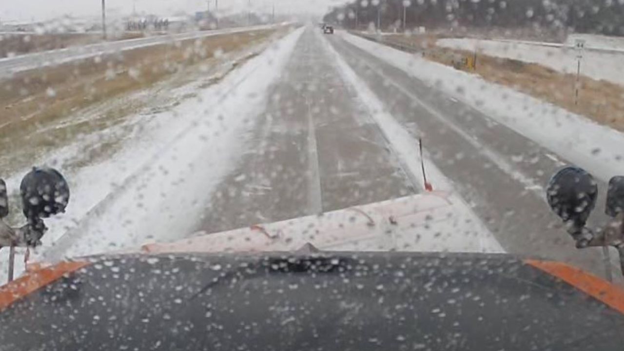
Courtesy: MnDOT
While this won’t be a whopper of a system, still go slow & remember your winter driving safety tips!
For the latest road conditions per the MnDOT, CLICK HERE.
To view road cameras provided by the Minnesota & Iowa D.O.T., CLICK HERE.
To submit a weather photo, CLICK HERE.