Strong wind with snow overnight – intense wind through Wednesday
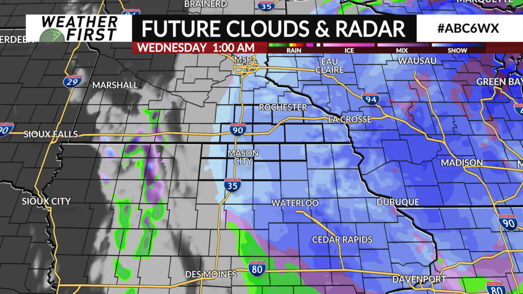
(ABC 6 News) – A strong storm system continues to intensify over the Midwest and will dominate our weather picture through Wednesday before departing to the east Wednesday night.
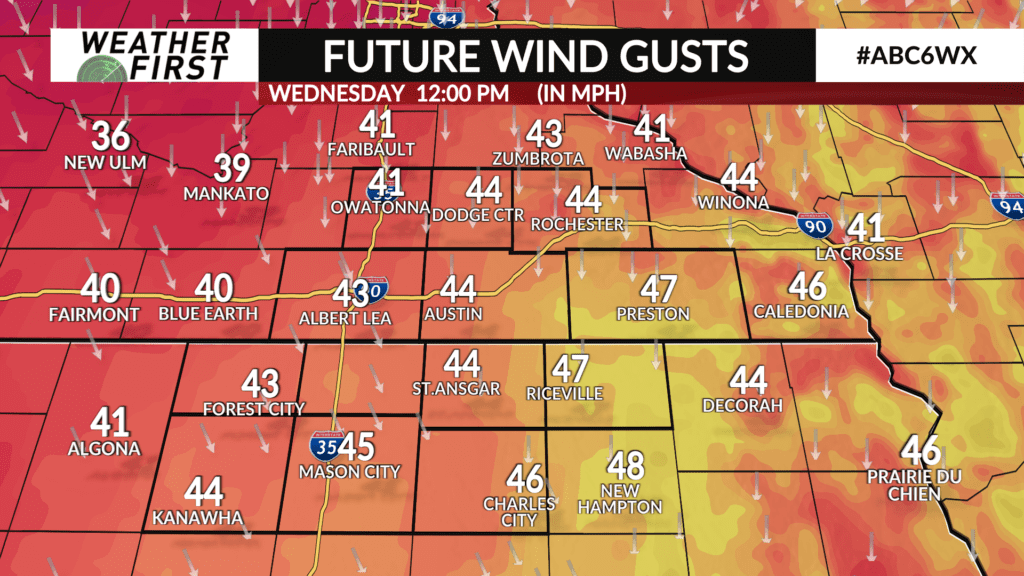
Wind gusts up to 45 mph in combination with falling snow from late Tuesday evening through Wednesday morning are the number one concern.
Even when snow wraps up Wednesday morning, winds will remain intense through the entirety of Wednesday.
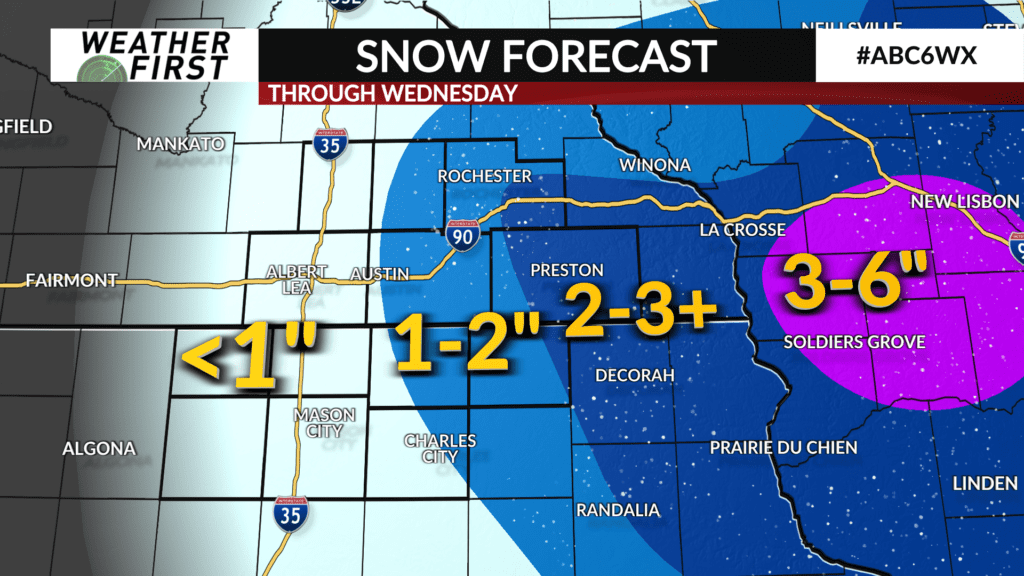
Snowfall totals will going to remain around 1-2″ for most of us, some spots in Fillmore County along with Winona County and Houston County may receive more with 3-4″ not out of the question closer to the Mississippi River.
With winds blowing up to 45 mph, possibly higher in some spots, there will be areas of blowing snow, lower visibility, and slick roads, especially in wide-open spaces.
Snow will taper off quickly Wednesday morning, especially west of Highway 52. Communities along I-35 will receive considerably less snow with less than an inch expected.