Wintry Tuesday with snow, falling temps
A storm that has had its grip on the area since Sunday will begin to pull away from the area on Tuesday with one batch of precipitation left before it exits.
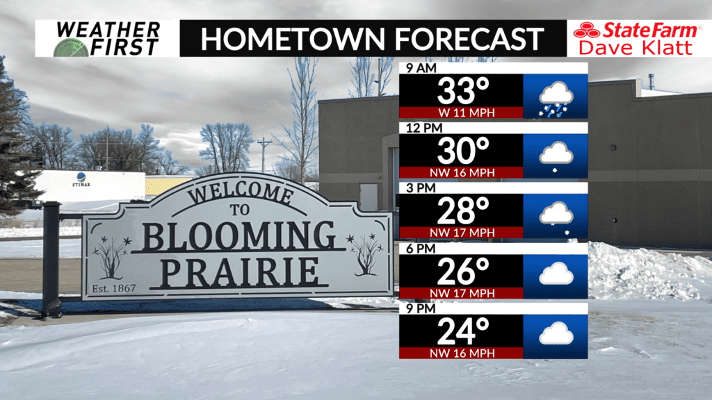
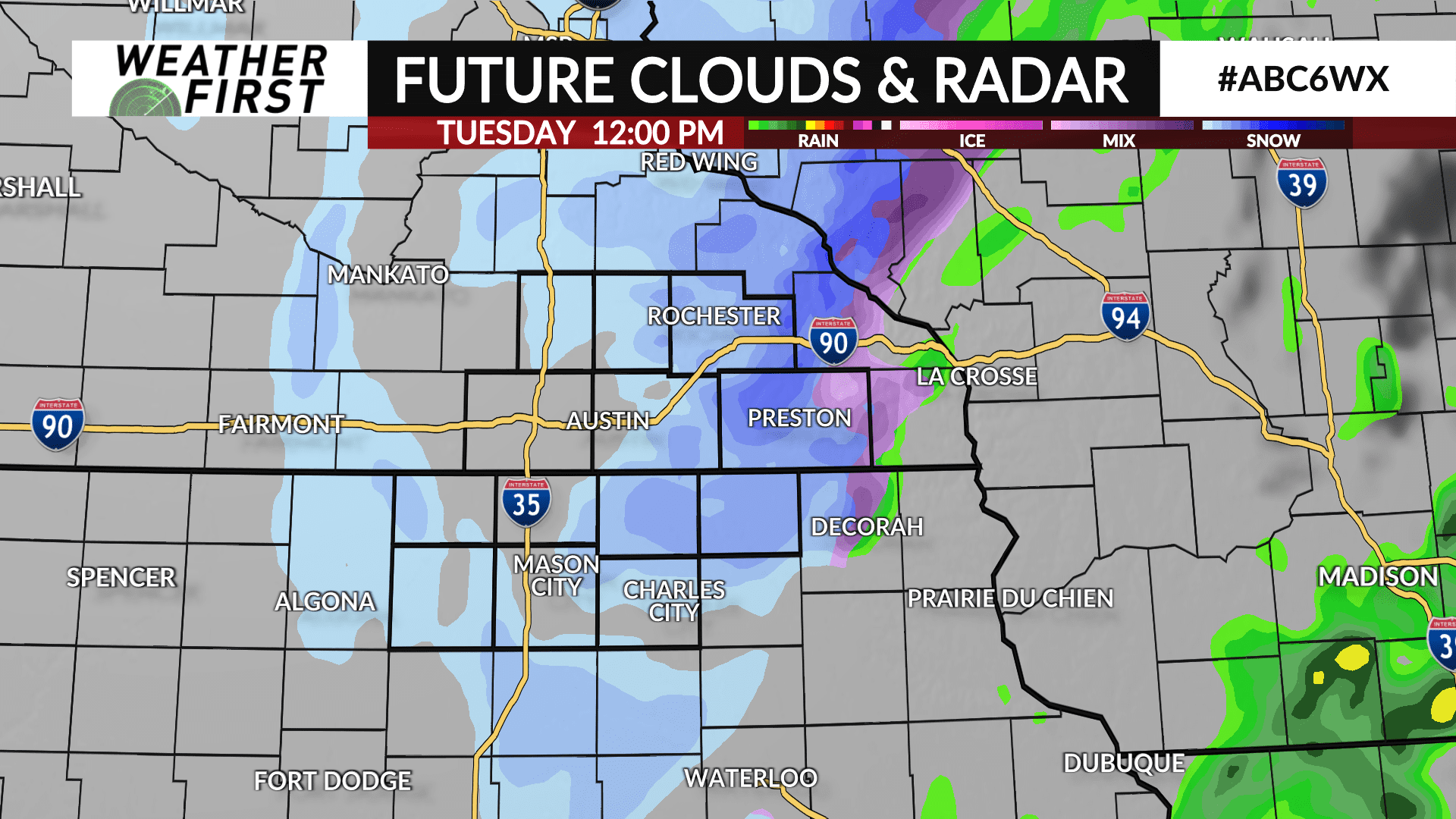
The storm will track northeast into Wisconsin as it heads towards the Great Lakes region. As it does, colder air will get pulled in on its backside with leftover precipitation changing from rain to snow by mid-to-late morning. There may be a brief period of a wintry mix of sleet/freezing rain/snow as that transition happens.
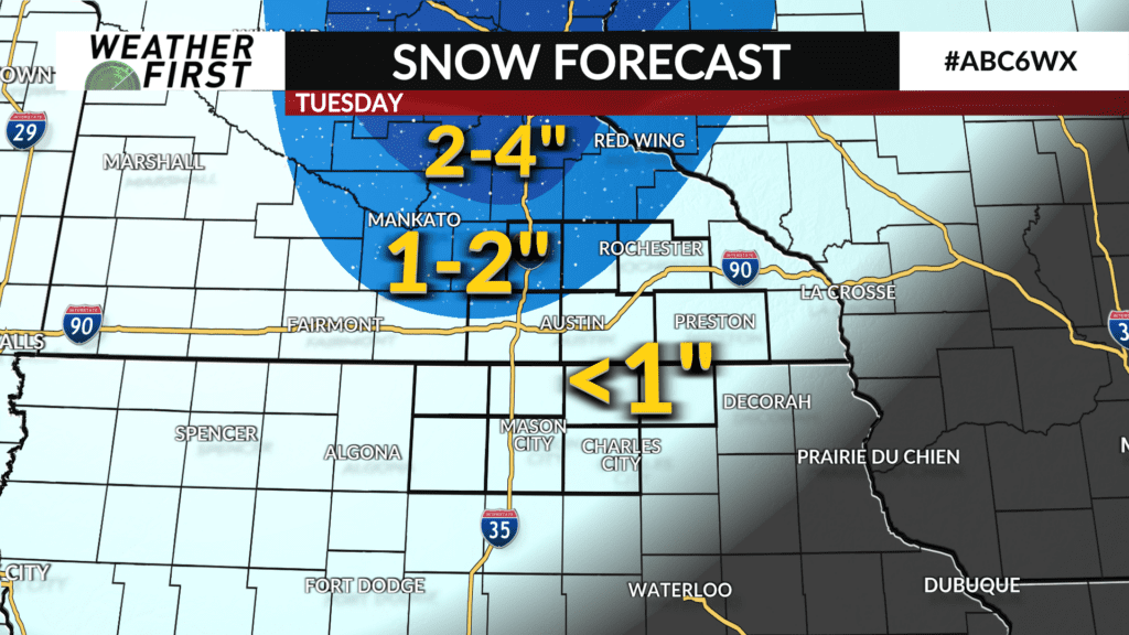
Snow showers will end by mid-to-late afternoon. Accumulations are expected to be around 1″ or less for many, however areas near and north of Highway 14 may see up to 2″.
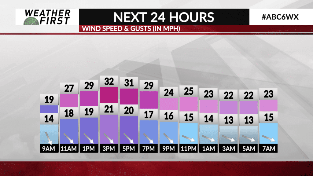
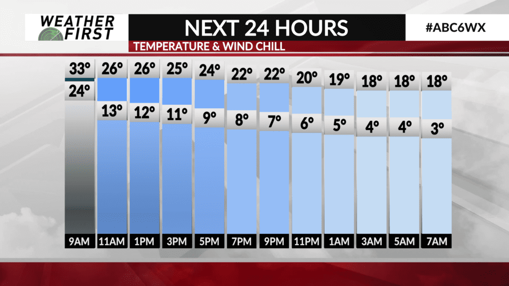
Temperatures will drop through the day into the 20s by late afternoon. An at times gusty wind up to 30 mph will lead to wind chills in the teens.