Winter storm has sights set on us
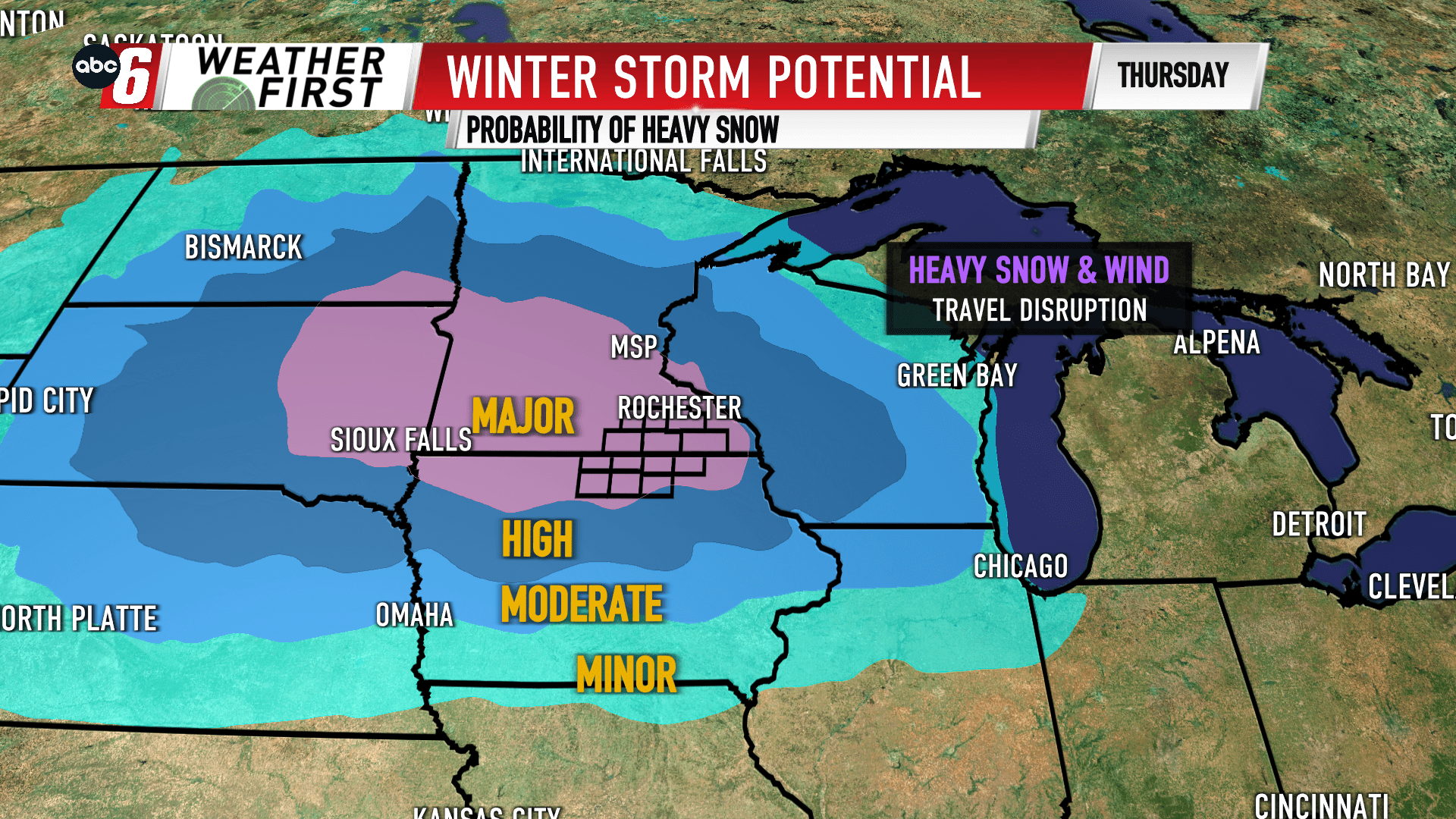
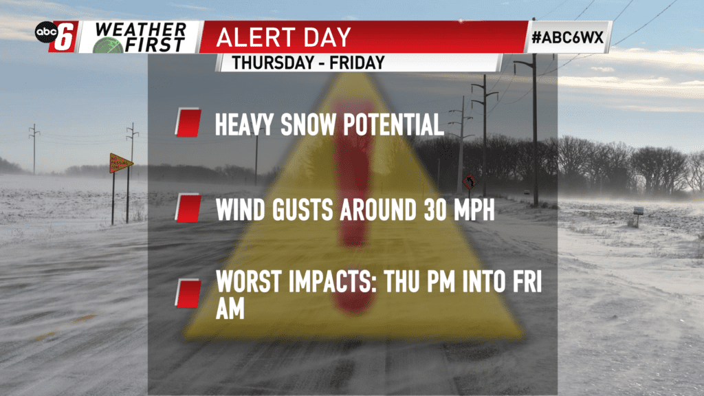
The end of this week is holding Winter Storm potential. In fact, confidence is increasing that we’ll see impacts from heavy snow and a gusty wind to create travel impacts.
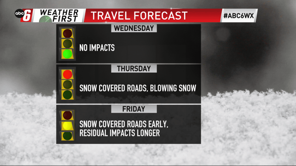
The entire window to watch will be from Wednesday night to mid-day on Friday. The worst effects should be from noon on Thursday to sunrise on Friday. It is in this timeframe the majority of snow will fall and the strongest wind will be felt.
While its too early to put specific amounts on the storm just yet, the confidence in several inches of accumulation is high.
Wind gusts reach towards 30 mph out of the east. We’ll avoid blizzard conditions but even at this strength, blowing and drifting snow is a concern in the open, especially while the heaviest snow is falling.
On the travel scene, expect some slowdowns on Thursday and Friday with conditions improving through the day on Friday.
More updates are coming as we continue closer to the timeframe.