Windy, chilly Wednesday with snow showers
A storm system tracking through the area will continue to have its grip on the area leading to snow showers and gusty winds heading into Wednesday.
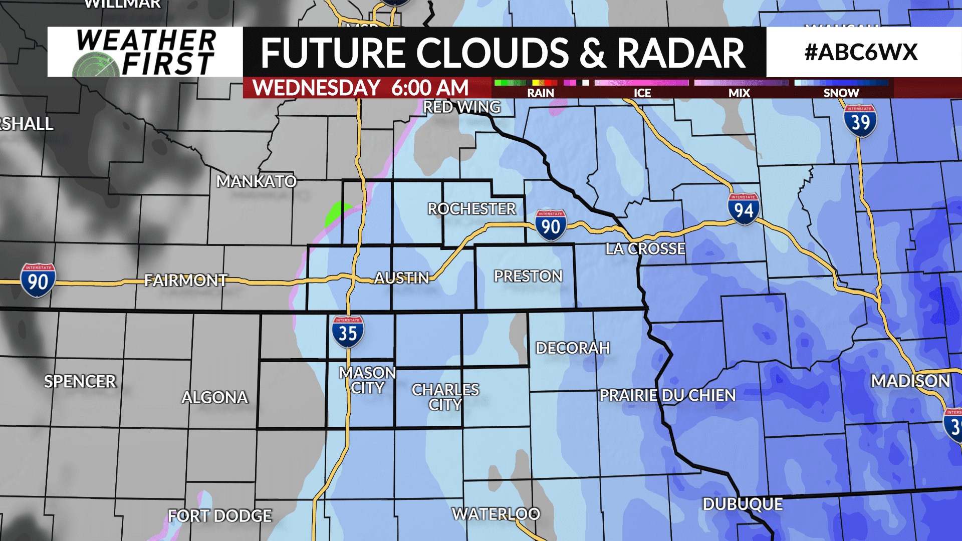
Occasional snow showers will be likely throughout the day which may lead to some slippery stretches and snow covered roads especially if any heavier snow bands do develop similar to Monday and Tuesday.
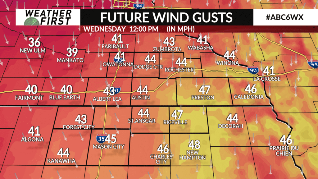
The wind will also ramp up with gusts up to 45 mph which may lead to some blowing snow and low visibility over short distances.
The storm has been trending further west in recent data with parts of southeast Minnesota and northeast Iowa likely to see snow accumulations. Snow amounts of 1-3″ is possible near and east of HWY 56 in southeast Minnesota and HWY 63 in northeast Iowa. Amounts of 3-6″ is possible in far southeast Minnesota, northeast Iowa and southwest Wisconsin. Shall any heavier snow bands develop, locally higher amounts will be possible.
Snow showers will come to end by Wednesday evening.
Clouds and snow showers will keep temperatures chilly with highs expected to be in the 30s.