Wind dominates, eventually cools us down
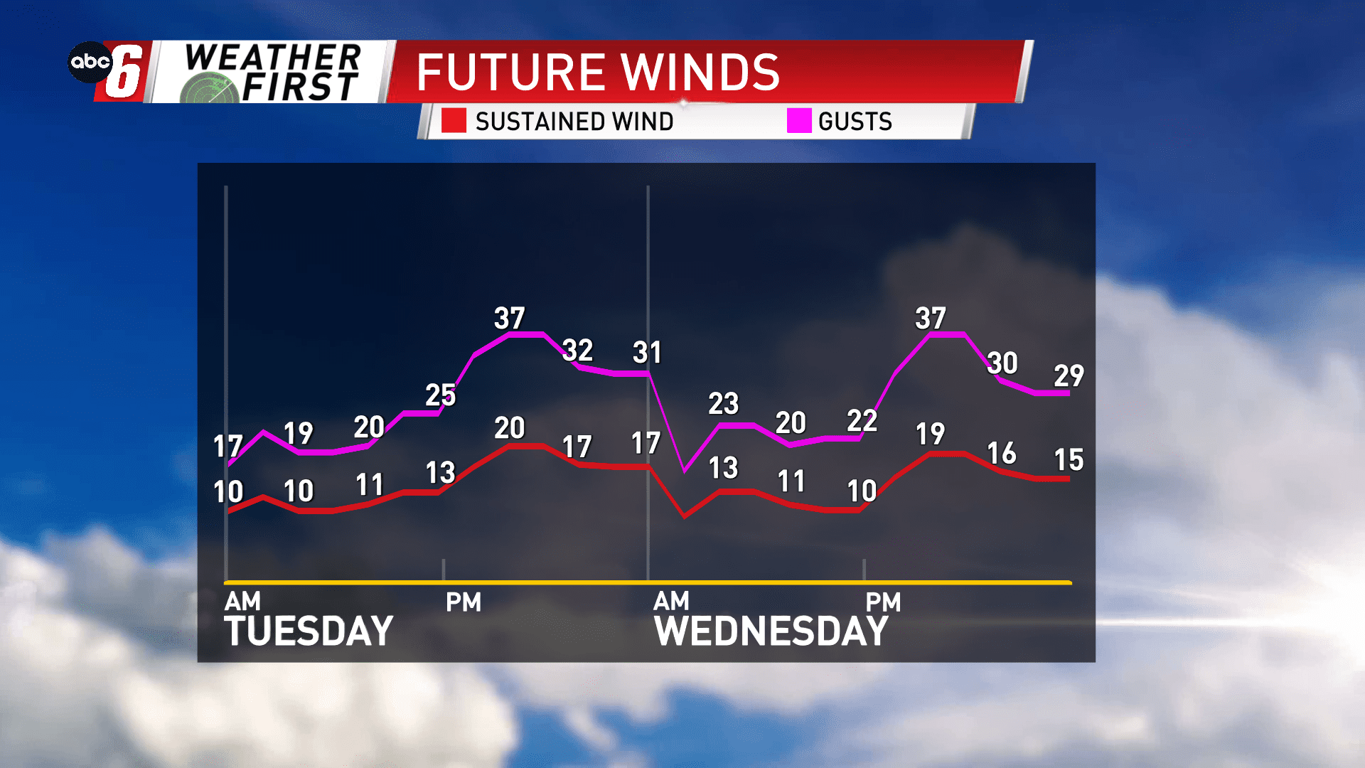
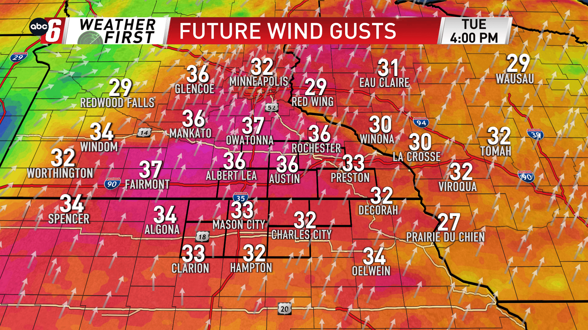
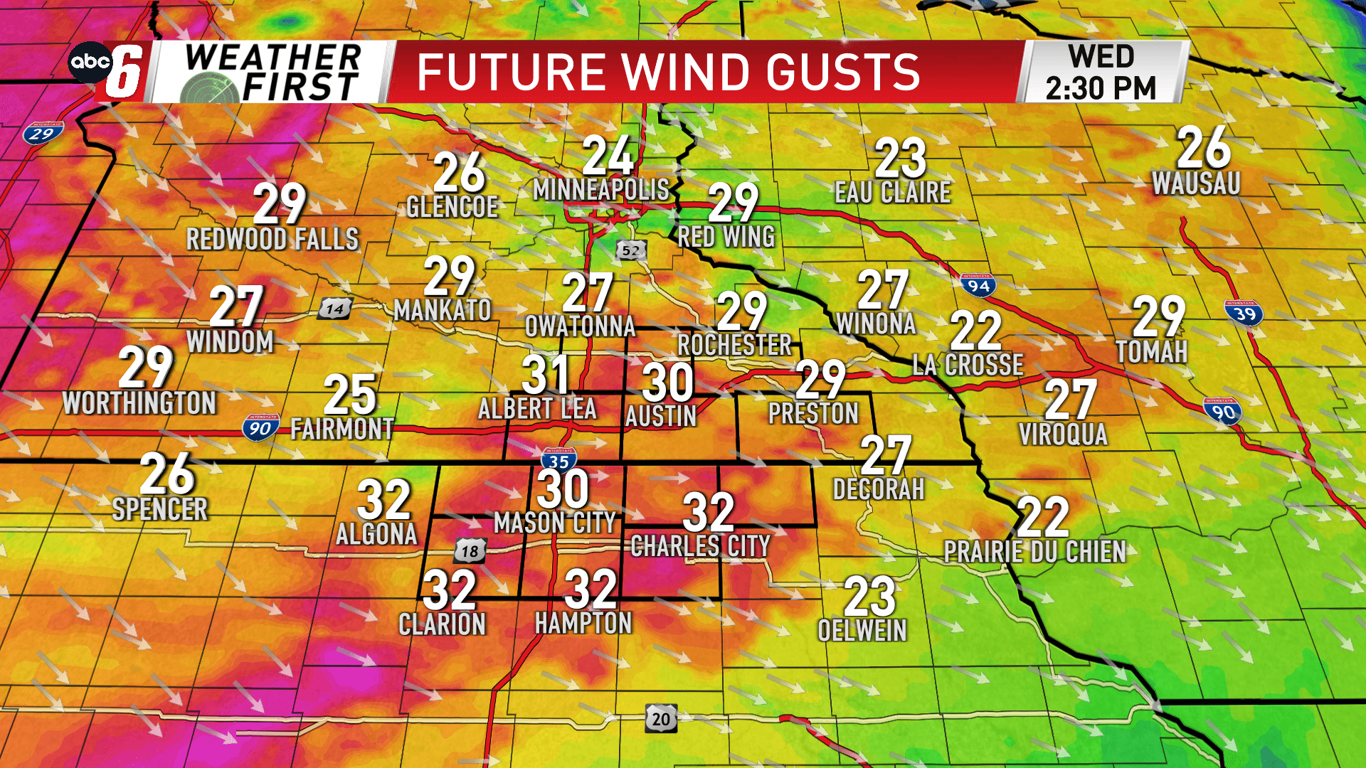
Both Tuesday and Wednesday feature a sharp wind during each day. Gusts will reach the 35-40 mph range during the peak of the afternoon. But one day features a south wind, the other a northwest wind.
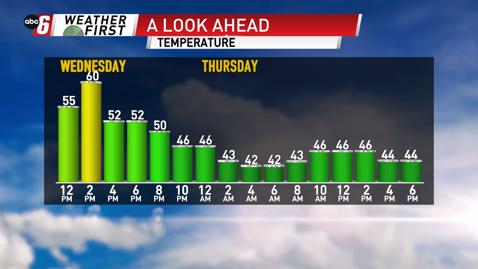
Wednesday is the colder of the two after a front moves through. You’ll notice a sharp difference with the wind involved. Temperatures will struggle to rebound back to 60° after reaching the upper 70s the day prior.
We’ll be even colder in the end after the effects of the wind take hold. Thursday’s highs will stay confined to the 40s.