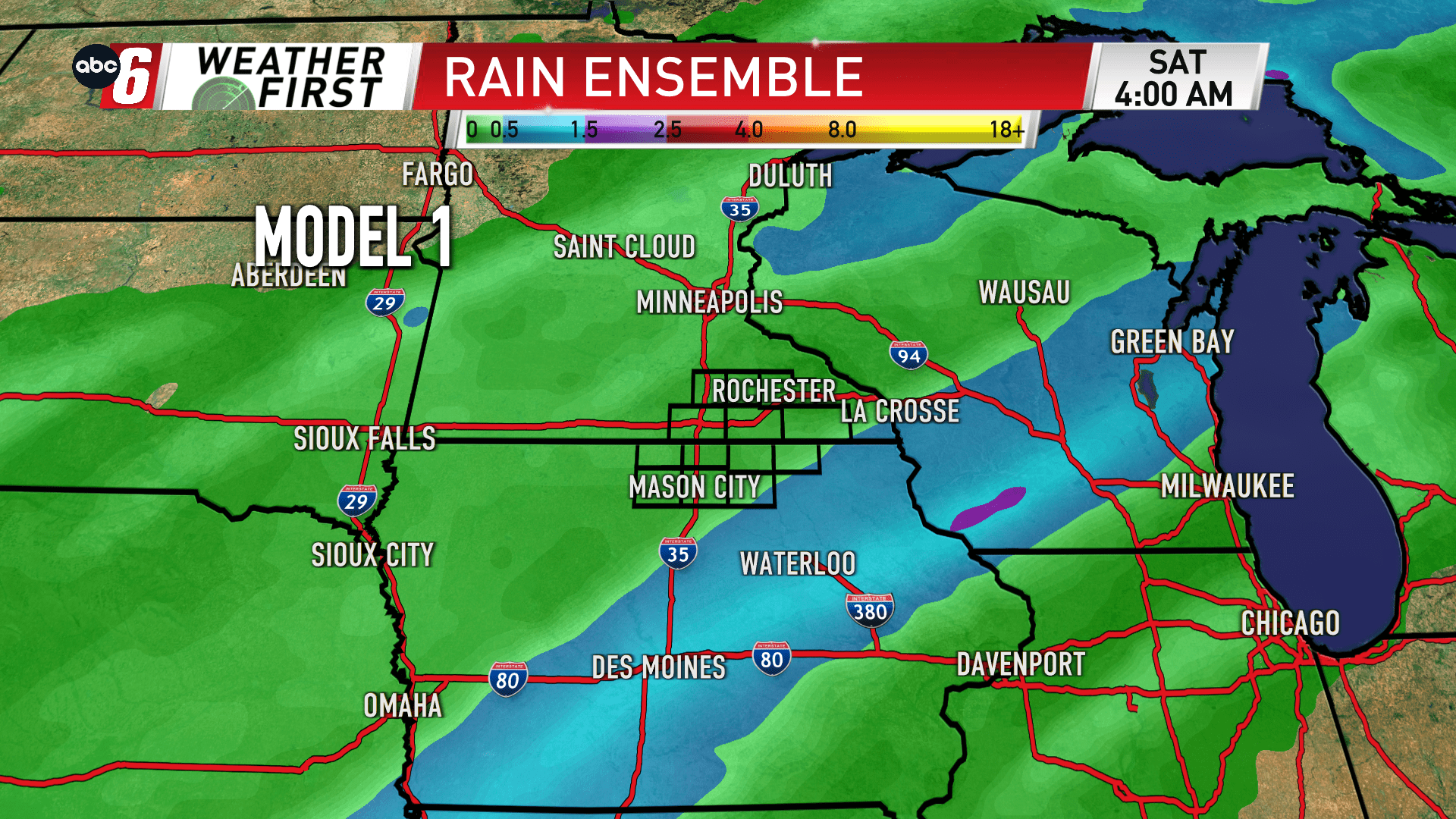
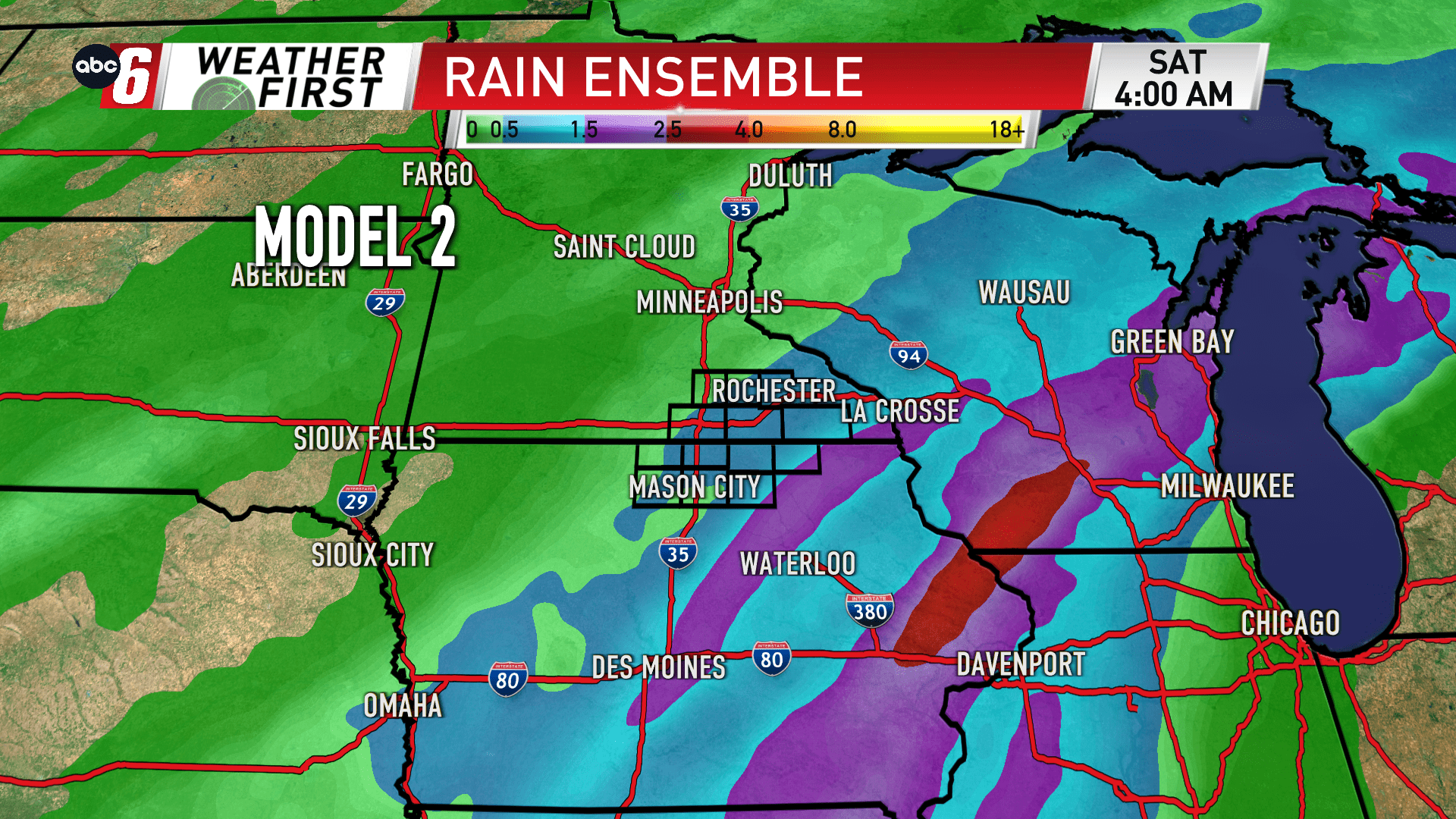
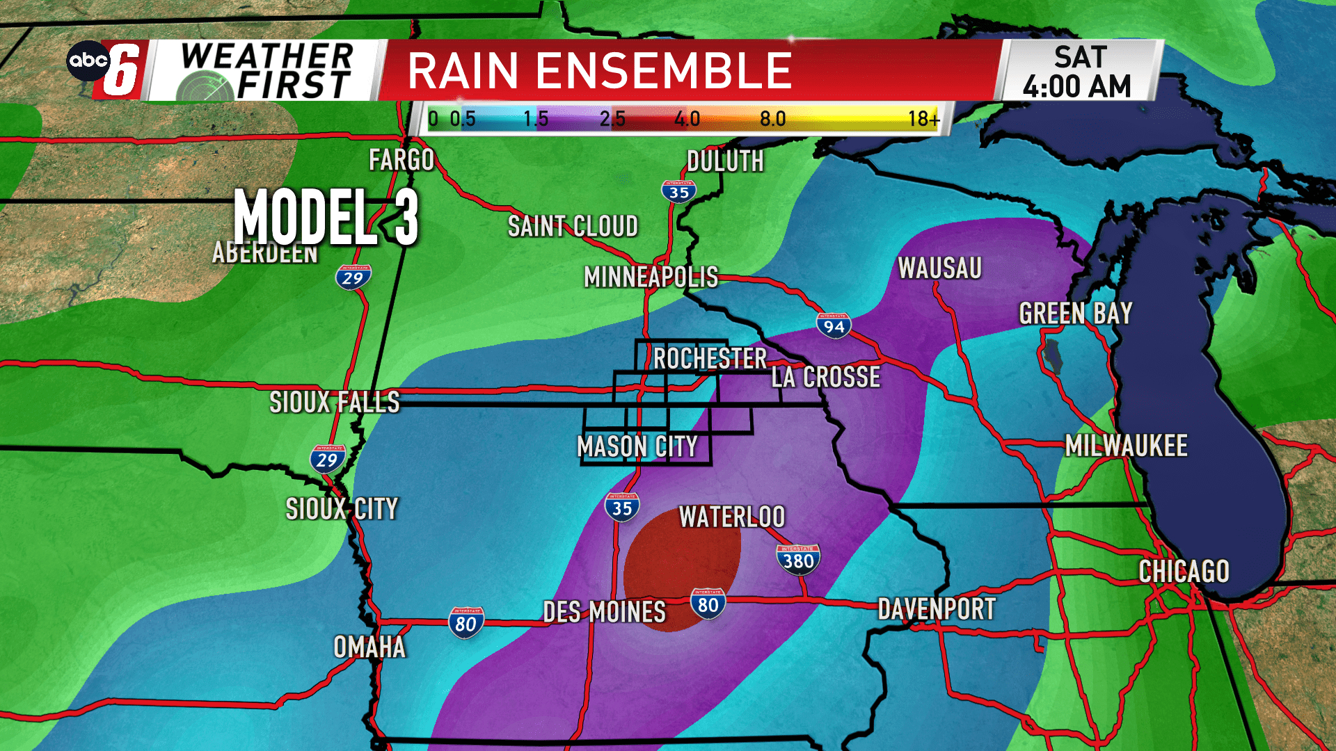
Where will the front slow down?

A stronger front and storm system is going to be developing towards the end of the week. The Thursday night-Saturday timeframe continues to be the time to watch for likely rain. While rain does look likely the amounts are still being dialed in.
One factor to watch will be where this incoming front begins to stall. This will dictate the path to which a storm system follows as it rides up the front. That stalling feature will mean higher amounts of rain. Latest trends have been to stall this front out a bit more on our eastern edge. That will trend the higher amounts that way. The model ensembles show that as the favored trend.
I’m not giving up on rain, but I do have less confidence that we’ll totals rise up to big-time levels. We’ll get the initial range on what to expect out Wednesday evening.