Wet start to the week with rain, snow showers possible through Tuesday
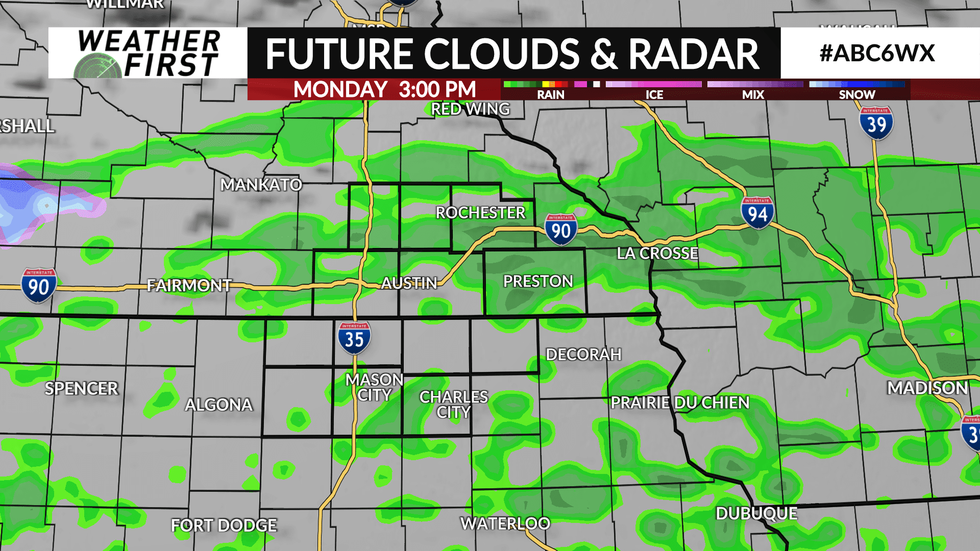
A large storm system will slowly pass through the region to begin the week leading to precipitation chances through Tuesday.
Rain will develop sometime mid-to-late Monday morning with rain showers likely throughout the day before becoming more scattered during the evening and overnight hours. As temperatures cool off, there may be some snow that mixes in at times especially Monday night into early Tuesday.
A lull with isolated rain and snow showers are possible Tuesday morning before a few more rain showers develop Tuesday afternoon. As temperatures cool off again, a rain/snow mix or all snow is possible Tuesday night into Wednesday with some grassy snow accumulations possible especially areas near and east of HWY 52.
High temperatures both Monday and Tuesday will range from the low 40s to upper 40s.


