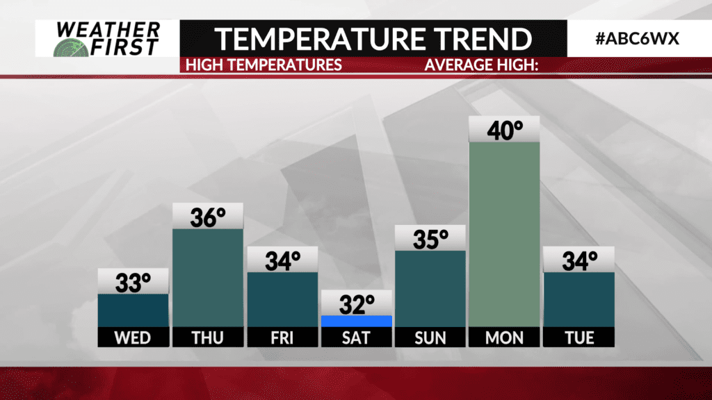
Snow to affect morning drive Friday
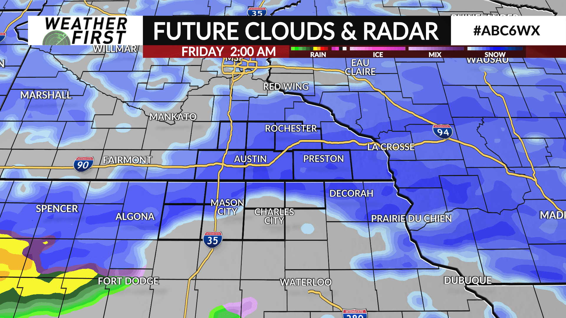
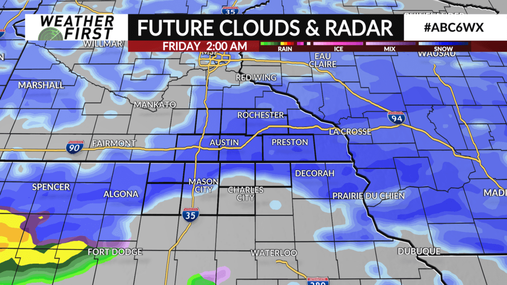
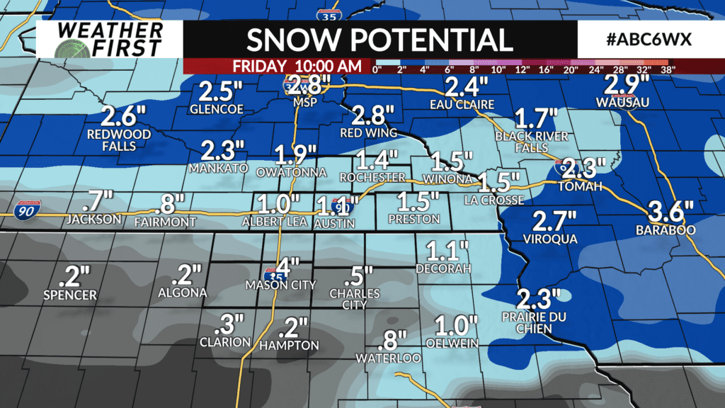
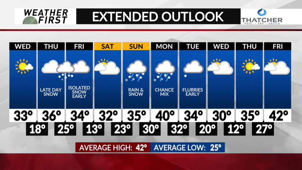
A clipper will slide through Thursday night through Friday morning bringing an accumulation of snow and the potential of slick roads. Amounts aren’t looking significant, mainly in the 1-3″ range for the ABC 6 News area, although some isolated higher totals can’t be ruled out. North Iowa looks to receive less snow as warmer air works in, but there should still be some much-needed precipitation. The more significant precipitation maker arrives Sunday into Monday. Whether that’s a majority rain or snow is still in question, but it’s a more potent system with more moisture. Stay tuned for more info on narrowing down snow totals forecasts for both systems.