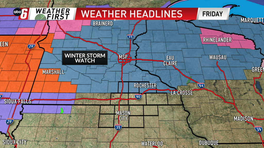
We close with a burst of snow
For about an 8 hour window from 10 PM to 6 AM, we’ll run into a band of snow cutting across the Weather First region.
There are considerable question marks that surround exactly how much we see. We’ll be going into the scenario on a mild note and that can’t be discounted. There is also a considerable amount of contamination in the data from those preceding thunderstorms to consider too. Snow will be most intense right at onset and should overtake the damp, warm scenario and start to accumulate. Intensity will lessen further into the overnight.
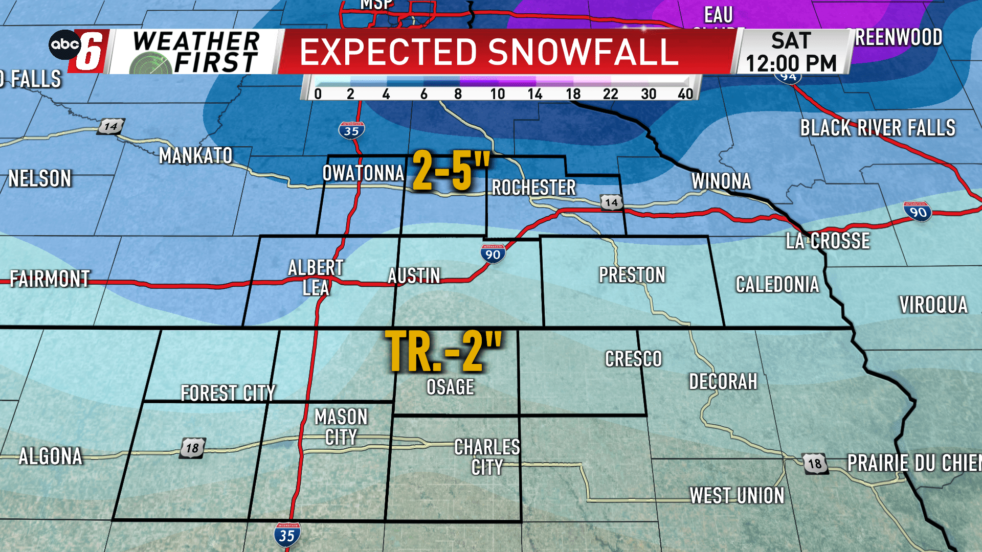
Amounts will be the highest in central Minnesota and northern Wisconsin where some 6-10″ of snow will fall. Locally, our highest amounts will be around 4-5″ north of US 14. Numbers trail off moving southward. South of US 18, amounts may be as little as a dusting.
There’s a very strong wind to consider. Gusts will come out of the north around 40-45 mph. This will drop visibility sharply as snow flies. Some blowing snow will occur too. Travel will be impacted, compounding moving northwards. After the wind begins easing and the sun comes out in the morning, conditions will be quickly mitigated.