Tracking Wednesday’s Snow
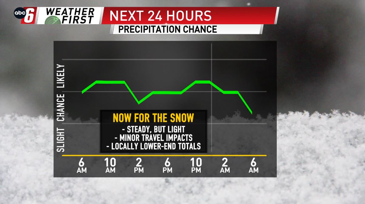
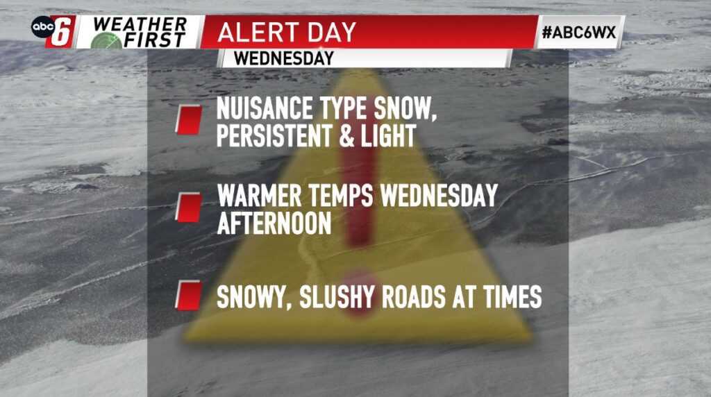
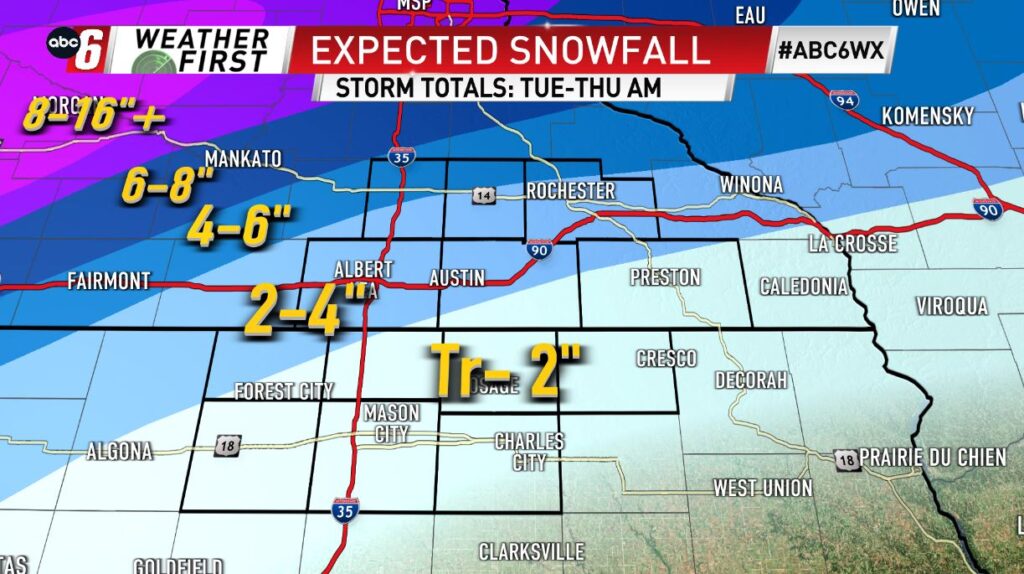
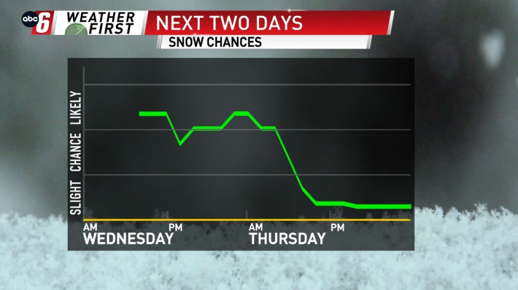
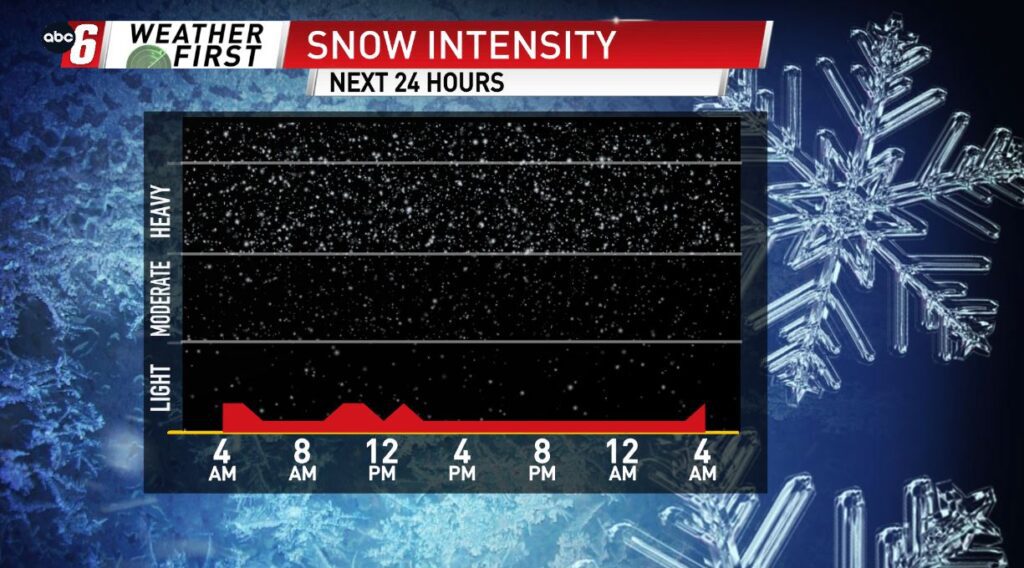
It won’t be a crippling event, but the snow we are expecting throughout Wednesday will be somewhat of a nuisance for the area. Roads are already slushy and a little icy, and we are going to add to the travel difficulties with the steady snow today. Not only will the roads b e a little slick, but it will be a little tough to see at times throughout the day not just Wednesday, but Wednesday night & early Thursday morning as well. The overall storm total snowfall trend will be extremely high, 8-16″ to our west and north. Locally, we won’t see anything close to that, with 4-6″ possible along and especially north of Highway 14, 2-4″ along and north of I-90, with a Trace-2″ likely throughout northern Iowa. Overall, the higher end totals again are to the north and west, with lesser amounts south and east.