Tracking Tuesday’s T-Storms
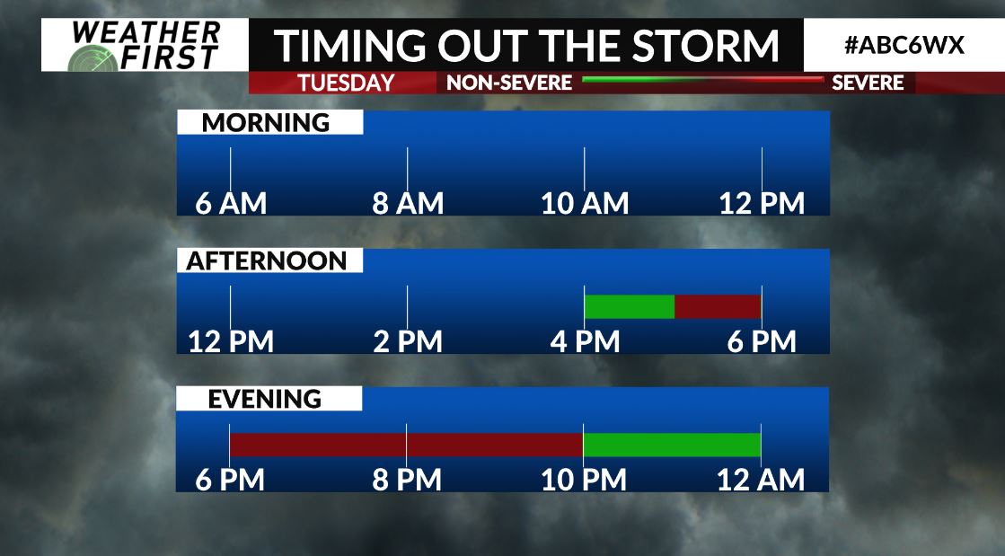
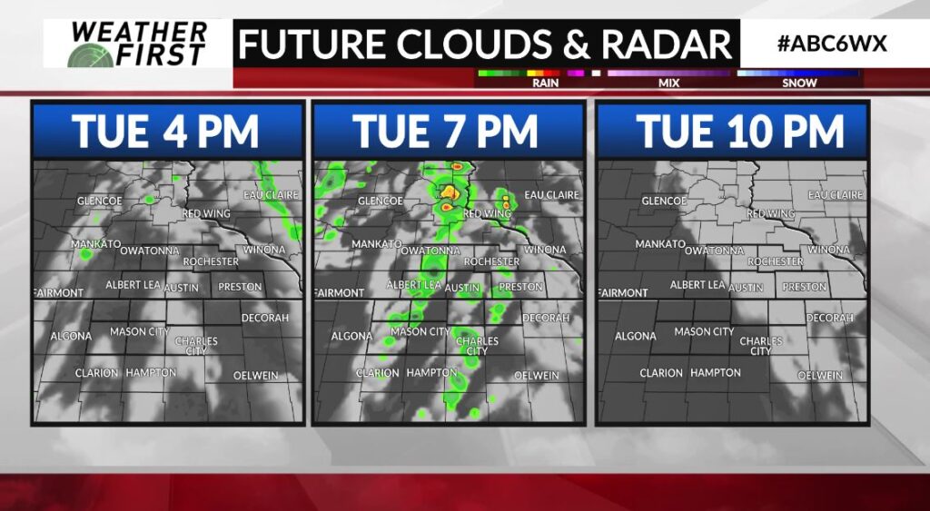
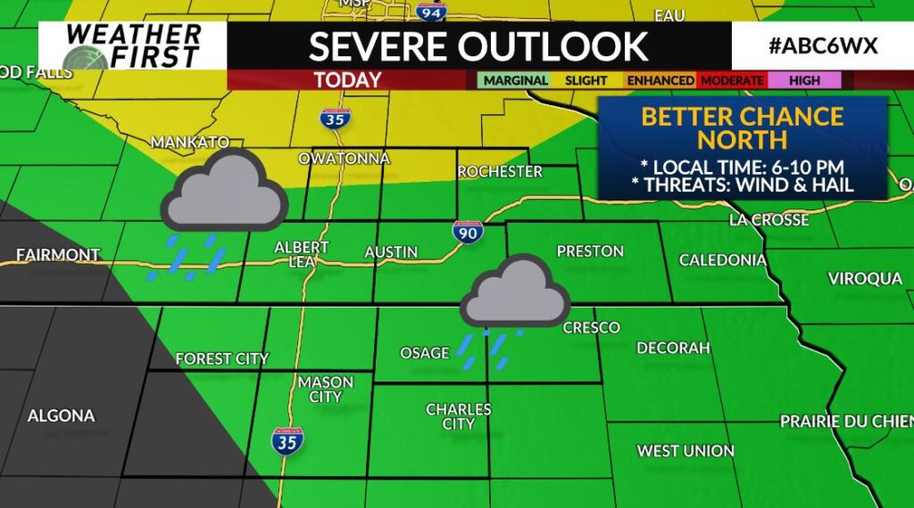
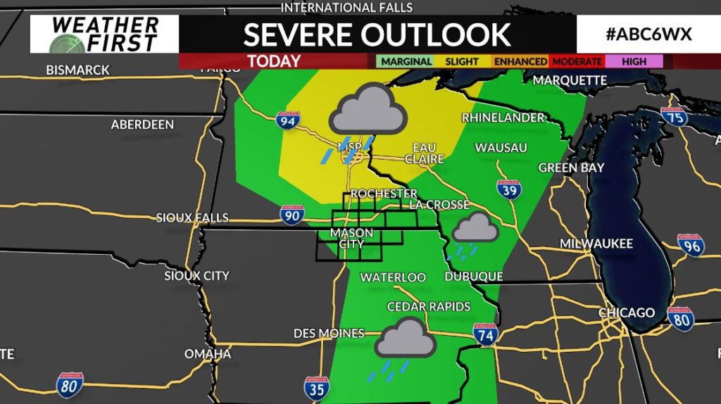
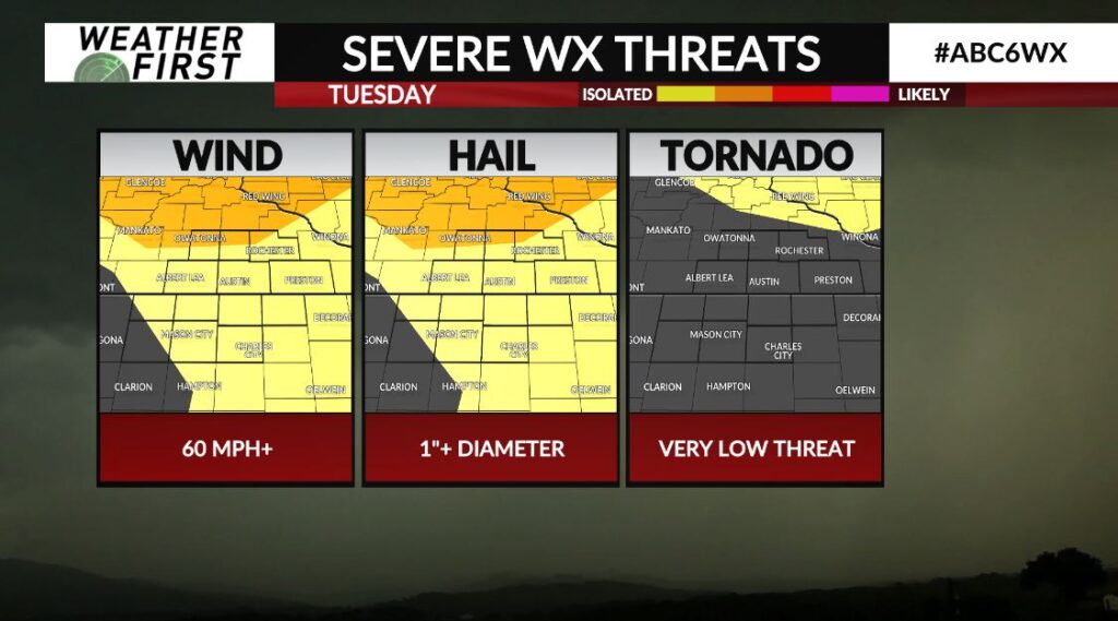
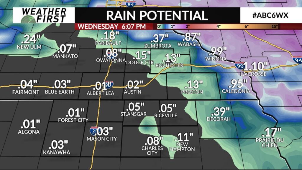
We are tracking our first round of showers and storms for the Weather First Area in about 3 weeks time! A few storms could be strong, possibly even severe, with damaging wind & large hail the primary concerns. Timing locally will favor 6-10 PM, with the overall better threat for severe weather staying just north & out of the area. Scattered showers will continue into the first part of Wednesday as well.