Tracking Monday Evening’s Storms
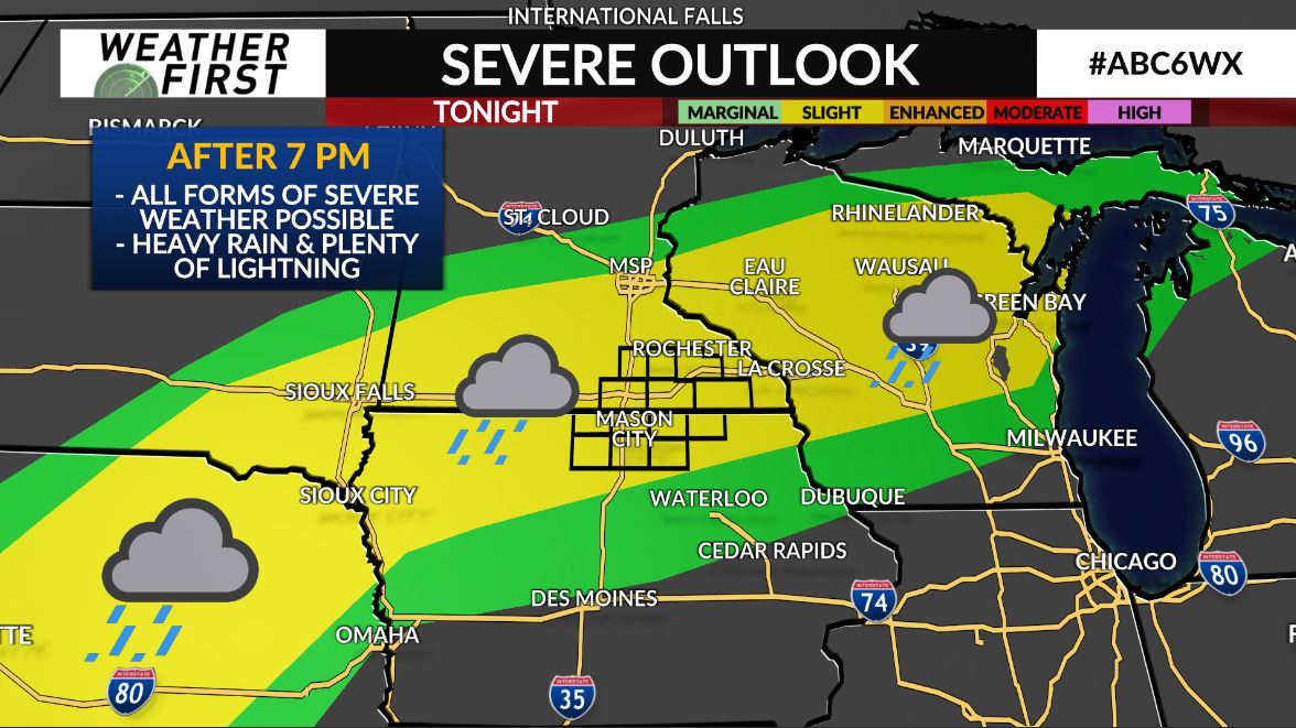
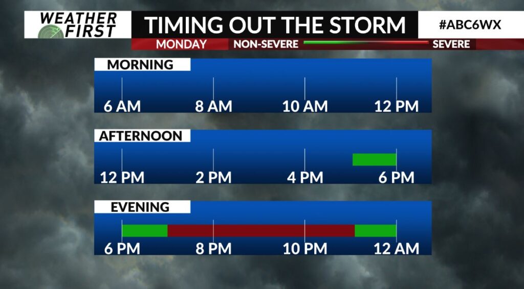
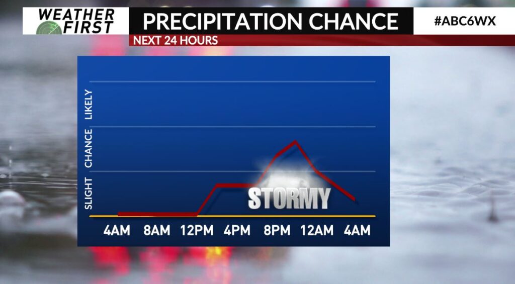
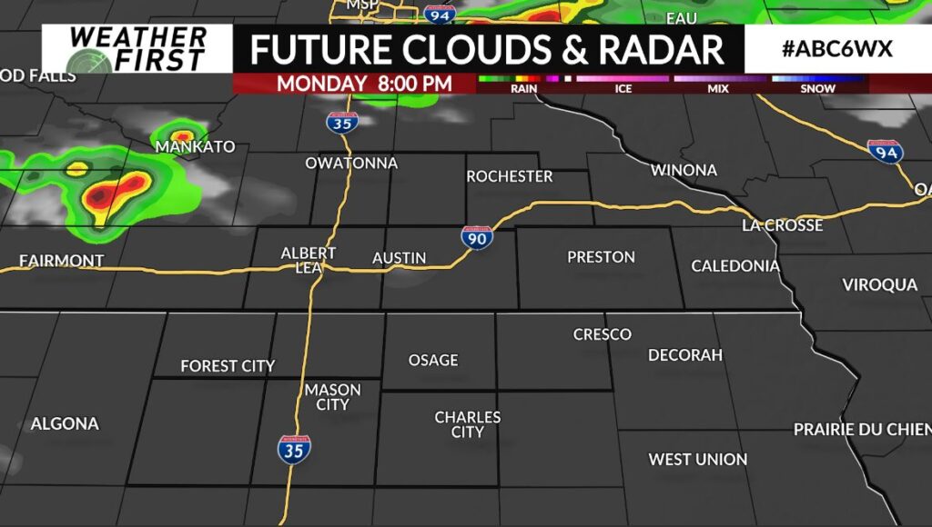
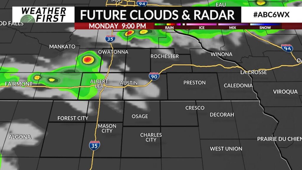
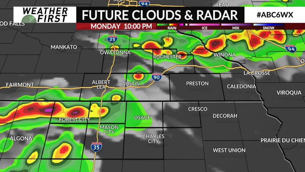
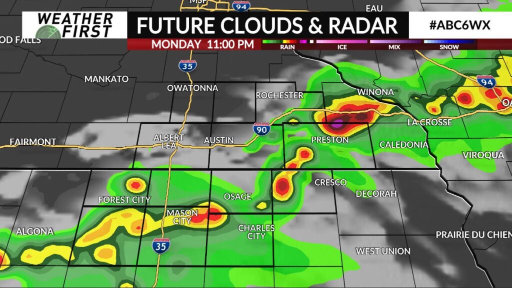
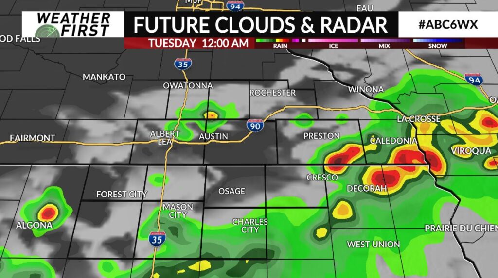
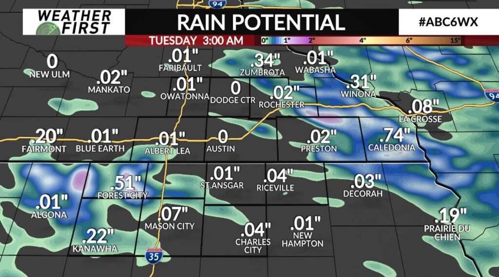
Storms are likely later Monday evening, as a cold front to the north drifts into the Weather First Area, interacting with a pretty unstable atmosphere. Timing out the storms, they look to rumble through between 7 PM – 12 AM Tuesday. All modes of severe storms will be possible, including a few tornadoes earlier in this timeframe, before the storms merge into more of a line, prompting the damaging wind potential closer to 10 PM. Heavy rain, with upwards if not more than a half of an inch for some will be possible as well, along with frequent lightning. Be sure to keep it on ABC 6 News on air online for the latest information on the storms before, during, and after they rumble through!