Tracking another large system
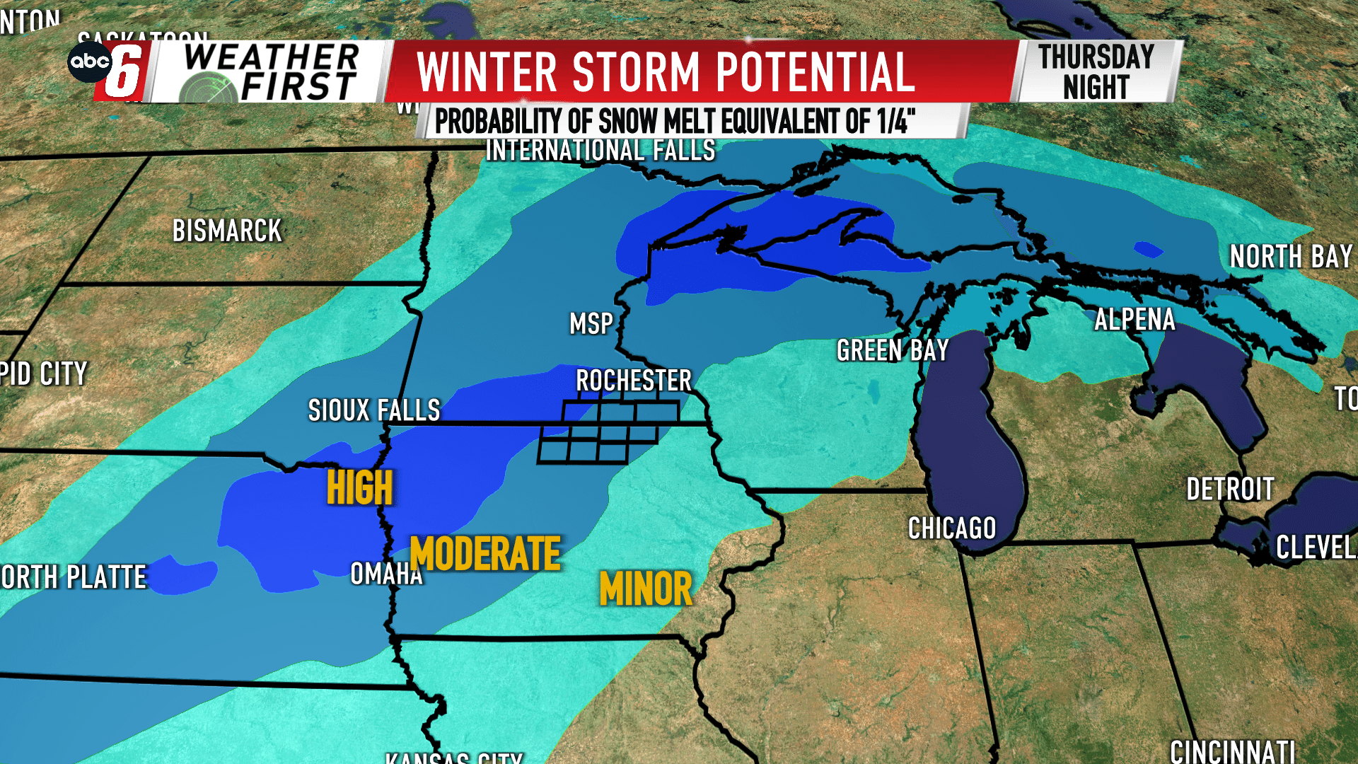
Late this week, we’re tracking our next large storm system. Thursday-Friday is the timeframe. We’ll be seeing rain and snow with a changeover occurring sometime Thursday night.
Initially, this one is warm. We’ll see plenty of rain on Thursday. As colder air approaches in the overnight, that transition of snow looks to bring snow accumulation back to the area. Add in a breezy wind turning from the warmer south to colder northwest with time, that will make an impact on the travel scene.
The big question right now is… how much? That rain/snow transition is still fluttering for timing. What is certain is the west would have the best chance of higher snow totals. But ultimately, that specific changeover is what will define if we see higher end totals or lower end. As it sits right now, it does appear we’ll see at least some accumulating snow for everyone locally. The target zone for worst impacts sits off to our west where plowable amounts are likely. Blowing/drifting snow effects are also a concern. We’ll continue to hone in on the forecast with those details as we get closer. That difference will dictate if we have an Alert Day or not.