Temps begin to tumble Friday
The leading charge of Arctic air begins arriving on Friday. After reaching near 30° in the mid morning on Friday, temperatures will fall back to 10-15°, driven by strong wind gusts.
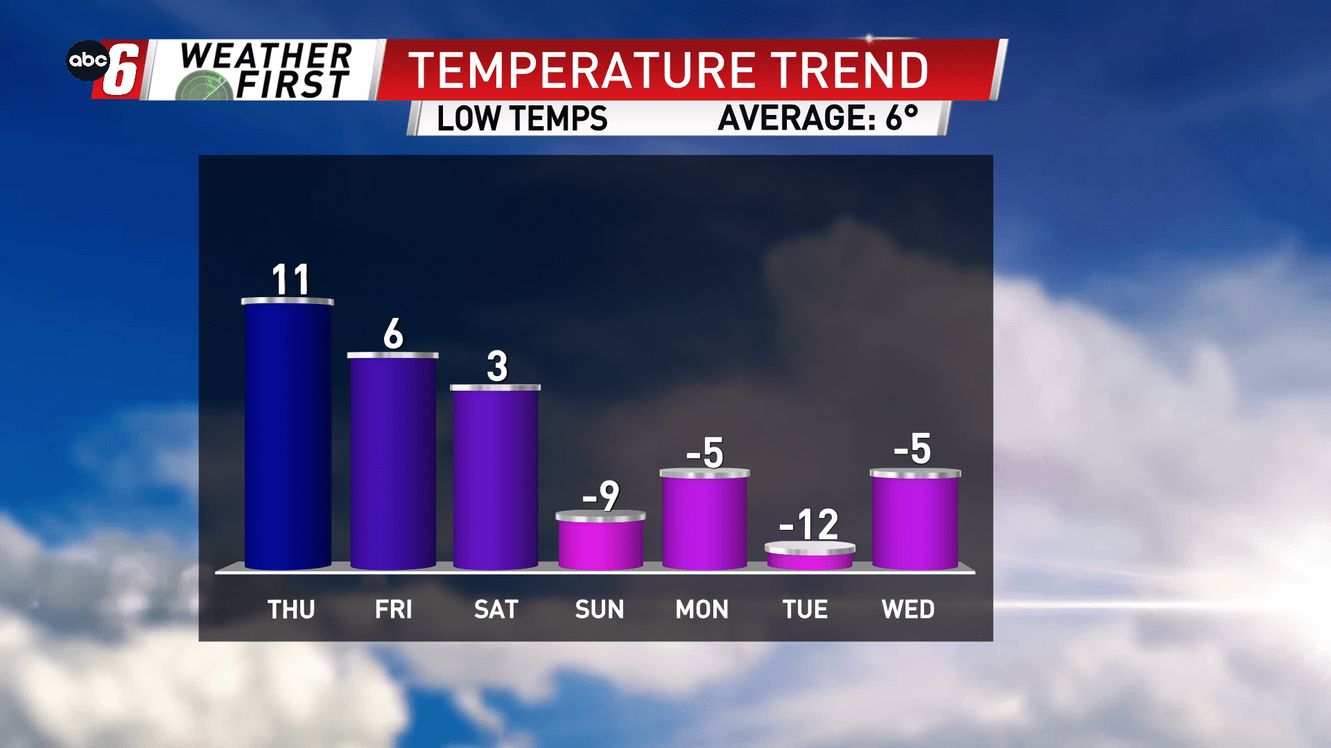
We’re in transition this weekend and ultimately start hitting some of our coldest marks Saturday night. Overnight lows will drift from -5 to -15° in the week long stretch ahead from Saturday to Saturday. Daytime highs are in the single digits.
At these temperatures, winds will take the wind chill down to the -20 to -30° range at times. You’ll want to dress warmly and be prepared for the elements.
Specific overnight temperatures are greatly influenced by the weather conditions of that night, specifically cloud cover. We’ll be monitoring if any fluctuations need to be made to the going forecast.

