Temperatures soar into early next week
An unseasonably warm airmass is set to arrive early next week that will deliver temperatures more typical of early May.
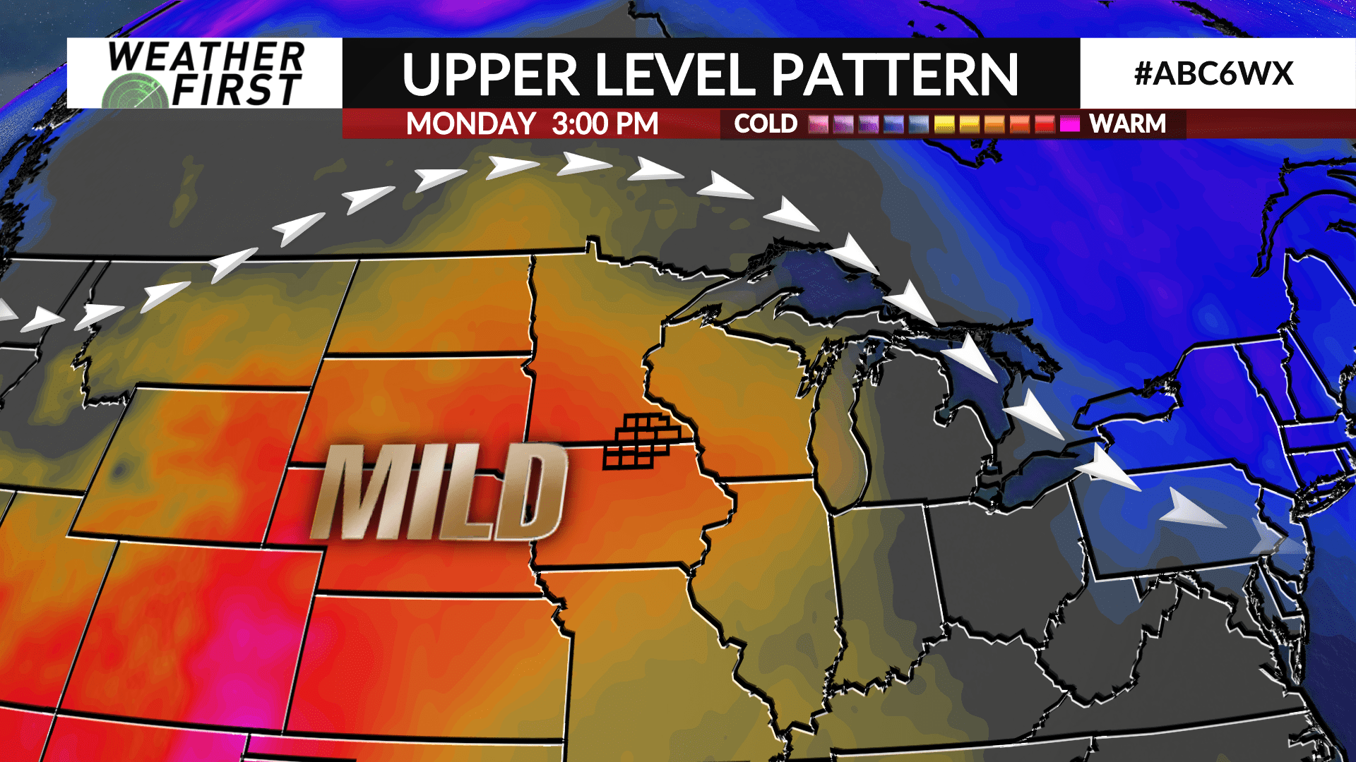
A high pressure ridge will setup over the central part of the country allowing for some mild Pacific air to flow into the region leading to well above average temperatures for March.
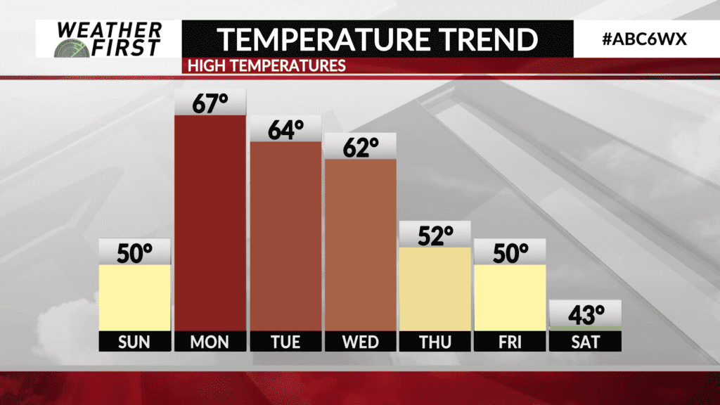
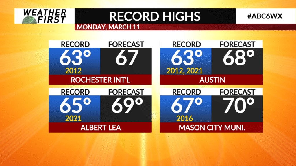
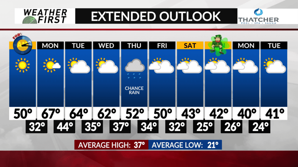
High temperatures will go from the low 50s on Sunday into the mid-to-upper 60s with some low 70s even possible on Monday.
Temperatures will dial back a bit on Tuesday and Wednesday before a passing cold front, but still will be well above average in the low-to-mid 60s.
Colder weather is set to arrive toward the second half of the week with highs only managing the 50s, and 40s look likely by next weekend heading toward St. Patrick’s Day.
The week ahead will be mostly quiet, however a frontal boundary will lay somewhere across the area, or close by, on Thursday and Thursday night leading to the chance for rain. Expect details to be ironed out in the days ahead.