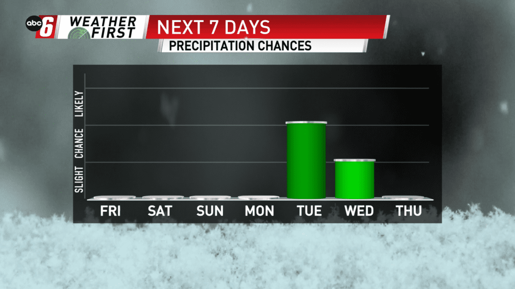
Targeting some Winter next week
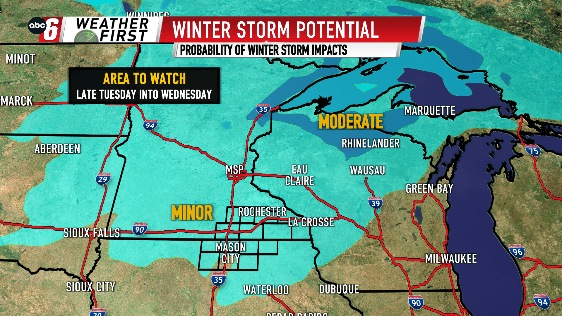
It’s still a ways off in the distance, but it’s been a constant the entire time. A larger storm system is targeting the Midwest on late Tuesday into Wednesday. Mostly a warm system, it appears we’re mostly riding the northwest edge of it. That’s where the colder air will lie.
Initially it looks like a quick mixture before turning to snow locally. Past that, specific timing, changeover times and amounts are impossible to speculate on. It does look possible that the travel scene may be impacted.
Confidence continues to grow we will see this system. We’ll continue to refine the forecast as we get closer.