Storms advancing through earlier on Thursday
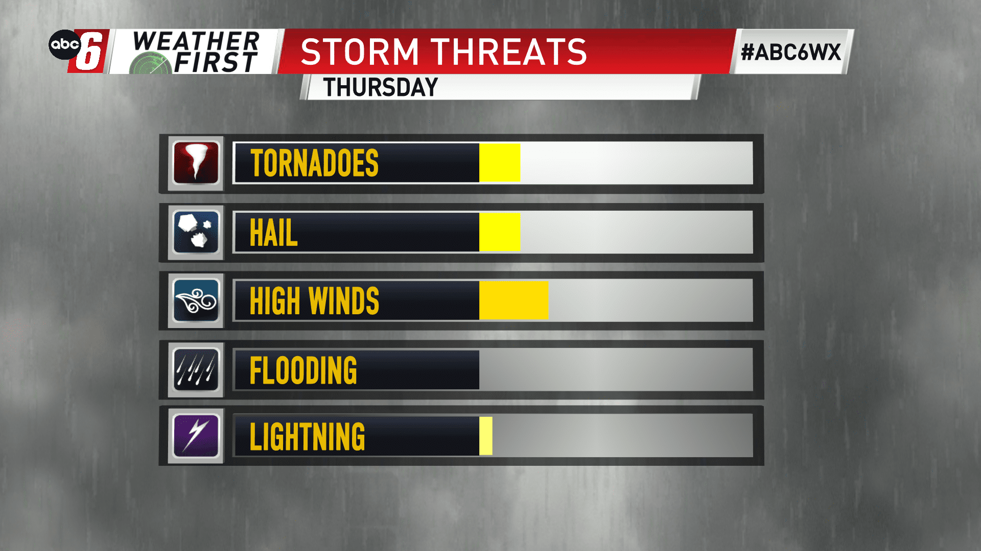
The progression of the timeline for Thursday’s cold front has moved up. Instead of the evening, the morning is now the time to watch. Rain including thunderstorms are still possible but they’ll just be starting to grow given the timing. With that advancement ahead in time, it will be much more difficult to see a stronger storm develop. That threat looks more likely to our east into Wisconsin.
We’ll be watching the 8 AM to 12 PM timeframe for the cold front to pass. Storms build along it with time.
The environment we have is weak in energy but strong in the wind structure of our atmosphere. If we can get a strong storm going, it’s most likely on our eastern edge, towards US 52. The ambient wind will already be strong and it won’t be hard to see a storm stir them up to severe limits a bit easier.
With everything considered, we’re holding off on issuing an Alert Day with the advancement of the timeline.