Storm to bring rain chance to the area Thursday
A storm system has its eye on the area Thursday leading to the chance of rain.
An area of low pressure will track south of the local area as the storm moves from the central plains northeast into southeast Iowa and eventually to the southern Great Lakes region.
The storm will pull moisture northward from the Gulf of Mexico and over the top of a warm front that will be draped from west-to-east somewhere across eastern Iowa.
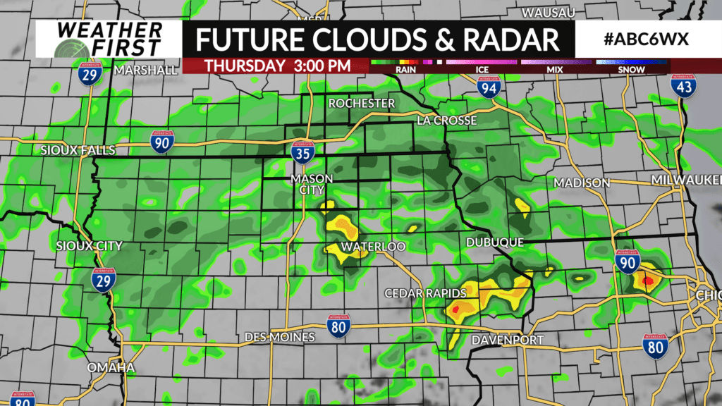
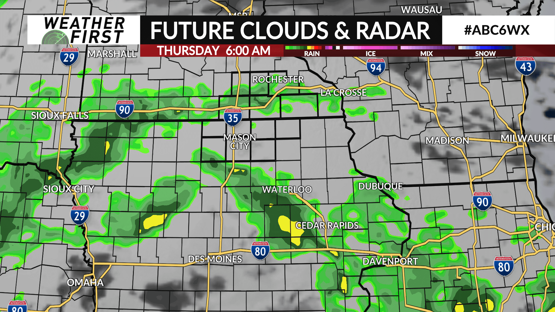
Rain will be likely late Wednesday night into early Thursday with rain chances continuing throughout the day Thursday. A dry northeast wind may limit how far north the rain gets, but areas along and south of I-90 have the best chance for rain. However, that may shift as the storm track continues to wobble around.
There may be just enough cold air available as temperatures cool off Thursday night into Friday morning for snow to mix in with rain. It’s all dependent on how cold temperatures drop.
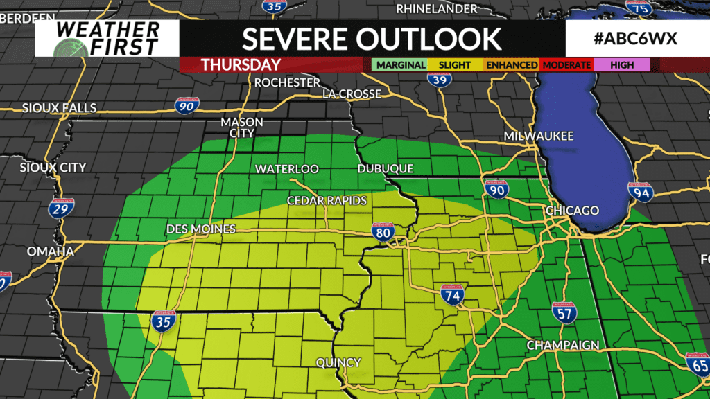
There is also a small threat for a strong thunderstorm across parts of north Iowa on Thursday afternoon. The highest threat for any organized severe weather is expected to stay south of the local area and confined to eastern Iowa, southeastern Iowa, northeast Missouri and western Illinois near the vicinity of the warm front and where the greatest instability is to fuel any strong storms. However, that area may still shift in the next 24-48 hours.
Precipitation will wind down late Thursday night into Friday morning.