Storm may graze the area Friday night; snow possible Saturday
A storm system will track awfully close to the area late Friday night into Saturday with another system passing through Saturday afternoon and evening leading to the chance for light snow.
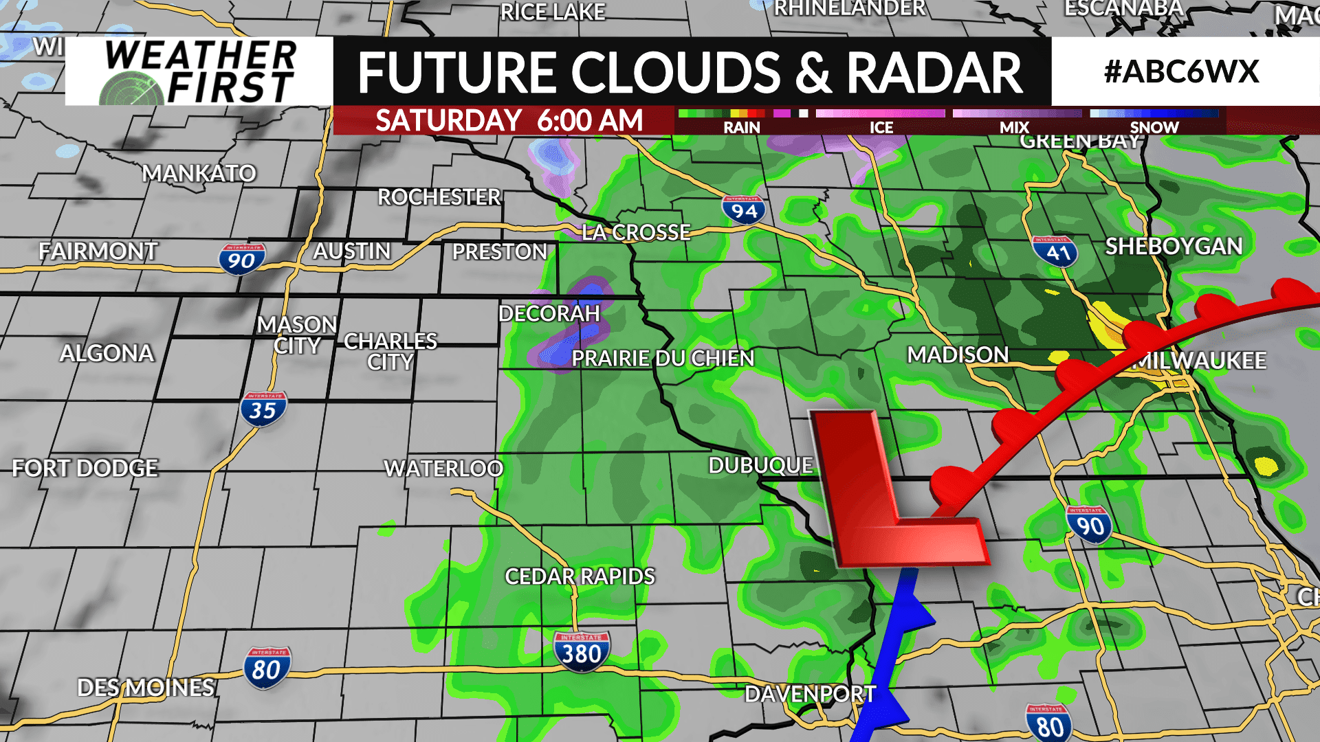
A low pressure system that we’ve been talking about all week may graze far southeast Minnesota and northeast Iowa late Friday night into early Saturday.
The latest trends as of Thursday morning have shifted the storm even further southeast with the bulk of any precipitation falling over eastern Iowa into southwest Wisconsin. Even with the latest shift, there still may be the possibility it wobbles back to the northwest. Given that possibility, there will be the chance of a rain/snow mix late Friday transitioning to some light snow early Saturday for areas in far southeast Minnesota.
Another wave of energy will rotate through Saturday afternoon into the evening squeezing out the remaining moisture leading to the chance of light snow showers. Accumulations are expected to be minimal with a coating to 1″ possible. It’ll be breezy with wind gusts up to 25 mph at times which may lead to periods of blowing snow especially in open areas.
