Soggy stretch towards the end of the week
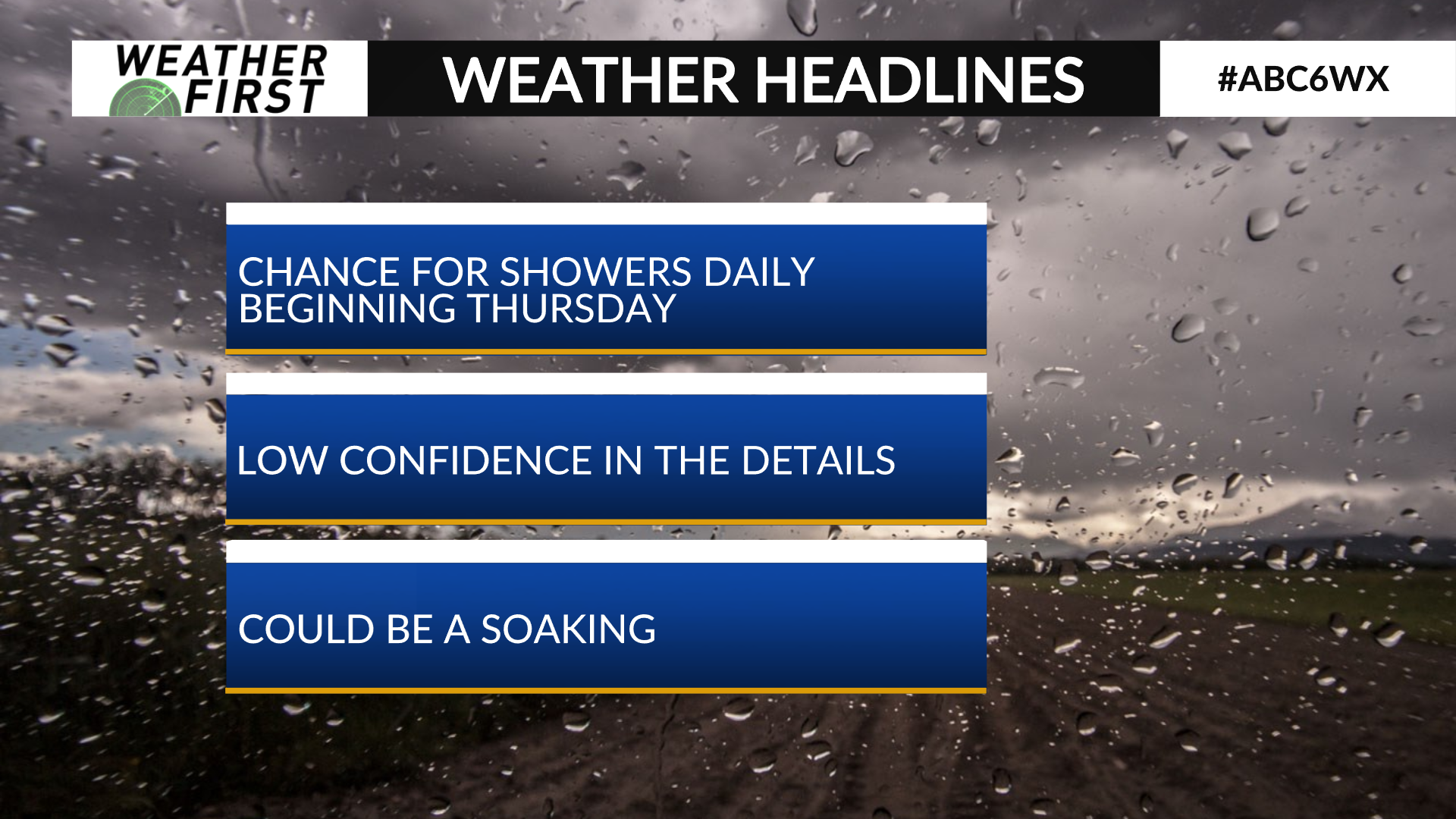
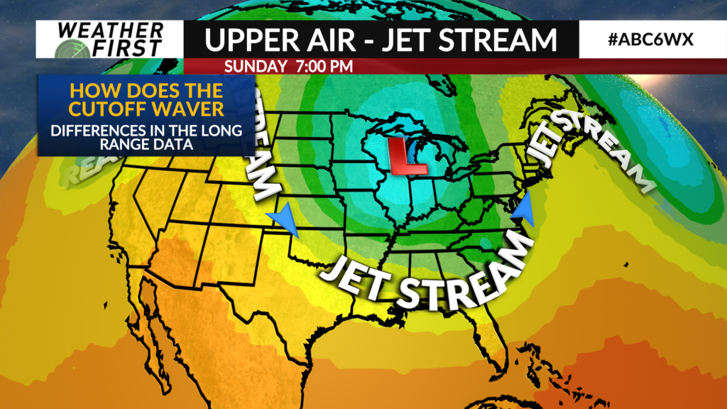
A cutoff low pressure system will divert out of the Jetstream and park it over the Upper Midwest. When this happens, we usually see the weather pattern stagnate and we’re stuck with what we have. It looks to be a soggy one with the setup ahead.
There are some differences in the long range, however. Usually the long range is a bit hazy as it’s difficult to ascertain how this system will meander as it ‘drifts in the wind’ so to speak. This gives us a low confidence long range forecast. So yes, while it does look a bit soggy, the finer details in what happens are far from nailed down.
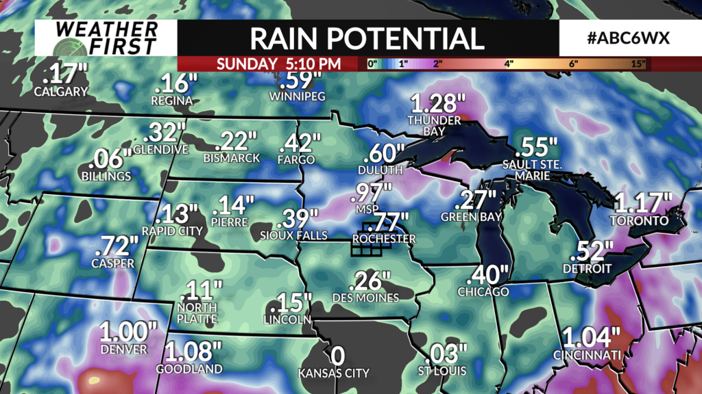
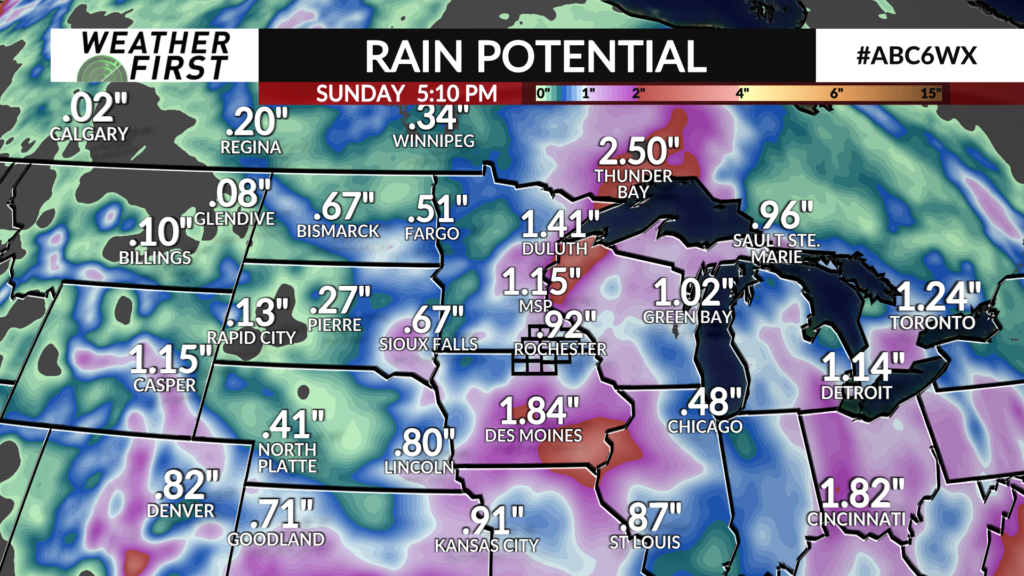
We’ll continue some rain chances on the daily level Thursday evening through Monday of next week.
As you can see with the raw data, one solution is far more soggier (in general in the Midwest) than the other. We’ll hone in on the specifics as we get closer.