Soggy stretch Friday night into Saturday
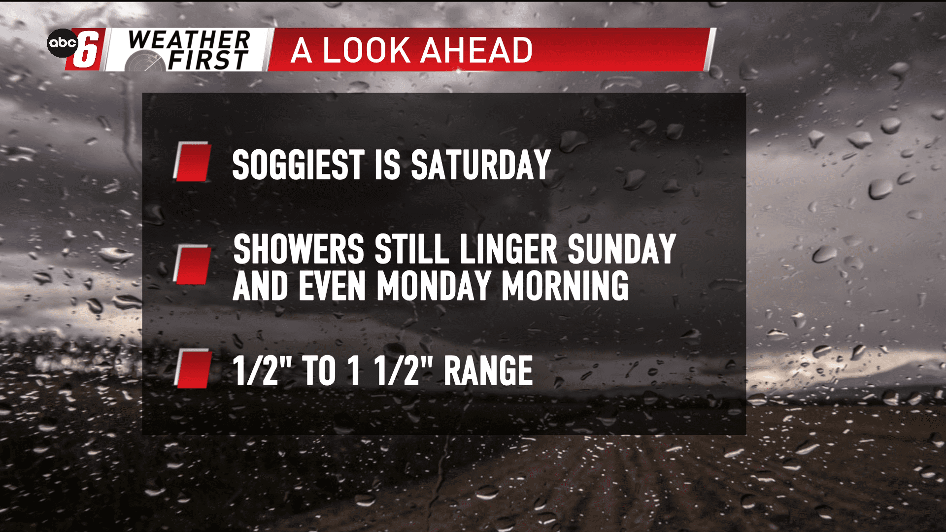
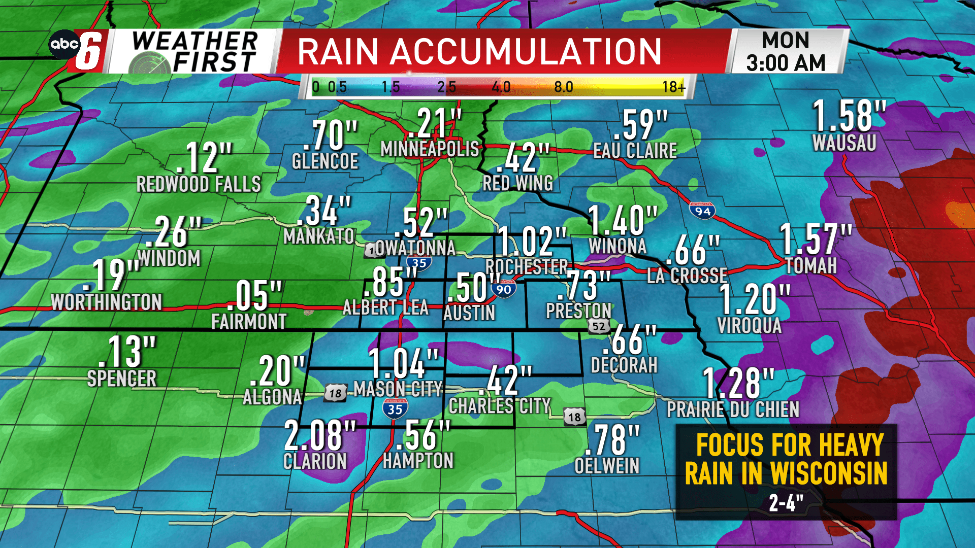
Most of our rain in a roughly 72 hour window from Friday night to Monday morning will fall Friday night into Saturday.
A slow moving cold front will bring persistent showers from late Friday evening into Saturday mid-day. A stray rumble of thunder is possible but we will avoid significant lightning, thunderstorms and heavy rain that accompanies them.
After a break on Saturday a slow moving system up that stalling out front will bring occasional light showers to the area Sunday and Monday morning too. In the end the range will be the 1/2″ to 1 1/2″ range.
That stalled out frontal boundary will serve as the focus for heavier rain still. It’s placement looks to be more favorable for central Wisconsin. It’s here, that 2, 3 or 4″ of rain is possible. It’s not overly heavy, but the persistence of rain will fill gauges here.