Snowy Sunday Breakdown
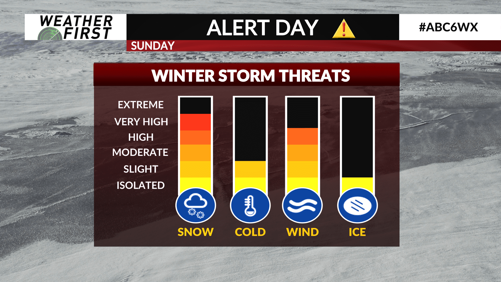
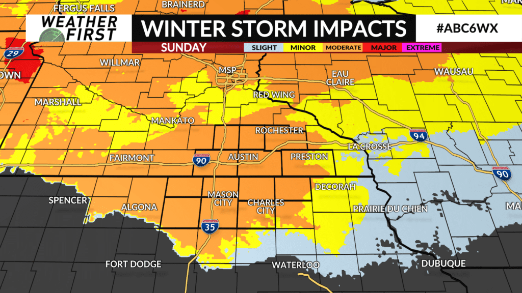
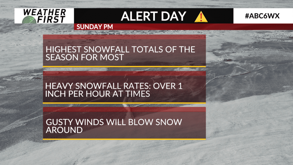
Sunday through Tuesday will all bring precipitation, of some sort, to our area. We start out with the biggest impacts on Sunday. An ALERT DAY has been added due to how snowy we will be and the gusty winds that will blow the snow around on roads.
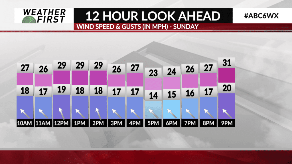
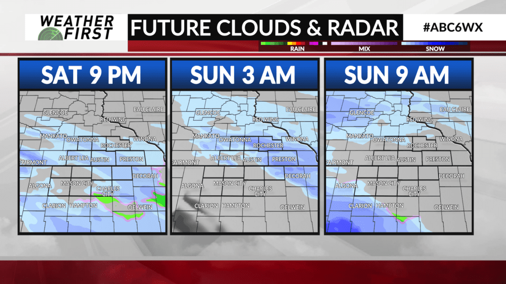
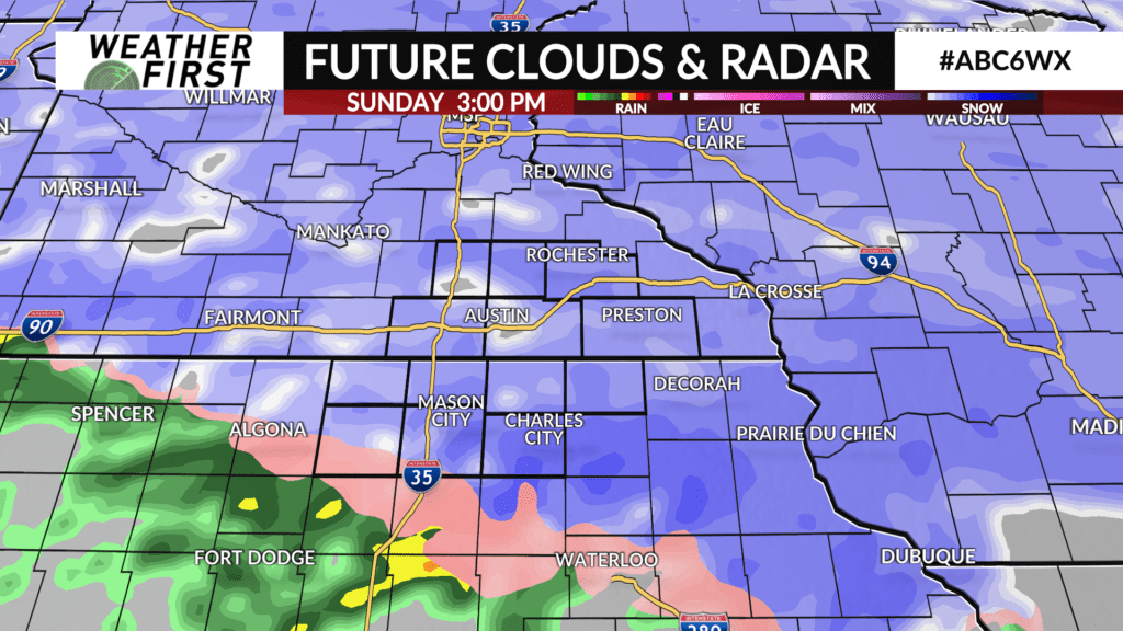
Snow will be at its heaviest during the afternoon and early evening (anywhere from about noon-8 PM). At times, snow will fall at more than an inch per hour. Combine this with the gusty winds that will take over around this time, this will limit visibility to under a mile. It will also make it more difficult for cleanup crews to clear off roads.
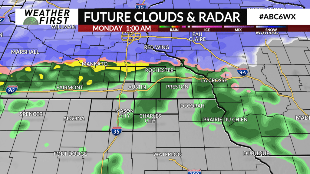
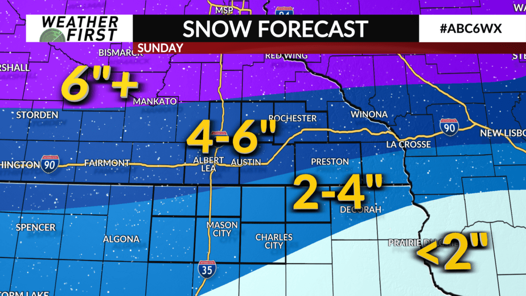
Snowfall totals are forecasted to be higher the further north you go. We are expecting about 2-4″ in northern Iowa (highest closer to the border) and about 4-6″ in southern Minnesota (highest around Highway 14 and north). Although, if the switch from snow to rain takes until Monday morning, that will increase snow totals for everybody.