Snowy, blustery Friday
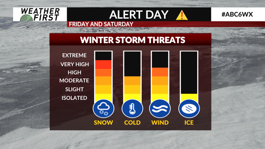
Friday is an ALERT DAY as a winter storm will bring snow, heavy at times, along with gusty winds that will lead to some hazardous travel.
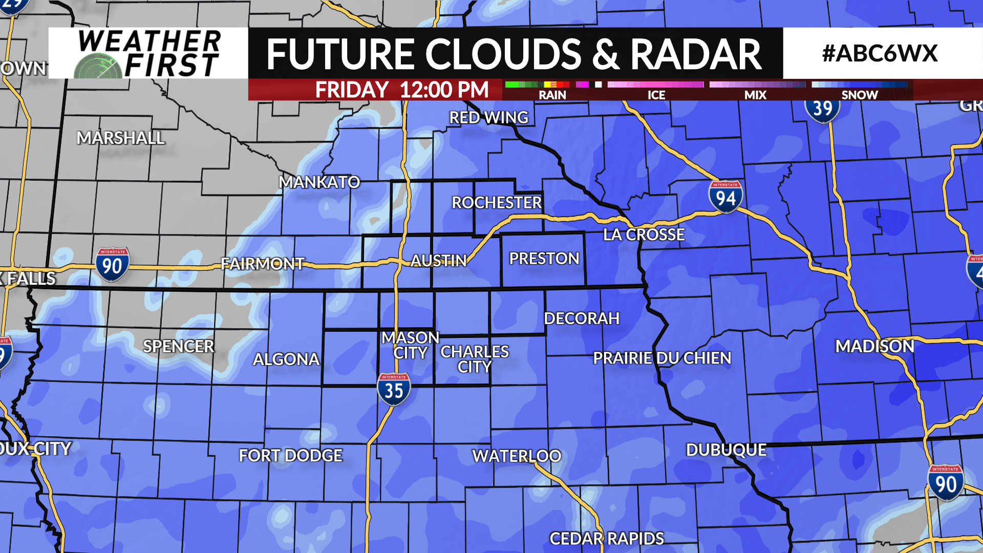
A WINTER STORM WARNING continues until Saturday morning for all of southeast Minnesota and northeast Iowa while a BLIZZARD WARNING covers counties in north Iowa including Cerro Gordo, Worth, Hancock and Winnebago.
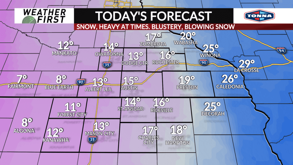
Snow will continue to overspread the area throughout the day and night with some pockets of heavier snow as snowfall rates approach 1″ per hour.
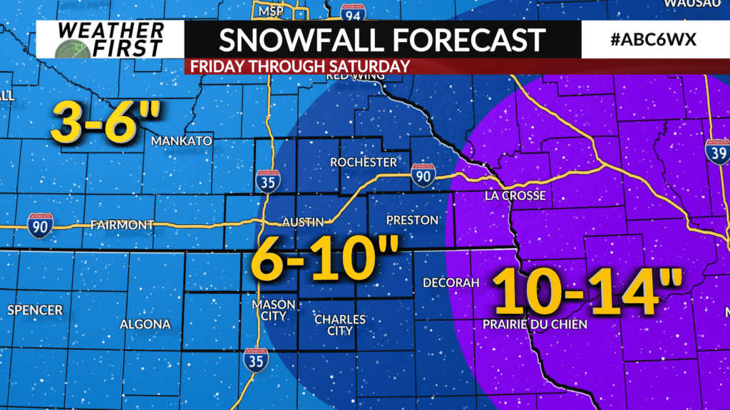
Snowfall amounts got trimmed down near and west of I-35 with the higher accumulations expected further east where most will likely see 6-10″.
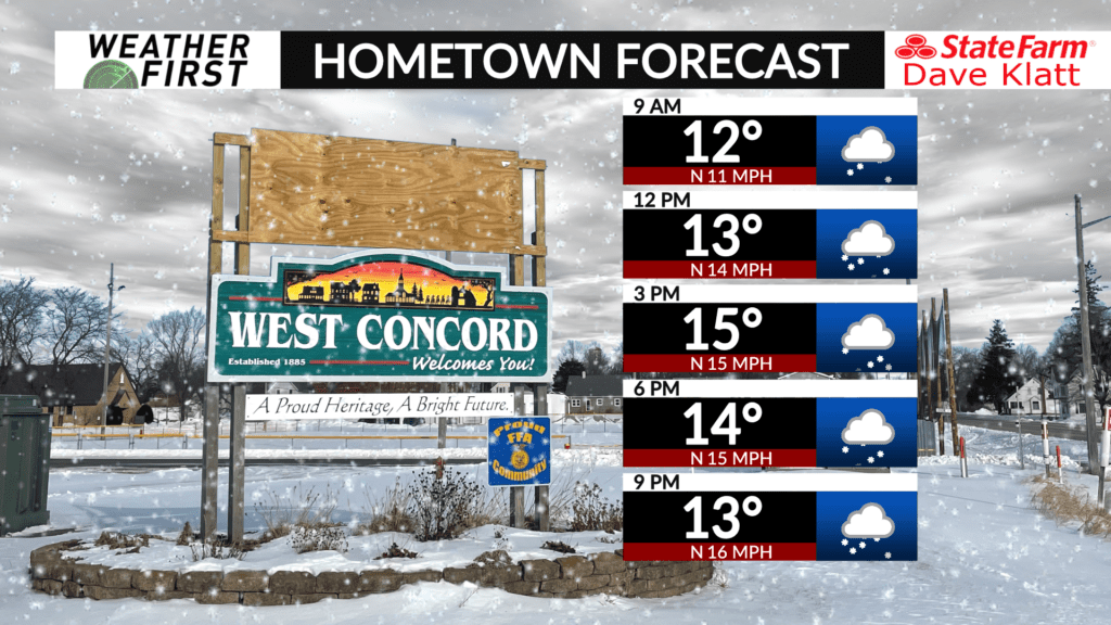
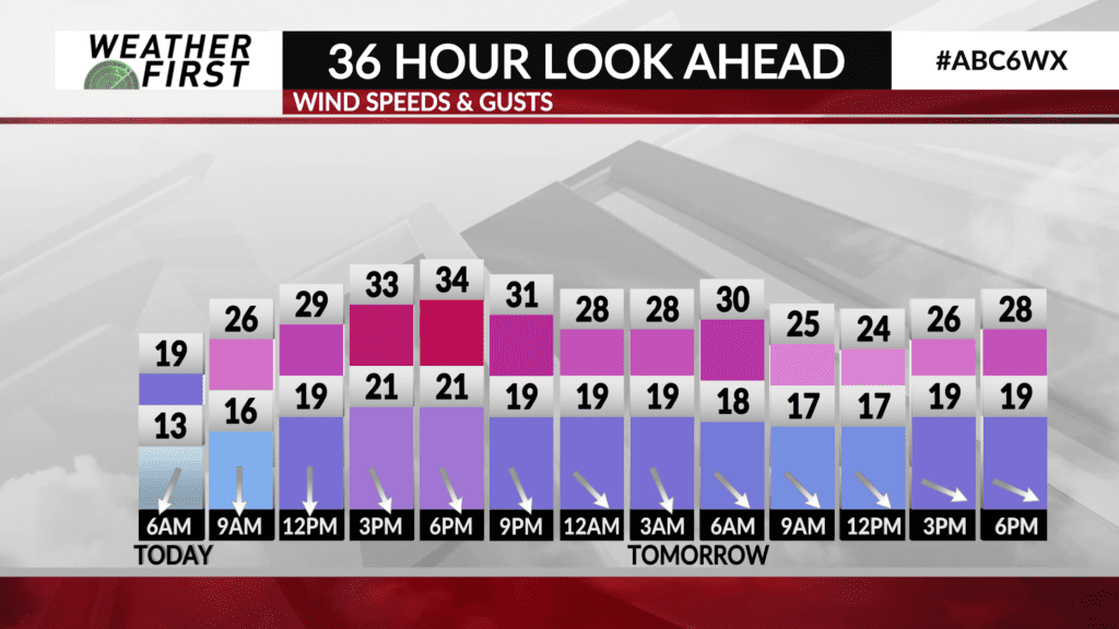
The wind will also ramp up with gusts up to 35 mph at times leading to blowing and drifting snow resulting in some tricky travel especially on open and rural roads. The worst travel times will be during the afternoon and night.
The clouds and snow will keep temperatures cold with highs expected to be in the teens.