Snow targeting Iowa on Saturday
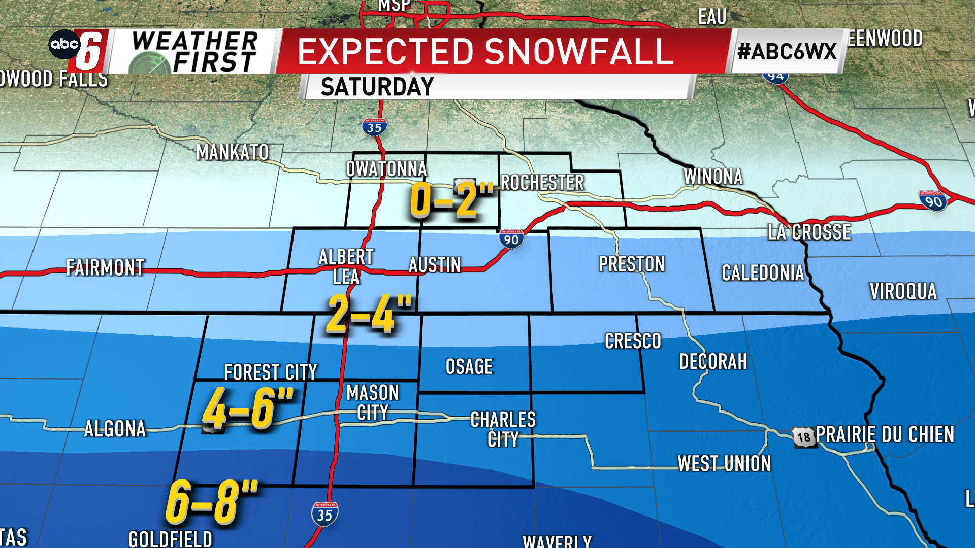
Our next system isn’t giving us much time to recover from Friday’s snow and wind. Another batch of snow is due on Saturday, right through the heart of the day. From pre-dawn to early evening, snowflakes will fly. The target zone is north central Iowa for this one. Some snow creeps across the border but totals will dwindle moving north. In all, totals will range from near nothing to over 6″ on our southern edge, along and south of US 18. Just south of our area has a chance to see some 6-8″ totals too. North of US 14, totals will be kept to a minimum.
There’s very little wind with this one. We’ll avoid the blowing snow component with this round. Travel will be most difficult where the heaviest snow falls as snow will have a better chance to accumulate on the roads. Add some time to get to your destination and go slow.
We have an Alert Day status in place for Saturday.
