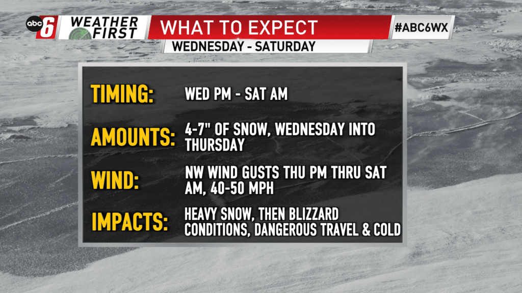
Snow first, blizzard to follow
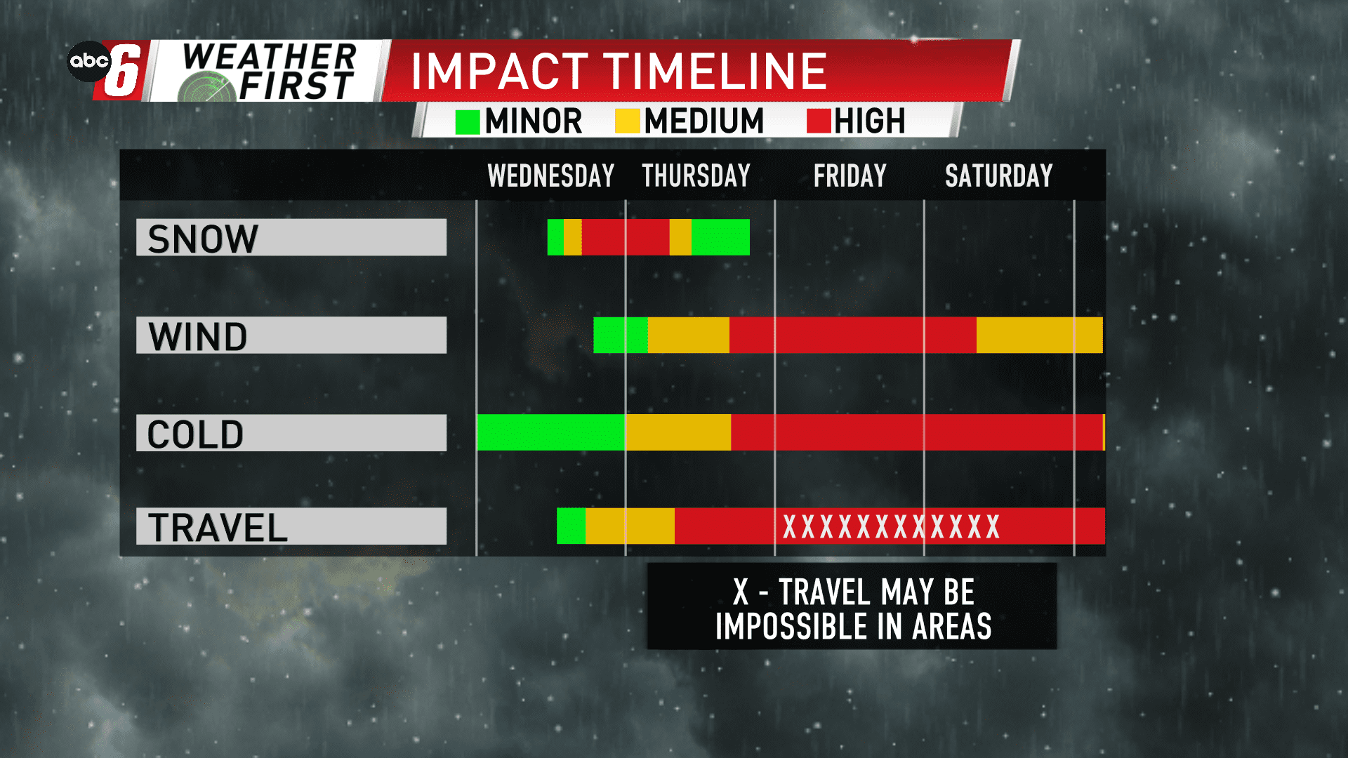
There is a bit of a disconnect between snow anticipated to fall on Wednesday into Thursday and the strongest wind with this system that arrives Thursday night through Saturday morning. This two pronged approach will mean long duration impact to our region with some high end impact at times too.
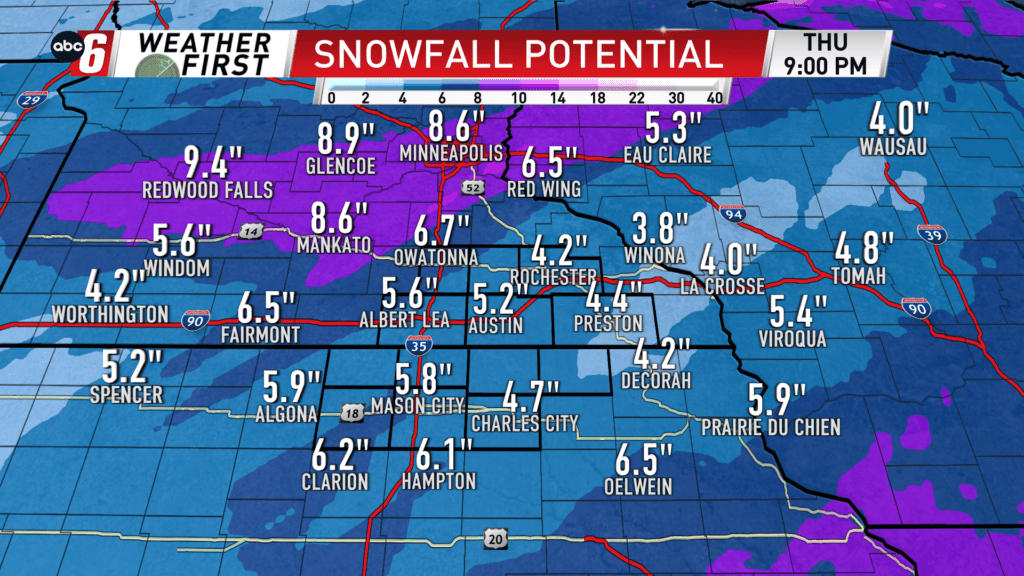
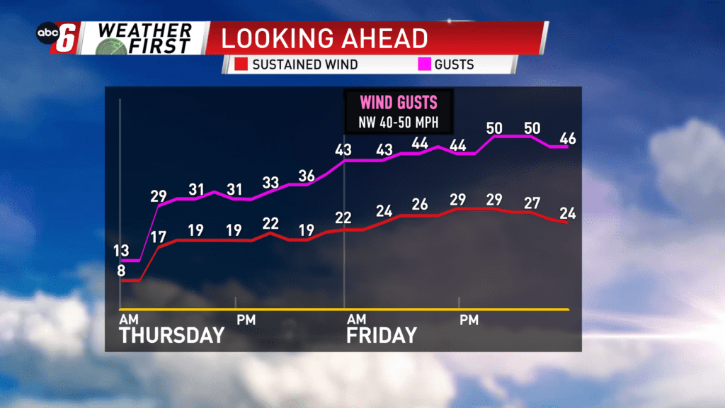
4-7″ widespread across our area is expected from noon on Wednesday through Thursday morning. Lingering flurries may extend longer. The snow alone will create impact on the travel scene. A wind will increase on Thursday morning. Some elements of blowing/drifting snow will be seen. But the worst of the blowing/drifting snow is ahead Thursday night into Saturday morning.
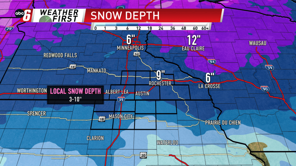
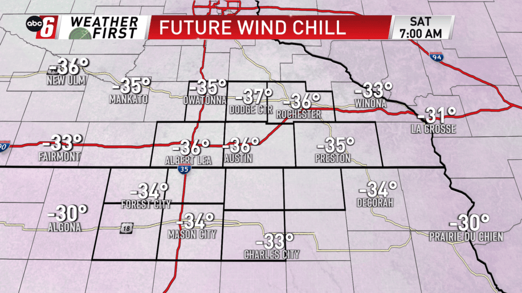
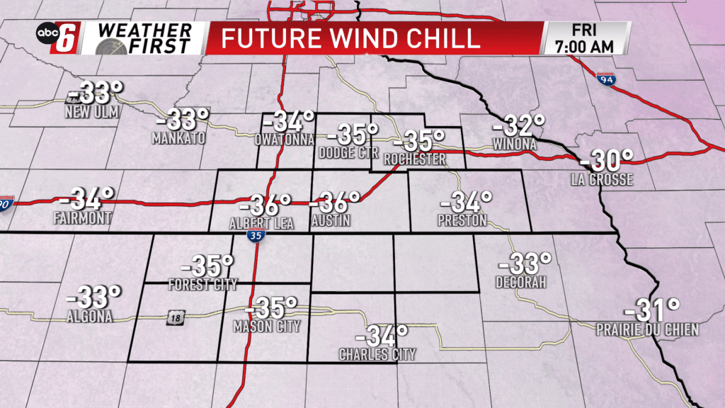
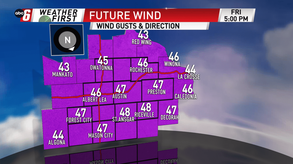
In addition to the expected snow, we currently have 3-10″ on the ground across the local area. We’ll have a deep snow pack, all of it susceptible to blowing around. The wind will have its way with all of it. From Thursday night to Saturday morning, a NW wind will gust 40-50 mph in the wide open, rural areas west of US 52. Terrain effects further east may limit the gusts, as typical. In town, the wind will also not be quite as noticeable. In the open, the travel scene will be very dangerous, if not impossible on some stretches of road due to blowing/drifting snow on the roads. Meaning, if you become stranded you may be out in the conditions for several hours. Visibility will also be severely impacted with whiteout conditions. Lingering travel impacts will extend into Saturday, even after the wind eases up. Due diligence on the roads is to be expected and be prepared to alter your route if roads are closed.
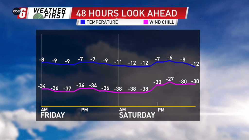
The danger comes with wind chills dropping to the -30 to -40 range as those winds are at their strongest. If you are stranded, ill-prepared to spend long durations in these conditions it can become a life threatening situation. At these wind chills, frost bite can form on exposed skin in around 10-15 minutes.
Please adjust your travel accordingly. Travel within communities will be achievable. Travel outside of town will be extremely difficult or impossible over long distances.