Snow carries on into Thursday
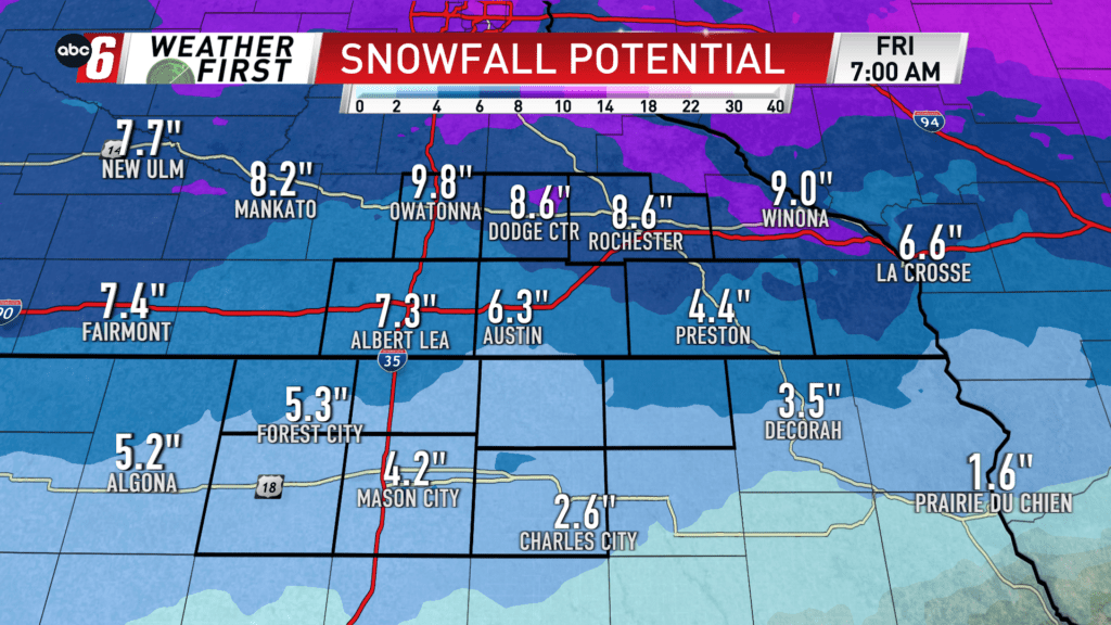
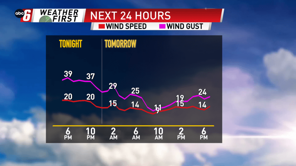
The wind is strongest through 3 AM on Thursday before dialing it back. But the snow carries on through mid-day and early Thursday afternoon! That’s a lot of time to see additional snow pile up. So far 3-10″ of snow has fallen across our area from south to north through afternoon. We can expect to about double that before it ends. Another intense burst of heavy snow should arrive after 4 AM.
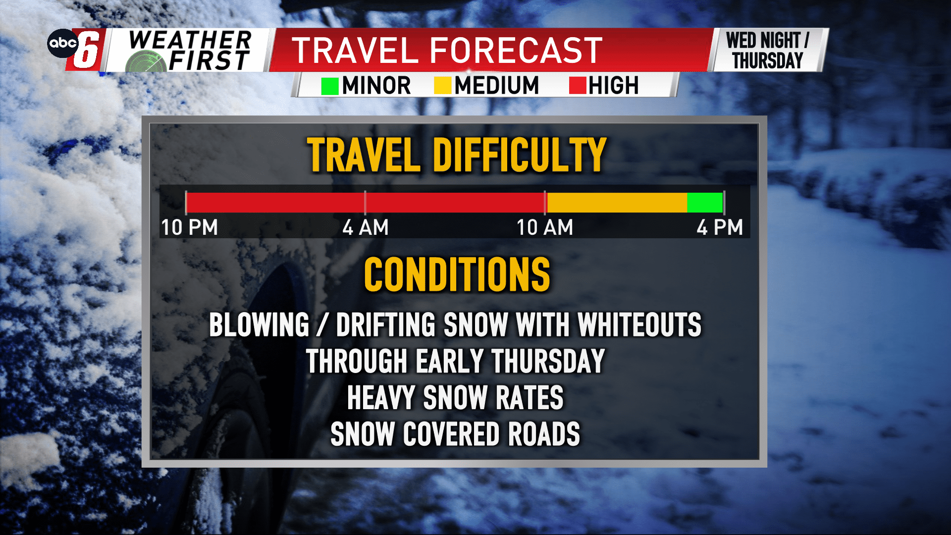
On the travel scene, it will be difficult. Blowing, drifting snow and whiteouts are possible in the open. Wind gusts will reach 35 to 40 mph at times in rural areas. In town won’t be near as intense. Roads are closing in the western reaches of Minnesota and Iowa. Some localized roads on the county level may get there so use caution. At this point, I don’t expect major roads in our area to close. It will be a difficult drive through Wednesday morning.