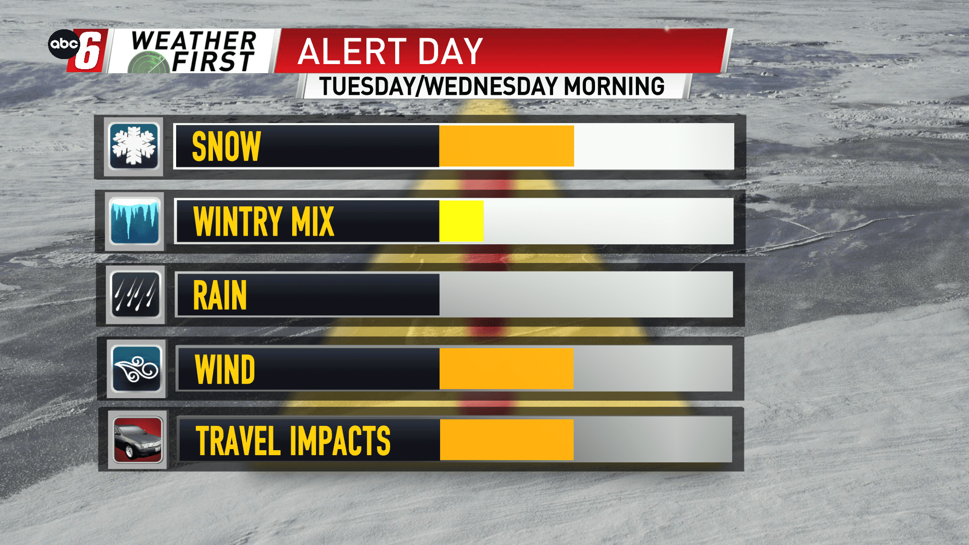
Snow and wind give us trouble
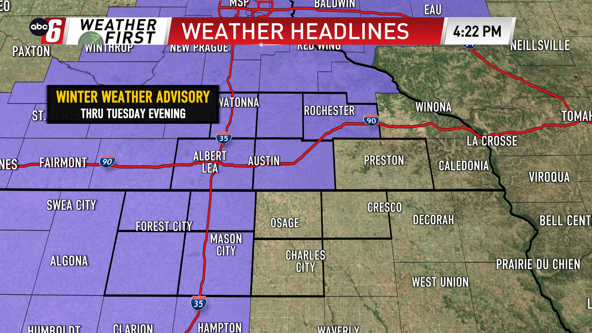
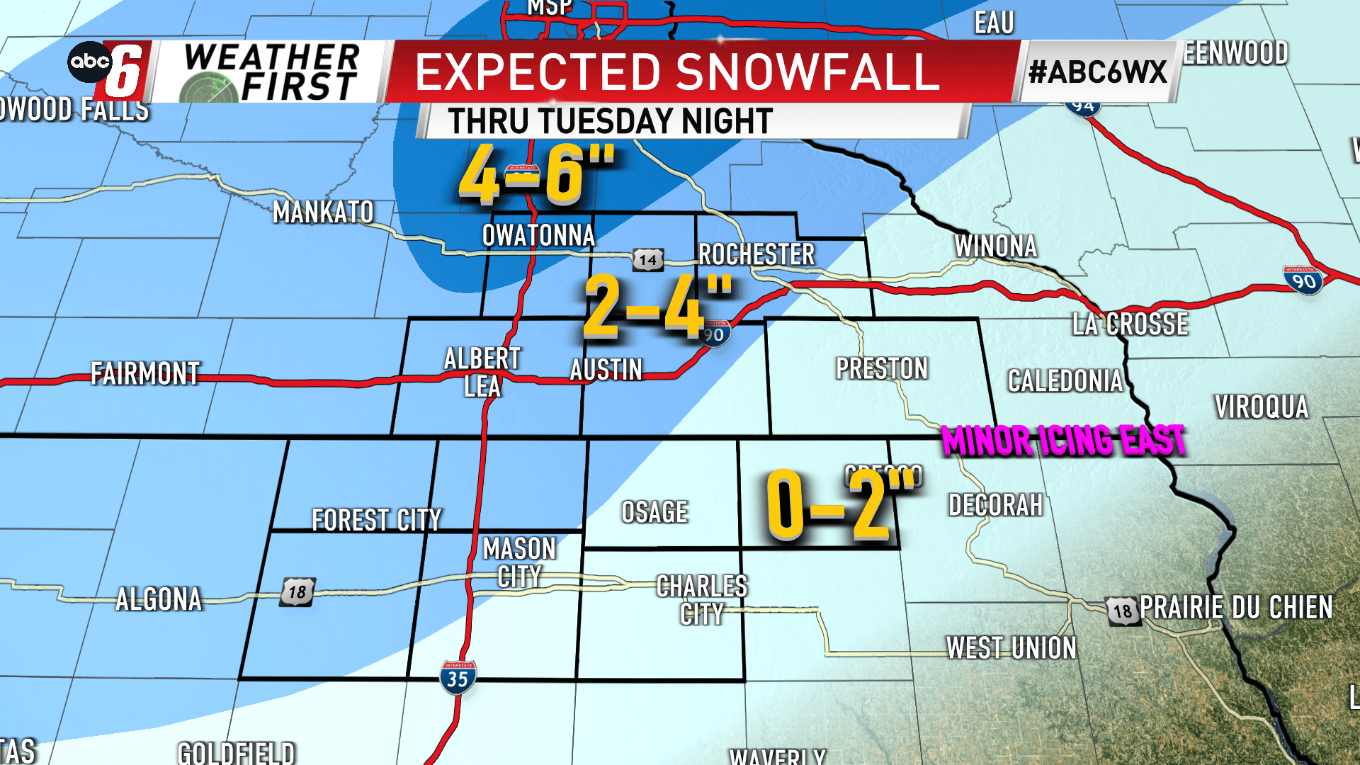
A Winter Weather Advisory is in place for part of our area. Generally, areas along and north of a line from Mason City to Rochester are included on the advisory through Tuesday evening.
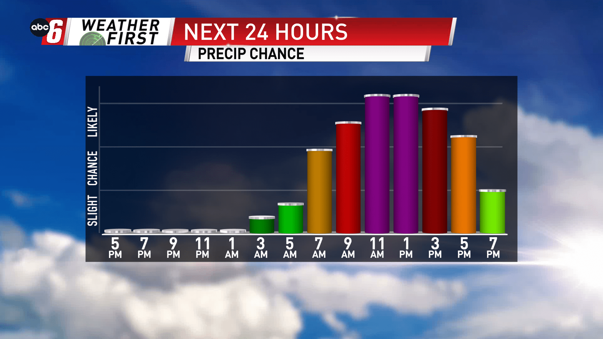
Snow is expected to fall through the day on Tuesday. The onset will include a brief period of wintry mix with minor icing potential too. Look for the first flakes to fly just before sunrise, but may take until late morning for all areas to see snow. The steadiest/heaviest falls through mid-day. Snow will exit the region from west to east between 7-9 PM.
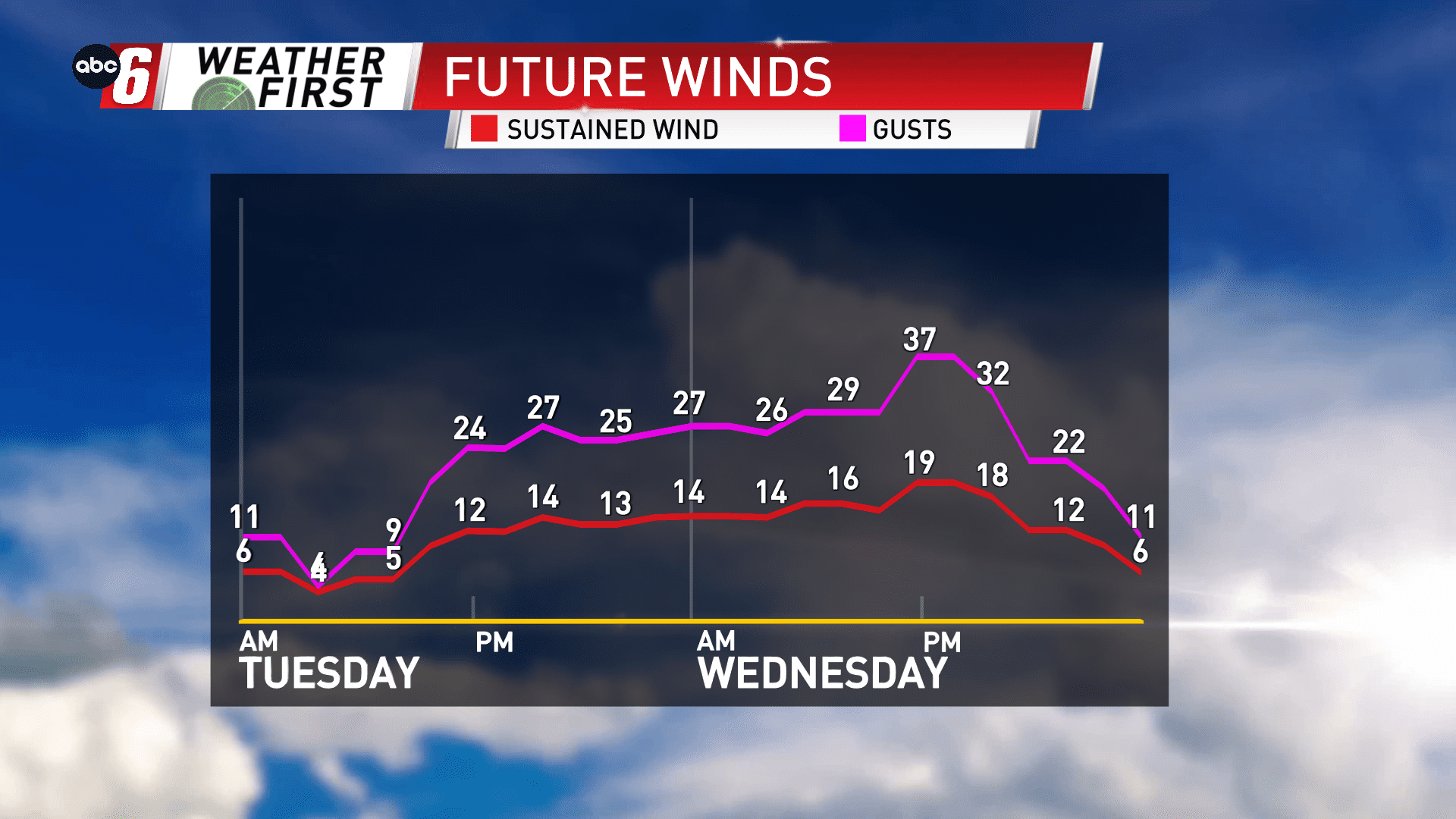
The wind component picks up from the northerly direction from mid-day and will continue into Wednesday. The strongest gusts will blow during the day Wednesday where northwest winds will reach 35-40 mph. The consistency of snow will be wet and clumpy which isn’t usually as susceptible to blowing around. But at those speeds, no doubt areas in the flat and open there will be areas of snow blowing around.
Generally, most of our area will fall in the 1-4″ range. On our southeast edge, there may be a few communities that fall on the short side of that range. On our northwest edge, a few may exceed the high end of the range. A better chance for 4-6″ exists generally north of our area.