Second storm next week is a big one
Eyes are focused on next week. The data is screaming that a large, slow moving and powerful storm system takes shape across our nation’s midsection. This is a storm in the general sense that will have it all. Severe Weather prospects in the deep south. Heavy rain and Wintry mix and a big swath of heavy snow on the north edge. Tied in to all that will be a stronger wind. The potential is there that we’ll be impacted by the colder components of this one…. Snow, wintry mix and wind.
It’s still too early for specifics but confidence is increasing for impact. If there are some major shifts, it likely doesn’t deter us to a scenario that yields nothing. What we’d monitor is maybe more of a rain/mix component working in. And even still, the amounts that could fall in the rain department could cause issues with the amount of ice we have out there. So there’s a lot to consider.
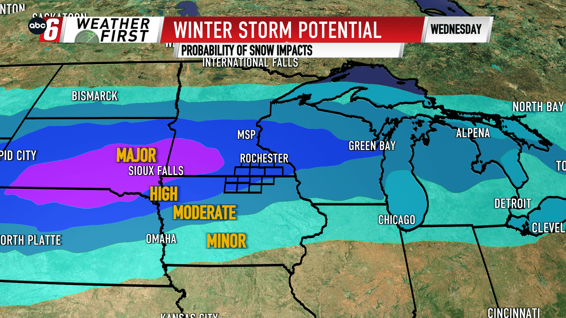
Days 5 & 6 are both heightened for the snow impacts across the Upper Midwest. The target zone is quite brazened for being this far out. For now, based on the latest long range data, the worst of the snowy impacts may be lined up just off our northern edge.
For now, plan on possible travel impacts at minimum on the regional level in the Tuesday through Thursday timeframe. We don’t have Alert Days just yet but it appears that we’re headed down that path.

