Second part of Winter Storm is powerful
We’ve got a complex, large and impactful winter storm on our hands. We’ve previously discussed the first part of this storm here. This section will primarily cover the second wave that moves in Wednesday mid-day through Thursday afternoon.
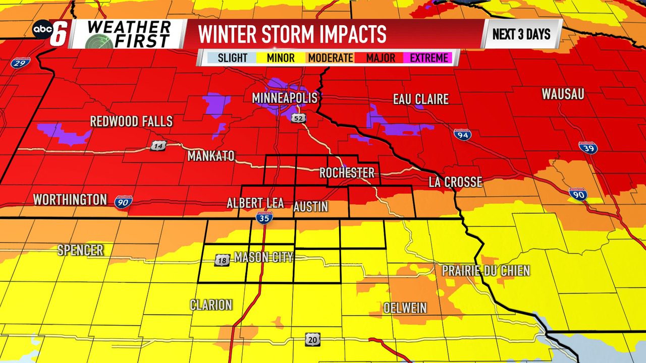
Heavy snow + wind gusts 35-40 mph will be the biggest concern over Minnesota and by far cause the worst impacts vs Iowa. In Iowa, wintry mix with sleet and freezing rain will limit snowfall totals and correspondingly the impacts.
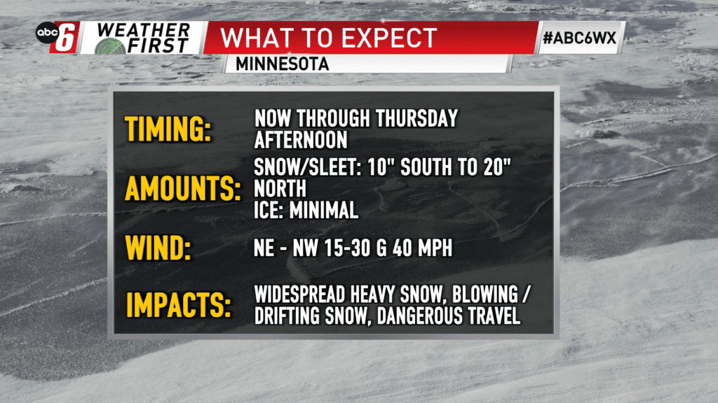
On the Minnesota side, areas north of I90/MN16 will see primarily all snow. And it will be heavy at times. Thunder may also occur. Snow totals will range from 12-16″ of snow. On top of what fell Tuesday into Wednesday morning, some totals will range from 10-20″ across the Minnesota side of the border.
North of our local area, central and western Minnesota may see spots reach 24″+ snowfall.
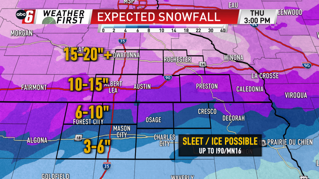
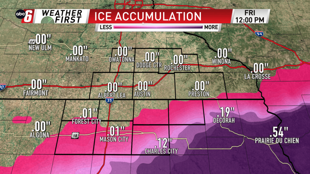
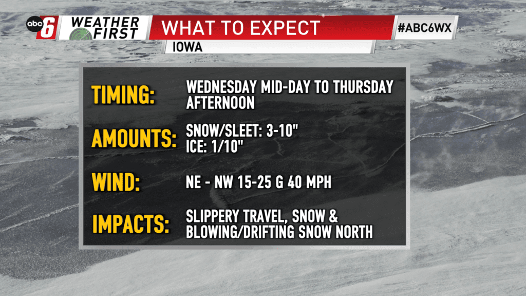
Southwards, sleet becomes more of a factor. Sleet is a snow killer, drastically reducing totals. South of US 18 in NE Iowa, freezing rain is also a factor. Although, more so south of our area. Still, amounts 1/10″ may accumulation around Floyd and Cerro Gordo Counties. A transition to all snow will take place early Thursday morning. Sleet will be accounted for in the snow totals in this area. Storm Total snowfall will range from 3-10″ south to north.
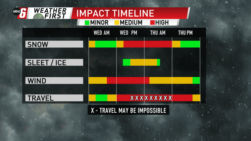
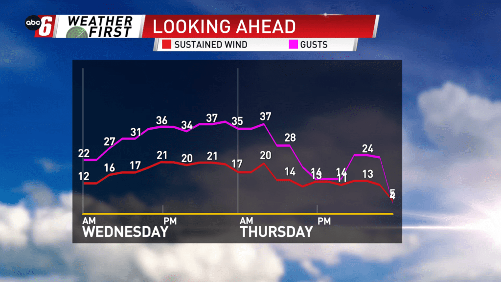
The wind increases gusting NE to NW at 35-40 mph Wednesday morning through Thursday morning. In the areas with the most snow, this is a huge issue. Widespread blowing/drifting snow is expected near the border and northwards. Whiteouts may be possible at times.
Travel will be extremely difficult from Wednesday mid-day through early Thursday morning. Some roads may become impassable with enough blowing snow. Should this happen. Look to our northern and western sections with the most snow and wind.