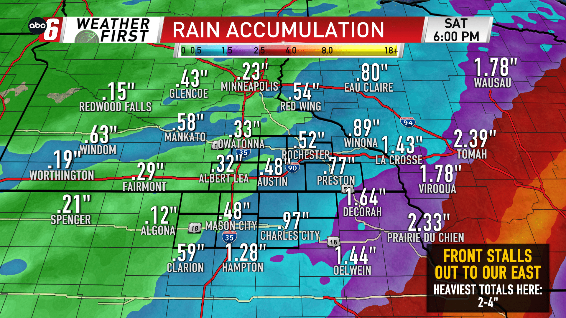
Rain looks likely, heaviest amounts do not
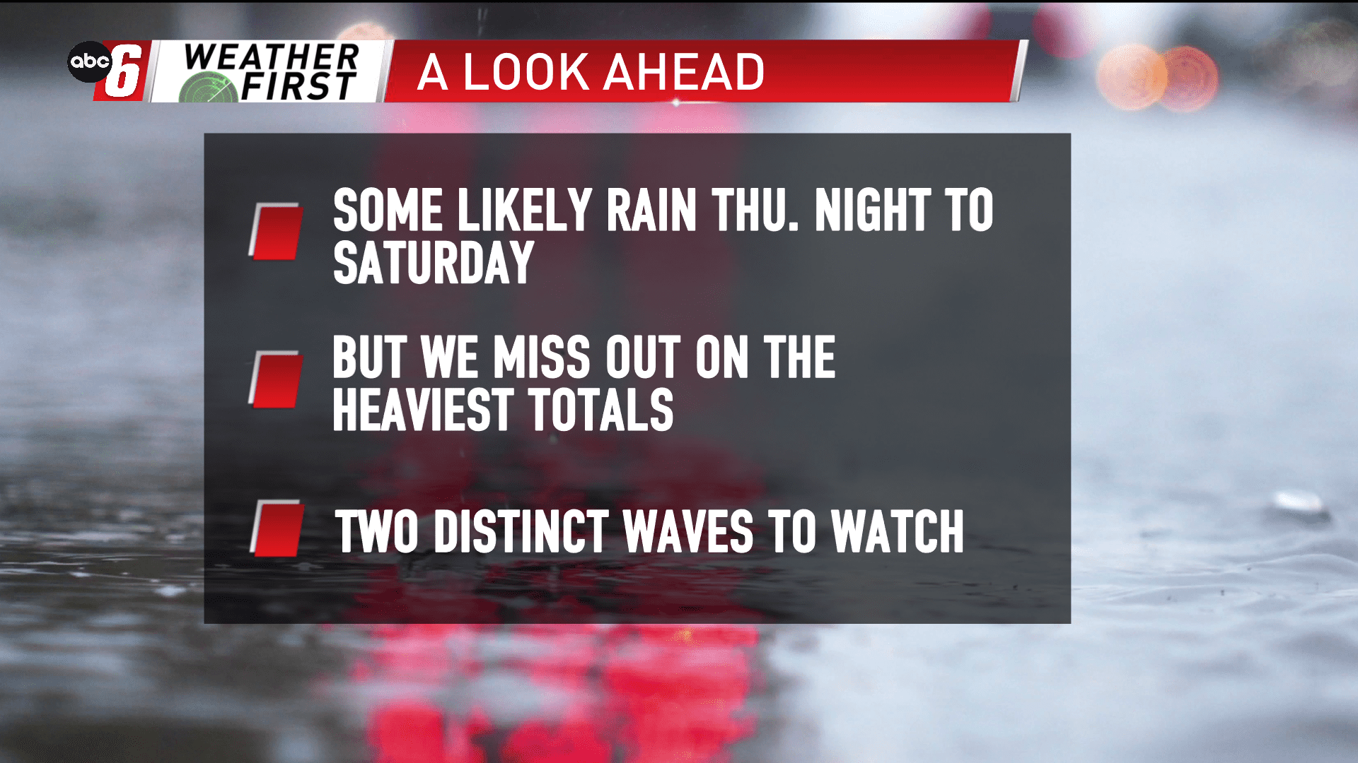
Our next system is up for the Thursday night to Saturday morning timeframe. It begins with a cold front that moves through and eventually stalls out to our east in Wisconsin. A wave of energy will then surge up the front into the area. This should give two better windows to see rain in the stretch.
Friday morning and Saturday morning look to be the key times. Both periods will feature a widespread swath of rain moving through. At other times, widely scattered showers and even an early t-storm Thursday night will be possible.
We’ll miss the heaviest amounts with the front stalling east. That’s where some 2-4″ of rain will be possible. For us, we’re probably looking more into the 1/3″ to 1″ range. With some exceptions, those marks will increase moving east/southeast over our area.
Don’t be surprised if we see some grassy accumulations early Saturday morning too. Temps will permit the brief mix in. But this isn’t looking like a scenario to bring hard hitting wintry conditions.