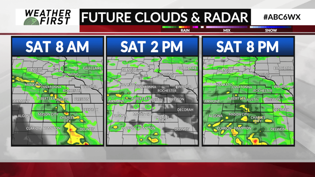
More waves of rain coming, tracking Sat. Night
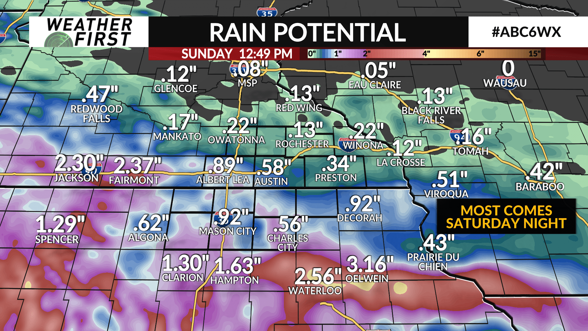
Saturday night will get the most interest in the going forecast. It’s where the strongest, most widespread and heaviest activity will slide through the area. Heavy rain is something we don’t really need at the moment.
There are three waves. A decaying cluster of storms arrives Saturday morning, hardly any lightning left. Outside of a few spots showers and that weakening line, we’re waiting until after sunset for the next rain. Showers will linger through the first half of Mother’s Day.
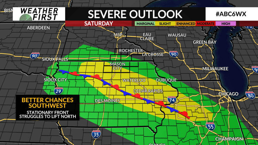
All eyes are on a stationary front for Saturday night to our southwest. It’ll be the barrier between us and a lot of energy for storms to feed on. Also, being stagnant, the storms will tend to move over the similar territory near that front producing large rain totals. As of now, I’m expecting this front to line up southwest of our area and should take the biggest risks of strong storms and heavy rain that direction.
Most susceptible to see both, those nearest the US 18 corridor. We’ll track the situation closely.