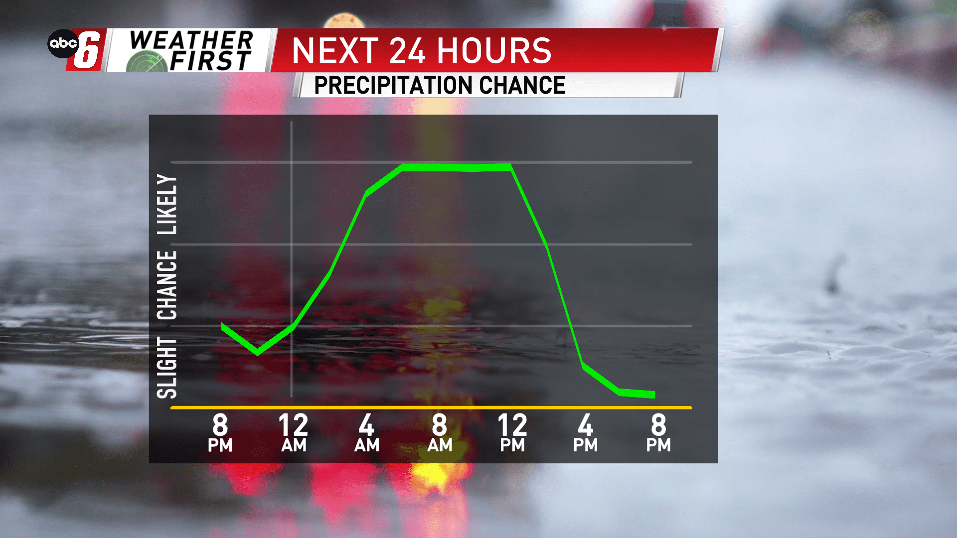
More sogginess into Saturday
A stalled out front to our east has kept much of the rain away for Friday evening. Another disturbance riding up that front brings the rain back in for our area overnight into Saturday. Morning into mid-day is the best opportunity for another widespread slug of rain. With temperatures flirting with the notion of mid 30s, even a few sloppy snowflakes are possible. Rain will wrap up from south to north from 11 AM to 3 PM.
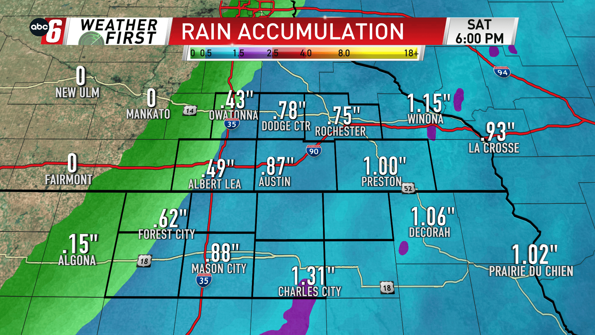
A sharp cutoff to the rain is right on our western edge. Totals may drastically reduce west of I35. I do think most of our area sees some rain, but totals ramp up to the east. Conceivably totals will range from near nothing to 1″. Most will be best served to pick up 1/2″ to 3/4″.