More Mid-Week Moisture
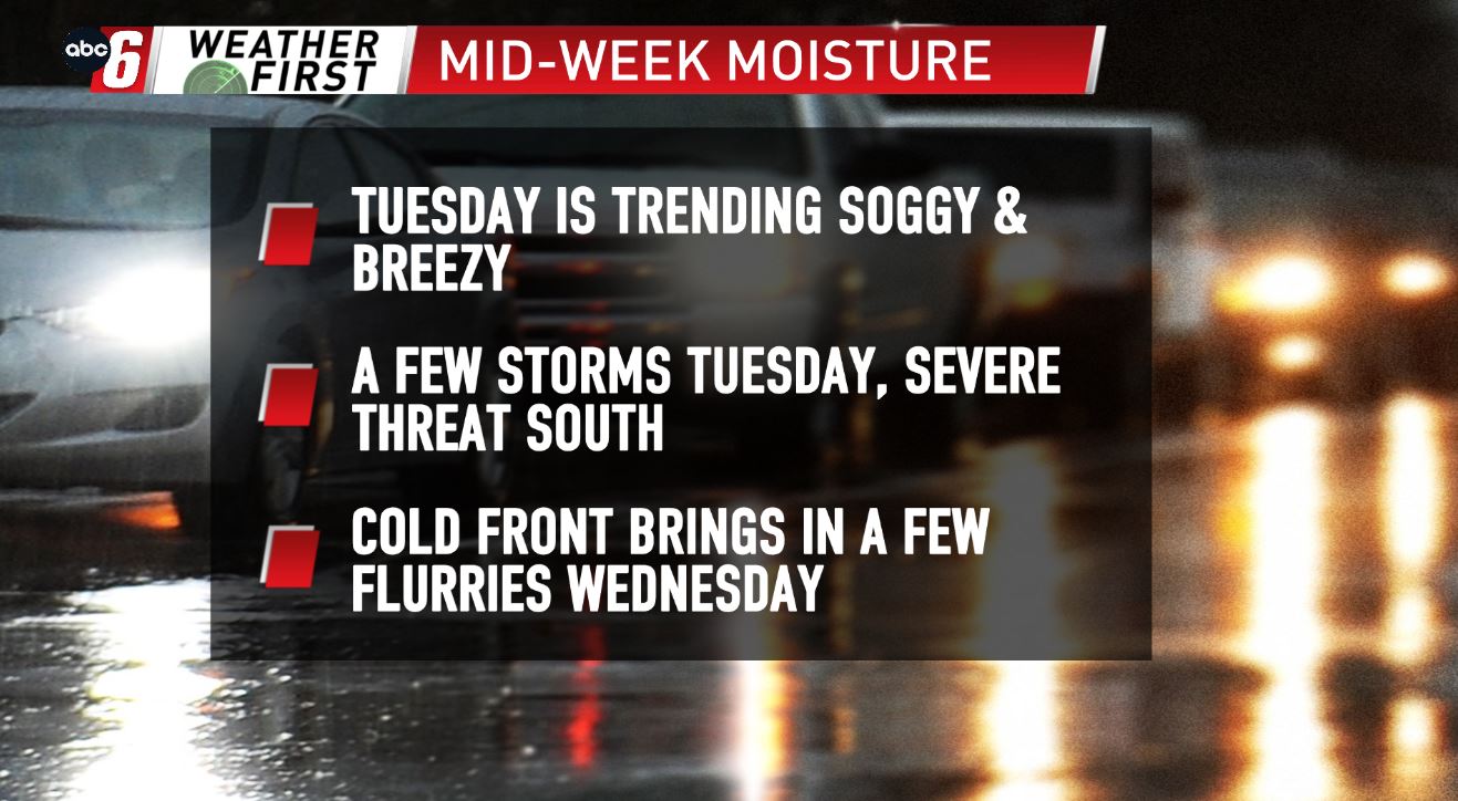


A potent Spring storm system will bring back another round of showers & thunderstorms, followed up with a little snow Tuesday into Wednesday. Early-day showers are possible Tuesday, along with an embedded rumble of thunder or two. Locally, our storm chance will be better later Tuesday evening, as a cold front sweeps through the area. A strong storm or two could be possible locally, however, the better chance for severe storms will once again be to our S/SE, unfortunately in the same areas impacted by Friday’s severe storms. Large hail & strong wind will be the primary threats with the stronger storms locally Tuesday evening/night. The cold front will usher in the cooler air very quickly Tuesday night, meaning Wednesday will see tumbling temps from the 40s & 50s around 12 AM, down to near 32° by the afternoon. This will allow for a few flurries to fly, with accumulating snow chances looking very slim.