Snow shower impacts increase with wind
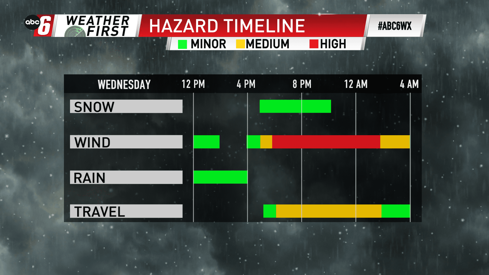
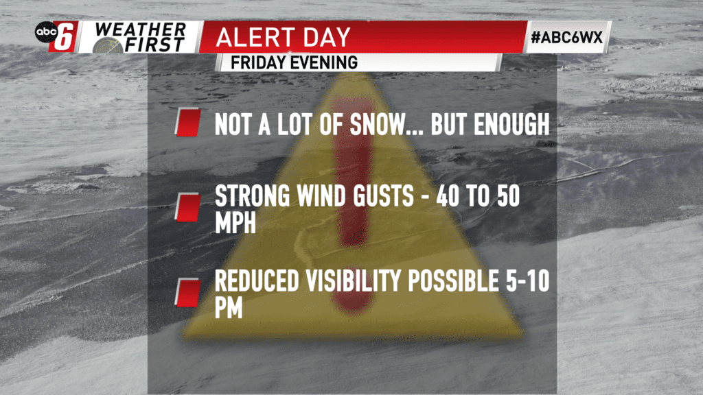
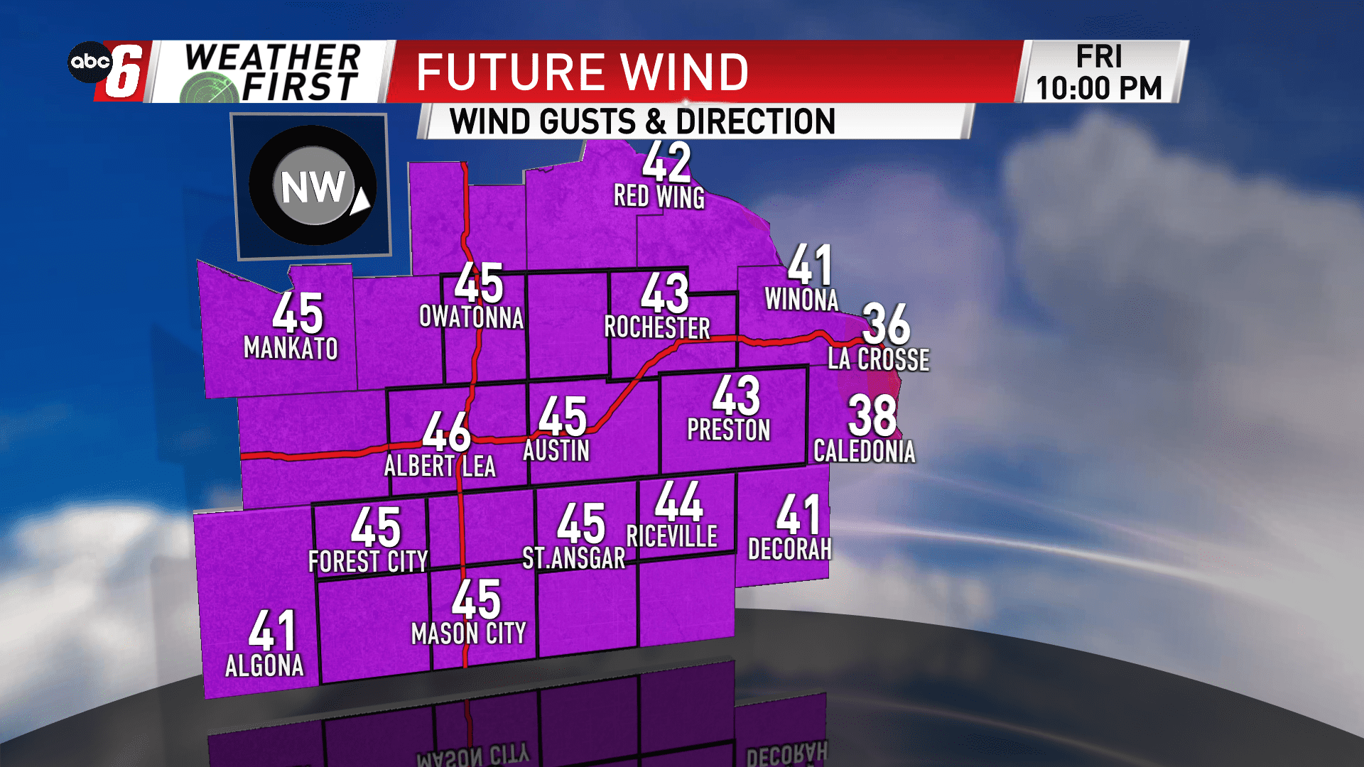
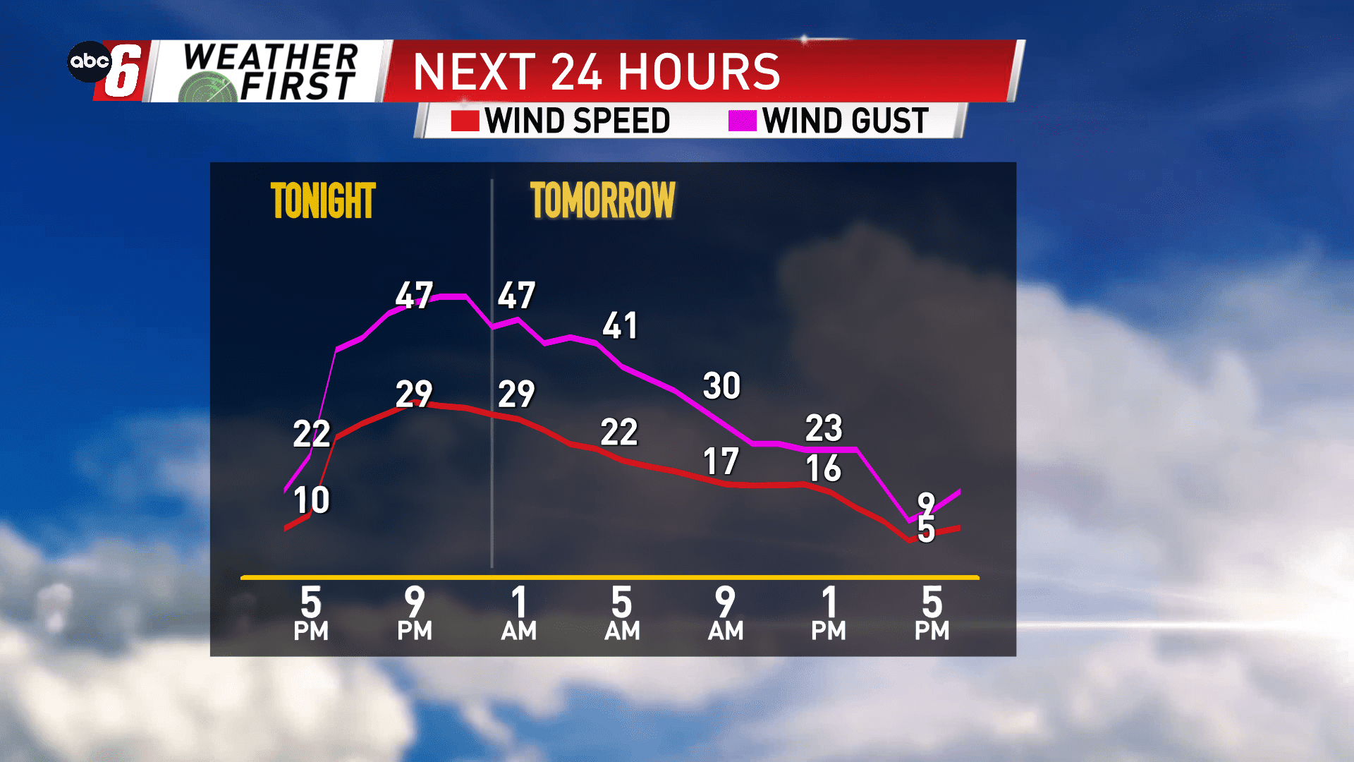
If this was just the snow, we wouldn’t have too much concern. But the wind will certainly intensify the situation for Friday evening. Gusts alone will be menacing out of the northwest 40-50 mph through early Saturday morning. Add in snow and suddenly it takes an inconspicuous situation and enhances it quickly.
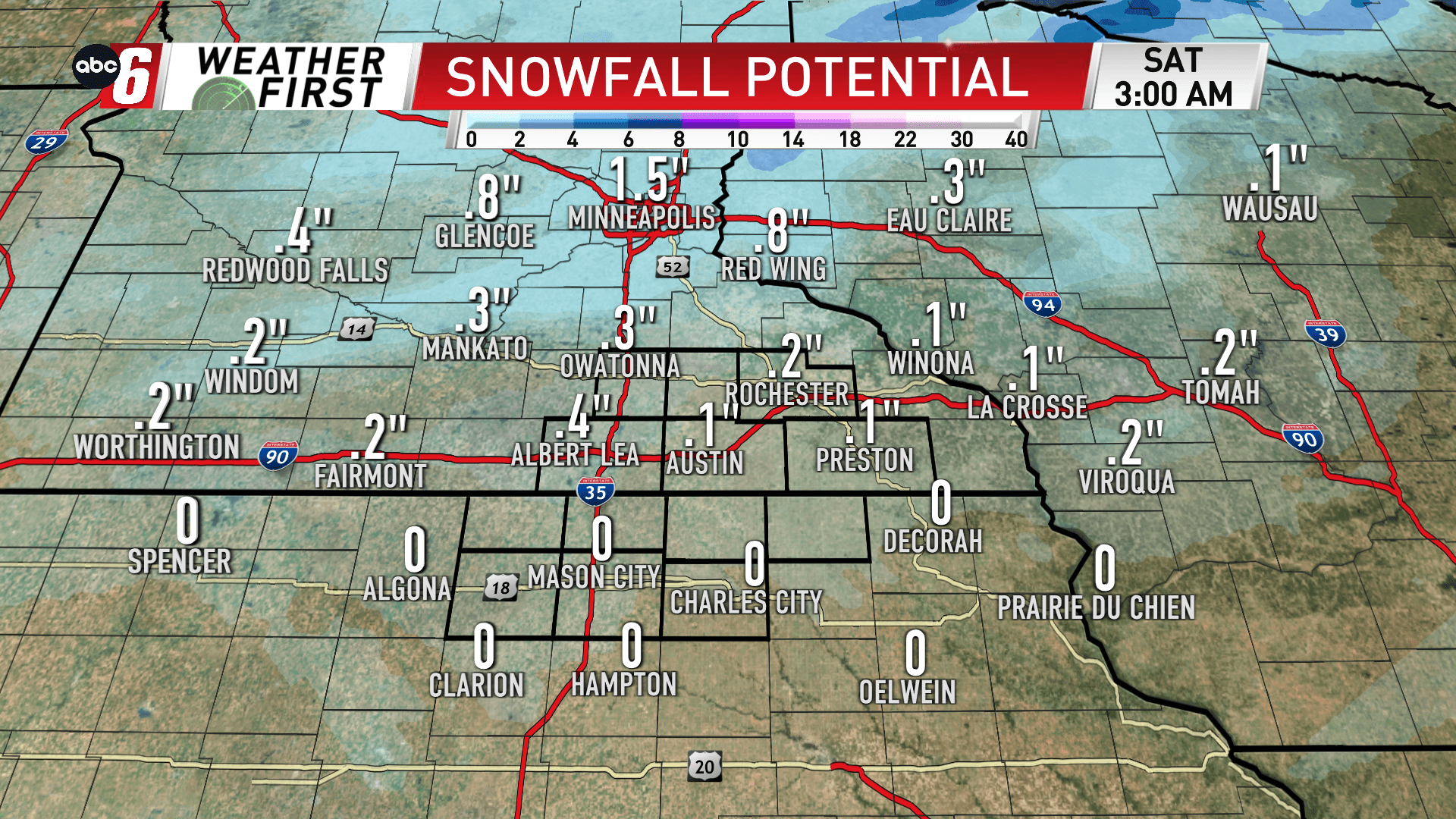
Thankfully our snow on the ground largely melted away today, otherwise the blowing snow concerns would be worse. We’ll be left monitoring what’s falling from the sky. Expectations are for around 1/2″ or less. During snow showers that move through the area through 9 PM, the sudden drop in visibility will be the biggest concerns. Those visibilities may drop into the 1/2 mile to 1 mile range at times inside those snow showers.
Add in some melting as snow initially falls followed by quickly falling temperatures, some icy stretches of roads may be possible.
High profile vehicles should especially take notice with the wind alone.
We’re giving this a short fused Alert Day to account for the situation.