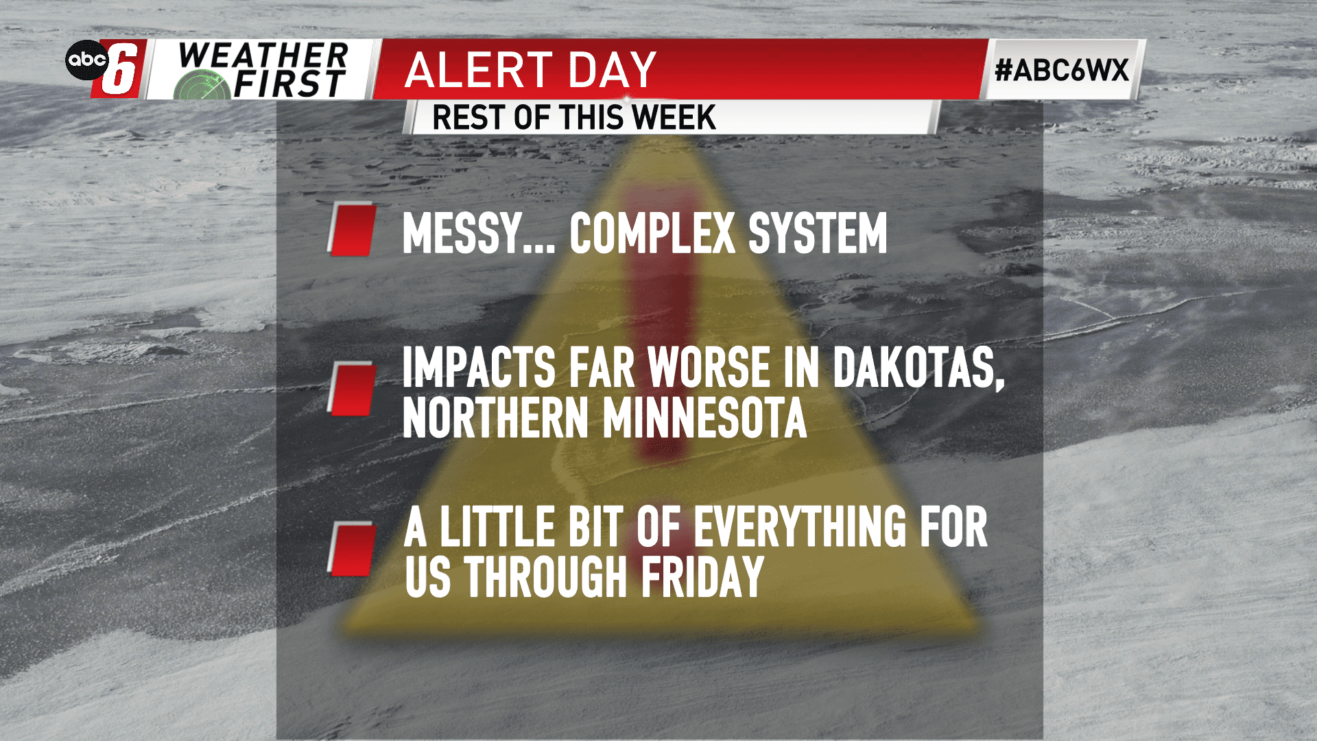
Messy, massive Midwest System leads of with mix
Make no bones about it. This system is a huge one with major impacts for those who see the worst. That will not be southern Minnesota and northern Iowa. That statement doesn’t mean this will be a walk in the park either.
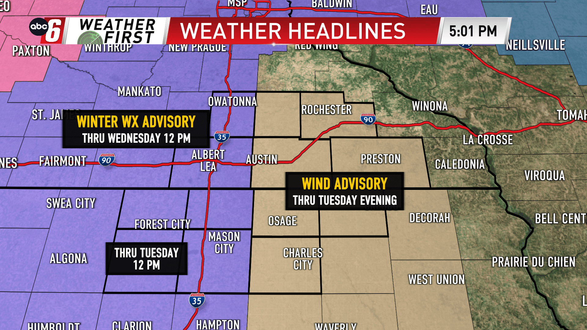
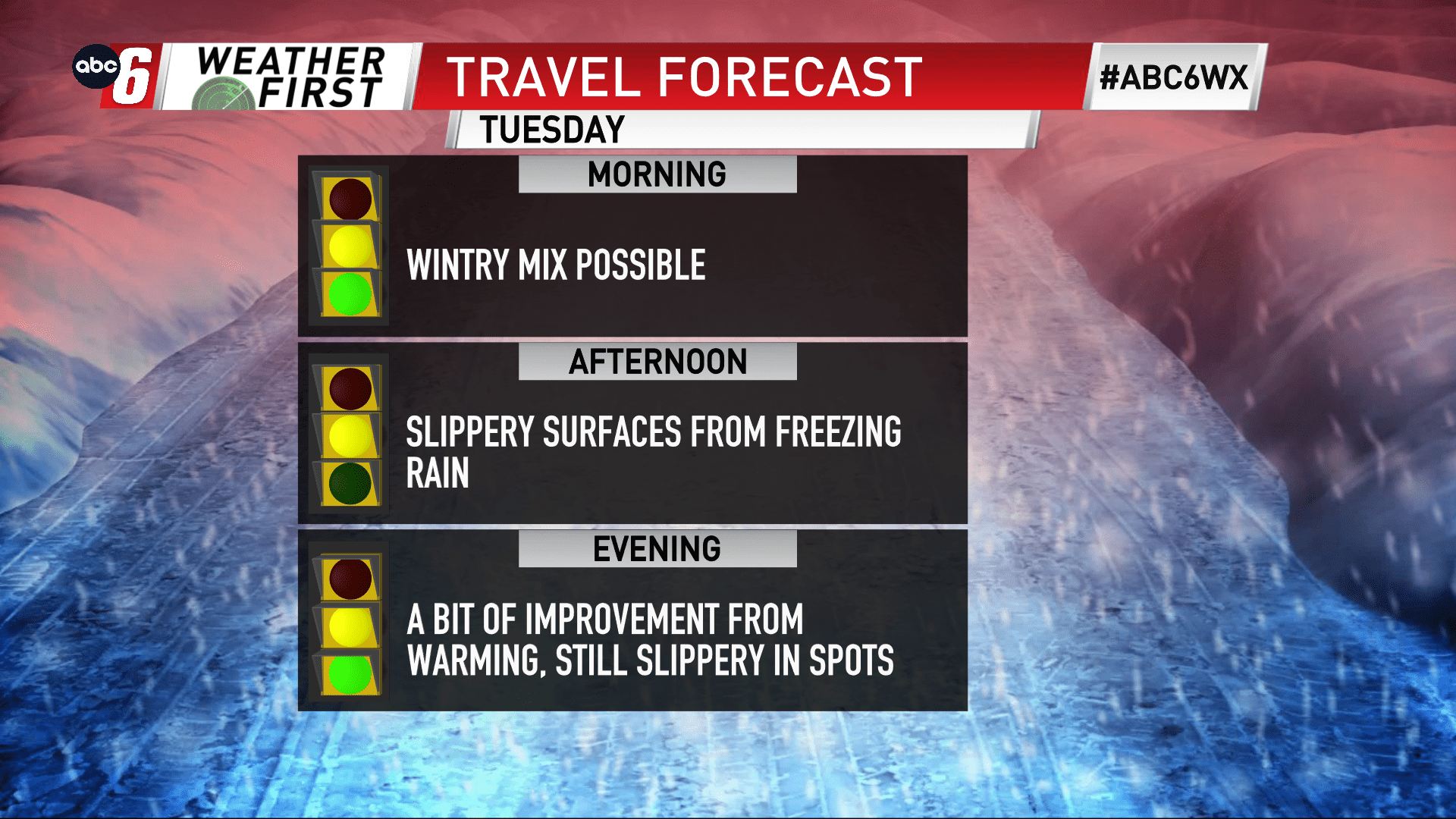
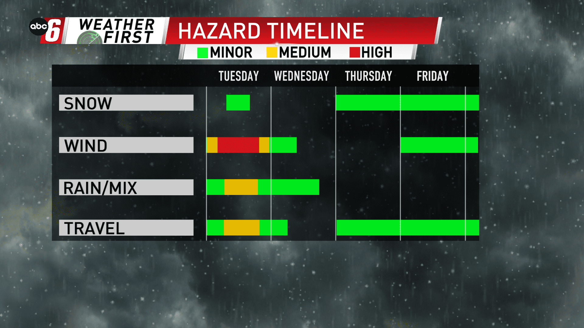
Tuesday in particular is one day of interest to watch. We’ll see this system bring a whole slew of precip types. We’ll run the gamut from rain, sleet, freezing rain and snow at times through the day. We’ll pick up the opportunity for this mixture just after sunrise and continue into the late evening.
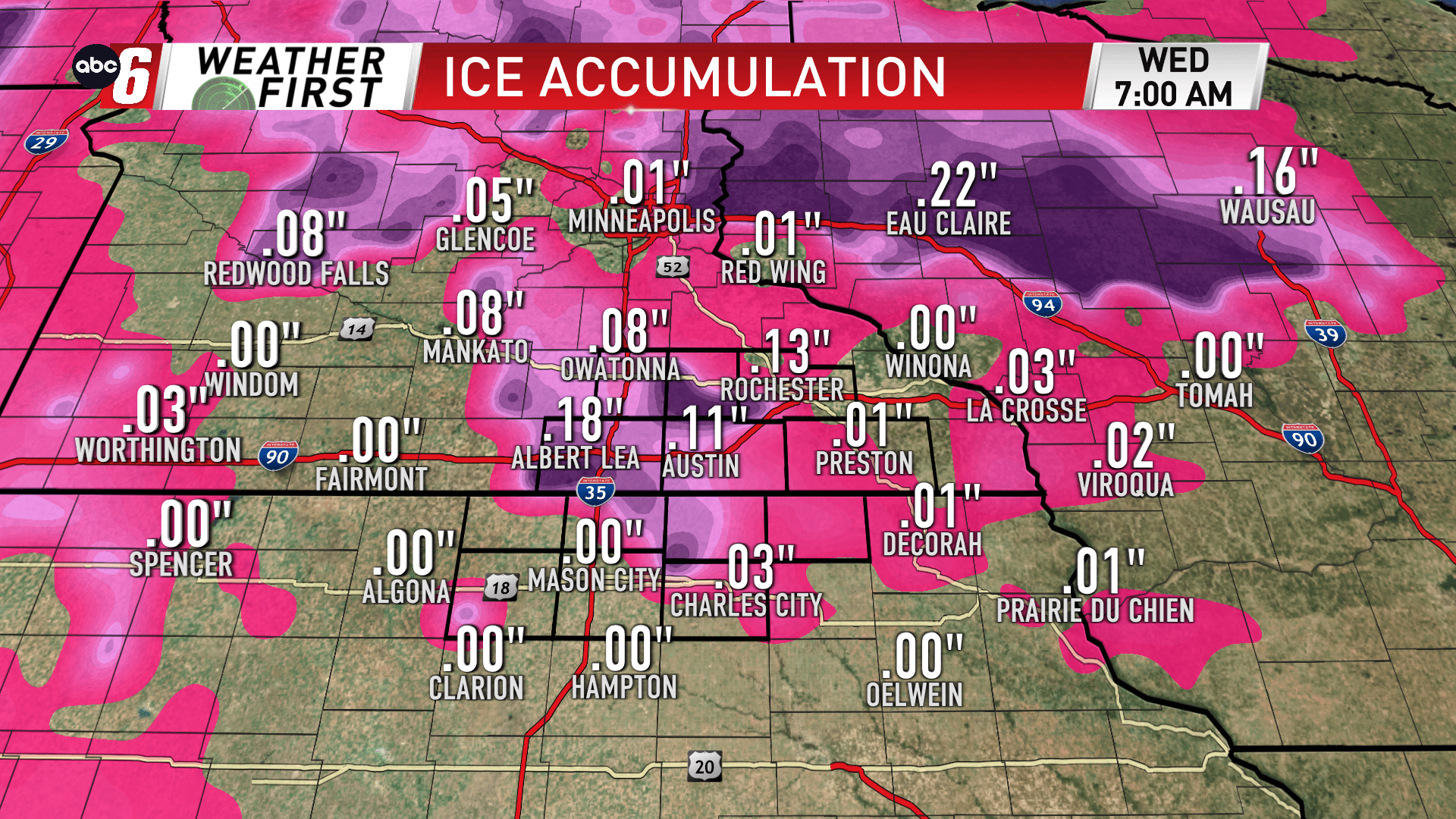
Temperatures prove critical for icing. If temps warm above freezing, icing threats are less. If we struggle, a icing potential would be maximized. I see the temps being pestering so I’m following an icing forecast more to suit. Around 1/10″ of icing is possible, especially west. I also wouldn’t be surprised if there’s a spot or two that makes it up to 1/4″.
Otherwise, snow/sleet will be minor and bring accumulations accordingly.
A slushy mess on the roads is possible, if not completely slippery on untreated surfaces.
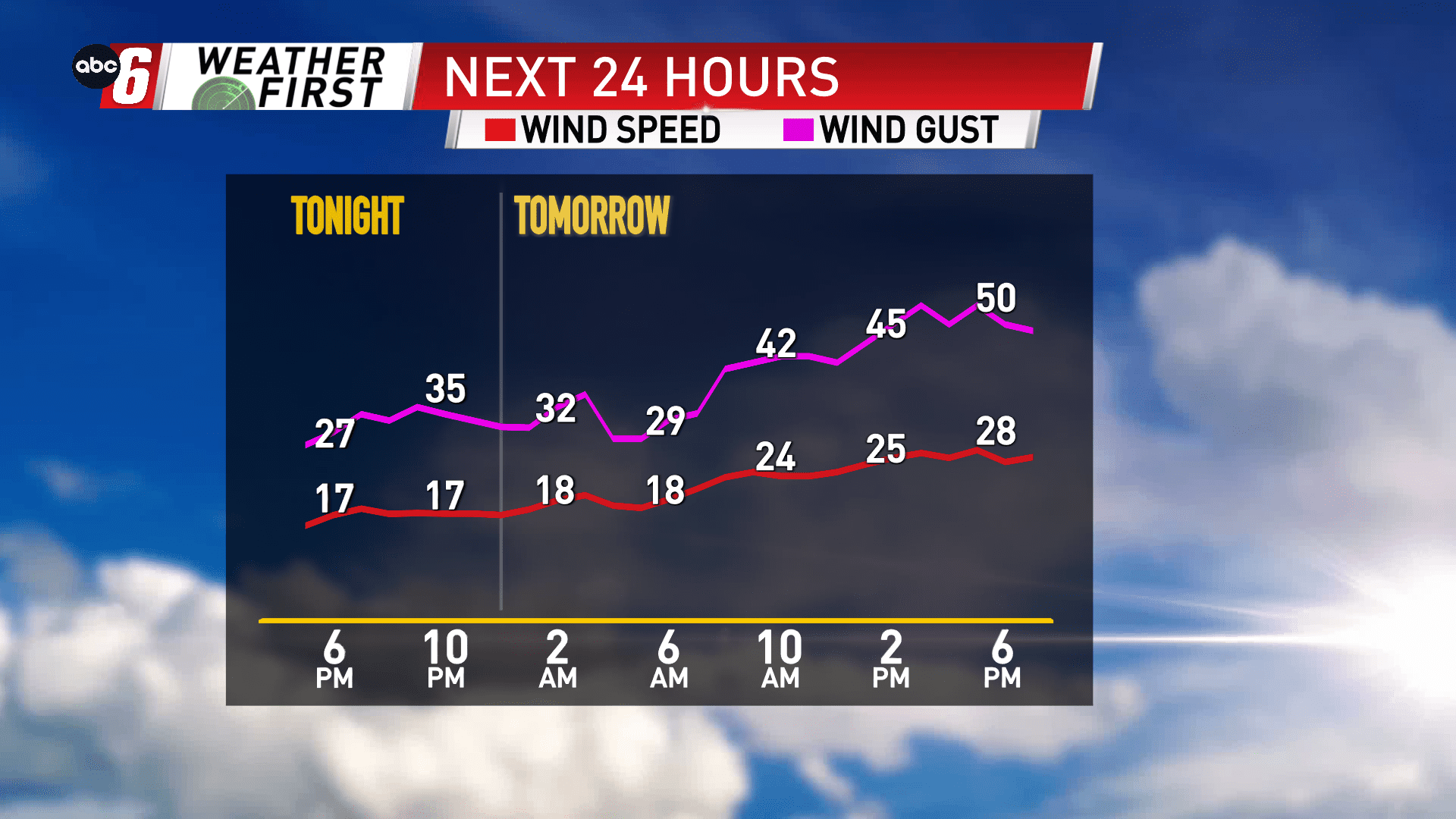
Wind also plays a major roll. It is downright windy. A southeast breeze sustained at 15-30 mph and gusts to 50 mph are possible. Thankfully the snow impact is minimal so I don’t expect major visibility disruptions. Any slippery stretches will be enhanced with the possibility of high profile vehicles more easily losing traction.
All in all. Take things a little bit easier out there on Tuesday. For Wednesday, we’ll get a bit of a reprieve as we enter the dry slot. Some drizzle is possible, but temperatures should stay above freezing to minimize impacts.